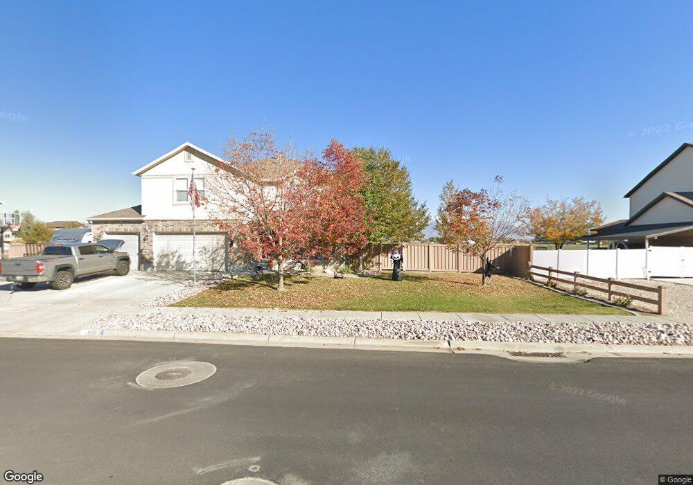
1188 W 2500 S Syracuse, UT 84075
Estimated Value: $766,000 - $958,000
7
Beds
4
Baths
3,016
Sq Ft
$283/Sq Ft
Est. Value
About This Home
This home is located at 1188 W 2500 S, Syracuse, UT 84075 and is currently estimated at $852,343, approximately $282 per square foot. 1188 W 2500 S is a home located in Davis County with nearby schools including Bluff Ridge Elementary, Legacy Junior High School, and Clearfield High School.
Ownership History
Date
Name
Owned For
Owner Type
Purchase Details
Closed on
Nov 16, 2023
Sold by
Gravley James Bryon and Gravley Jennifer A
Bought by
James Bryon Gravley And Jennifer Ann Gravley and Gravley
Current Estimated Value
Purchase Details
Closed on
Jun 6, 2019
Sold by
Clair Jared St
Bought by
Gravley James Bryon and Gravley Jennifer A
Home Financials for this Owner
Home Financials are based on the most recent Mortgage that was taken out on this home.
Original Mortgage
$386,750
Interest Rate
4.1%
Mortgage Type
New Conventional
Purchase Details
Closed on
Dec 16, 2014
Sold by
Allen Ralph V and Allen Tambara
Bought by
Clair Jared St
Purchase Details
Closed on
Feb 21, 2012
Sold by
Allen Ralph V and Allen Tambara
Bought by
Allen Ralph and Allen Tambara
Home Financials for this Owner
Home Financials are based on the most recent Mortgage that was taken out on this home.
Original Mortgage
$233,150
Interest Rate
3.11%
Mortgage Type
New Conventional
Purchase Details
Closed on
Mar 25, 2005
Sold by
Allen Ralph V and Allen Tambara
Bought by
Allen Ralph and Allen Tambara
Purchase Details
Closed on
Feb 2, 2005
Sold by
Allen Ralph V and Allen Tambara
Bought by
The Allen Family Trust
Purchase Details
Closed on
Apr 13, 1998
Sold by
Mark Robinson Construction Inc
Bought by
Allen Ralph and Allen Tambara
Home Financials for this Owner
Home Financials are based on the most recent Mortgage that was taken out on this home.
Original Mortgage
$223,550
Interest Rate
7.07%
Purchase Details
Closed on
Aug 29, 1997
Sold by
Jade Development Lc
Bought by
Mark Robinson Construction Inc
Create a Home Valuation Report for This Property
The Home Valuation Report is an in-depth analysis detailing your home's value as well as a comparison with similar homes in the area
Home Values in the Area
Average Home Value in this Area
Purchase History
| Date | Buyer | Sale Price | Title Company |
|---|---|---|---|
| James Bryon Gravley And Jennifer Ann Gravley | -- | None Listed On Document | |
| James Bryon Gravley And Jennifer Ann Gravley | -- | None Listed On Document | |
| Gravley James Bryon | -- | Stewart Title Ins Agency | |
| Gravley James Bryon | -- | Stewart Title Ins Agency | |
| Clair Jared St | -- | Inwest Title Servic | |
| Clair Jared St | -- | Inwest Title Servic | |
| Allen Ralph | -- | Backman Title Servi | |
| Allen Ralph | -- | Backman Title Servi | |
| Allen Ralph | -- | Backman Title Servi | |
| Allen Ralph | -- | Backman Title Servi | |
| Allen Ralph | -- | -- | |
| Allen Ralph | -- | None Available | |
| Allen Ralph | -- | -- | |
| Allen Ralph | -- | None Available | |
| The Allen Family Trust | -- | -- | |
| The Allen Family Trust | -- | -- | |
| Allen Ralph | -- | Security Title | |
| Allen Ralph | -- | Security Title | |
| Mark Robinson Construction Inc | -- | Bonneville Title Company Inc | |
| Mark Robinson Construction Inc | -- | Bonneville Title Company Inc |
Source: Public Records
Mortgage History
| Date | Status | Borrower | Loan Amount |
|---|---|---|---|
| Previous Owner | Gravley James Bryon | $386,750 | |
| Previous Owner | Allen Ralph | $233,150 | |
| Previous Owner | Allen Ralph | $223,550 |
Source: Public Records
Tax History Compared to Growth
Tax History
| Year | Tax Paid | Tax Assessment Tax Assessment Total Assessment is a certain percentage of the fair market value that is determined by local assessors to be the total taxable value of land and additions on the property. | Land | Improvement |
|---|---|---|---|---|
| 2025 | $3,763 | $363,000 | $126,474 | $236,526 |
| 2024 | $3,579 | $347,600 | $112,496 | $235,104 |
| 2023 | $3,503 | $620,000 | $156,281 | $463,719 |
| 2022 | $3,673 | $356,400 | $88,848 | $267,552 |
| 2021 | $3,129 | $470,000 | $132,217 | $337,783 |
| 2020 | $2,854 | $415,000 | $111,172 | $303,828 |
| 2019 | $2,863 | $411,000 | $113,581 | $297,419 |
| 2018 | $2,779 | $396,000 | $107,028 | $288,972 |
| 2016 | $2,774 | $207,295 | $40,900 | $166,395 |
| 2015 | $3,063 | $217,965 | $40,900 | $177,065 |
| 2014 | $2,857 | $207,207 | $40,900 | $166,307 |
| 2013 | -- | $172,837 | $41,993 | $130,844 |
Source: Public Records
Map
Nearby Homes
- 2487 S 1200 W
- 2490 S 1150 W
- 1164 W 2500 S
- 1195 W 2500 S
- 1177 W 2500 S
- 2509 S 1225 W
- 2465 S 1200 W
- 1155 W 2500 S
- 2786 S 1200 W
- 1220 W 2500 S
- 1165 S 1225 W Unit 207
- 1151 S 1225 W Unit 212
- 1148 S 1225 W Unit 210
- 1133 S 1225 W Unit 211
- 1127 S 1225 W Unit 211
- 2460 S 1200 W
- 2491 S 1150 W
- 1166 W 2615 S
- 2610 S 1175 W
- 2521 S 1225 W