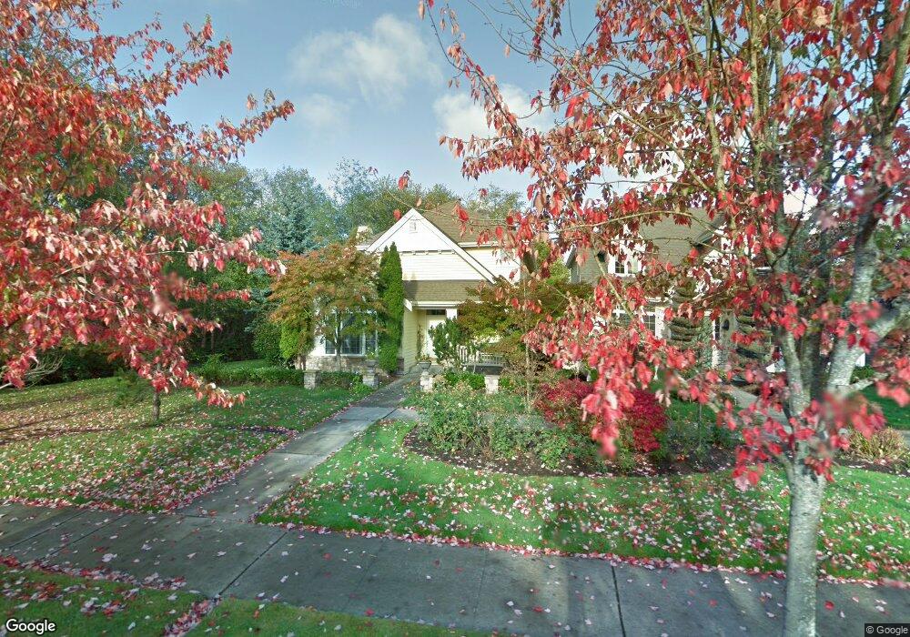
11882 Possession Way Mukilteo, WA 98275
Harbour Pointe NeighborhoodEstimated Value: $956,715 - $1,012,000
3
Beds
3
Baths
2,270
Sq Ft
$437/Sq Ft
Est. Value
About This Home
This home is located at 11882 Possession Way, Mukilteo, WA 98275 and is currently estimated at $992,179, approximately $437 per square foot. 11882 Possession Way is a home located in Snohomish County with nearby schools including Endeavour Elementary School, Harbour Pointe Middle School, and Kamiak High School.
Ownership History
Date
Name
Owned For
Owner Type
Purchase Details
Closed on
Jul 1, 2003
Sold by
Federal National Mortgage Association
Bought by
Damp Matthew R and Maekawa Chiho
Current Estimated Value
Home Financials for this Owner
Home Financials are based on the most recent Mortgage that was taken out on this home.
Original Mortgage
$250,400
Outstanding Balance
$106,137
Interest Rate
5.22%
Mortgage Type
Purchase Money Mortgage
Estimated Equity
$886,042
Purchase Details
Closed on
Mar 19, 2003
Sold by
Lofstrom Randall H and Chase Manhattan Mortgage Corp
Bought by
Federal National Mortgage Association
Purchase Details
Closed on
Oct 20, 2000
Sold by
John F Buchan Construction Inc
Bought by
Lofstrom Randall H
Home Financials for this Owner
Home Financials are based on the most recent Mortgage that was taken out on this home.
Original Mortgage
$248,700
Interest Rate
8.31%
Create a Home Valuation Report for This Property
The Home Valuation Report is an in-depth analysis detailing your home's value as well as a comparison with similar homes in the area
Home Values in the Area
Average Home Value in this Area
Purchase History
| Date | Buyer | Sale Price | Title Company |
|---|---|---|---|
| Damp Matthew R | $313,000 | First American | |
| Federal National Mortgage Association | $284,162 | First American | |
| Lofstrom Randall H | $310,950 | -- |
Source: Public Records
Mortgage History
| Date | Status | Borrower | Loan Amount |
|---|---|---|---|
| Open | Damp Matthew R | $250,400 | |
| Previous Owner | Lofstrom Randall H | $248,700 |
Source: Public Records
Tax History Compared to Growth
Tax History
| Year | Tax Paid | Tax Assessment Tax Assessment Total Assessment is a certain percentage of the fair market value that is determined by local assessors to be the total taxable value of land and additions on the property. | Land | Improvement |
|---|---|---|---|---|
| 2025 | $6,387 | $907,500 | $506,100 | $401,400 |
| 2024 | $6,387 | $880,800 | $488,200 | $392,600 |
| 2023 | $6,274 | $893,200 | $446,300 | $446,900 |
| 2022 | $5,495 | $671,300 | $292,000 | $379,300 |
| 2020 | $4,799 | $589,900 | $265,000 | $324,900 |
| 2019 | $4,404 | $553,800 | $232,000 | $321,800 |
| 2018 | $4,817 | $525,500 | $224,000 | $301,500 |
| 2017 | $4,251 | $482,100 | $201,000 | $281,100 |
| 2016 | $4,004 | $451,700 | $179,000 | $272,700 |
| 2015 | $4,247 | $430,800 | $167,000 | $263,800 |
| 2013 | $3,739 | $354,400 | $155,000 | $199,400 |
Source: Public Records
Map
Nearby Homes
- 12013 Possession Way
- 4818 Pointes Dr
- 12058 Concord Way
- 11702 Wilmington Way
- 12303 Harbour Pointe Blvd Unit W101
- 5400 Harbour Pointe Blvd Unit F 201
- 5300 Harbour Pointe Blvd Unit 307A
- 5300 Harbour Pointe Blvd Unit 311H
- 5500 Harbour Pointe Blvd Unit B202
- 5615 114th St SW
- 10834 53rd Place W
- 5824 111th Place SW
- 13303 48th Place W
- 12807 60th Ave W
- 13322 47th Place W
- 10705 57th Place W
- 12900 Beverly Park Rd
- 3910 132nd St SW Unit B
- 3910 132nd St SW Unit A
- 13318 Beverly Park Rd
- 11876 Possession Way
- 11860 Possession Way
- 4704 Northport Dr
- 4716 Northport Dr
- 11879 Possession Way
- 11883 Possession Way
- 11875 Possession Way
- 4720 Northport Dr
- 11854 Possession Way
- 11871 Possession Way
- 4679 Northport Dr
- 11840 Possession Way
- 11775 Hartford Way
- 11771 Hartford Way
- 11779 Hartford Way
- 4665 Northport Dr
- 11767 Hartford Way
- 11869 Possession Way
- 4665 Northport Dr
- 4711 Northport Dr