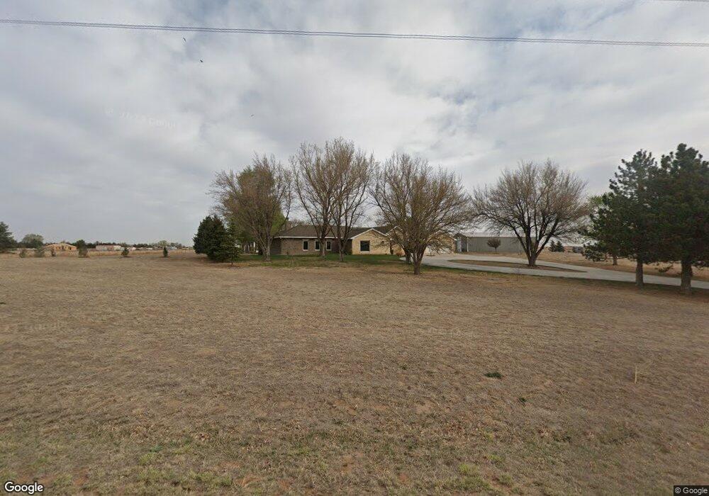
118858 Ew 3 Rd Turpin, OK 73950
Estimated Value: $166,000 - $226,000
2
Beds
2
Baths
1,953
Sq Ft
$101/Sq Ft
Est. Value
About This Home
This home is located at 118858 Ew 3 Rd, Turpin, OK 73950 and is currently estimated at $197,464, approximately $101 per square foot. 118858 Ew 3 Rd is a home located in Beaver County with nearby schools including Turpin High School.
Ownership History
Date
Name
Owned For
Owner Type
Purchase Details
Closed on
Dec 20, 2023
Sold by
Dawson N & D Living Trust
Bought by
Timmer Valerie Ruth and Tyler Dale Lai
Current Estimated Value
Home Financials for this Owner
Home Financials are based on the most recent Mortgage that was taken out on this home.
Original Mortgage
$118,750
Outstanding Balance
$112,468
Interest Rate
0.68%
Mortgage Type
Construction
Estimated Equity
$84,996
Purchase Details
Closed on
Aug 24, 2004
Sold by
Joseph Timmer
Bought by
Niel Dawson
Purchase Details
Closed on
Nov 18, 1995
Sold by
Timmer Joseph
Bought by
Dawson Neil and Dawson Alfreda
Create a Home Valuation Report for This Property
The Home Valuation Report is an in-depth analysis detailing your home's value as well as a comparison with similar homes in the area
Home Values in the Area
Average Home Value in this Area
Purchase History
| Date | Buyer | Sale Price | Title Company |
|---|---|---|---|
| Timmer Valerie Ruth | $125,000 | -- | |
| Niel Dawson | -- | -- | |
| Dawson Neil | $5,500 | -- |
Source: Public Records
Mortgage History
| Date | Status | Borrower | Loan Amount |
|---|---|---|---|
| Open | Timmer Valerie Ruth | $118,750 |
Source: Public Records
Tax History Compared to Growth
Tax History
| Year | Tax Paid | Tax Assessment Tax Assessment Total Assessment is a certain percentage of the fair market value that is determined by local assessors to be the total taxable value of land and additions on the property. | Land | Improvement |
|---|---|---|---|---|
| 2024 | $1,332 | $20,583 | $1,216 | $19,367 |
| 2023 | $1,180 | $18,355 | $937 | $17,418 |
| 2022 | $1,141 | $17,820 | $547 | $17,273 |
| 2021 | $1,117 | $17,301 | $547 | $16,754 |
| 2020 | $1,075 | $16,797 | $547 | $16,250 |
| 2019 | $1,006 | $15,833 | $547 | $15,286 |
| 2018 | $805 | $15,372 | $547 | $14,825 |
| 2017 | $782 | $14,924 | $547 | $14,377 |
| 2016 | $799 | $14,490 | $547 | $13,943 |
| 2015 | $768 | $14,068 | $547 | $13,521 |
| 2014 | $787 | $14,386 | $547 | $13,839 |
Source: Public Records
Map
Nearby Homes
- 3498 U S 83
- 1401 Forrest Ave
- 1202 S Washington Ave
- 1420 Mission Blvd
- 1013 S Washington Ave
- 1161 South St
- 1300 S Grant Ave
- 1331 S Clay Ave
- 1211 Charles St
- 732 S New York Ave
- 1349 Jewell Ave
- 425 Driftwood Ln
- 723 S Clay Ave
- 720 S Webster Ave
- 618 S Jordan Ave
- 238 W Hickory St
- 852 S Cain Ave
- 000 Road S- 390 Acres
- 6263 Meadows Ln
- 1771 Hillside Dr