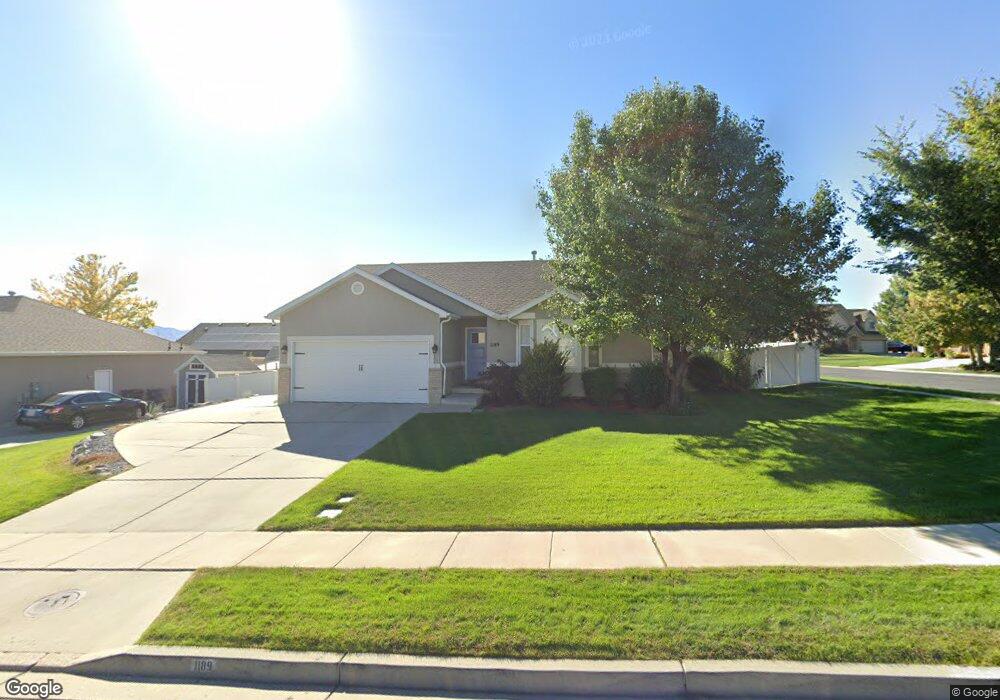
1189 N 530 W American Fork, UT 84003
Estimated Value: $578,000 - $643,000
5
Beds
3
Baths
2,562
Sq Ft
$239/Sq Ft
Est. Value
About This Home
This home is located at 1189 N 530 W, American Fork, UT 84003 and is currently estimated at $611,270, approximately $238 per square foot. 1189 N 530 W is a home located in Utah County with nearby schools including Legacy Elementary School, American Fork Junior High School, and American Fork High School.
Ownership History
Date
Name
Owned For
Owner Type
Purchase Details
Closed on
Jan 23, 2025
Sold by
1189 North 530 West Llc
Bought by
Mcmullin Samuel and Mcmullin Javie
Current Estimated Value
Home Financials for this Owner
Home Financials are based on the most recent Mortgage that was taken out on this home.
Original Mortgage
$100,000
Outstanding Balance
$98,088
Interest Rate
1%
Mortgage Type
New Conventional
Estimated Equity
$513,182
Purchase Details
Closed on
Dec 10, 2020
Sold by
Whitelock Andrew J and Whitelock Audrey G
Bought by
Delange Darrin and Delange Amy
Home Financials for this Owner
Home Financials are based on the most recent Mortgage that was taken out on this home.
Original Mortgage
$337,000
Interest Rate
2.8%
Mortgage Type
New Conventional
Purchase Details
Closed on
Oct 8, 2014
Sold by
Taylor Kelsi
Bought by
Whitelock Andrew J and Whitelock Audrey G
Home Financials for this Owner
Home Financials are based on the most recent Mortgage that was taken out on this home.
Original Mortgage
$283,100
Interest Rate
4.08%
Mortgage Type
New Conventional
Purchase Details
Closed on
Jun 6, 2012
Sold by
Taylor Landon
Bought by
Taylor Kelsi
Purchase Details
Closed on
Apr 7, 2010
Sold by
Brown Steven Kerry and Brown Virginia
Bought by
Taylor Landon and Taylor Kelsi
Home Financials for this Owner
Home Financials are based on the most recent Mortgage that was taken out on this home.
Original Mortgage
$206,100
Interest Rate
4.91%
Mortgage Type
New Conventional
Purchase Details
Closed on
Jun 25, 2002
Sold by
Salisbury Development Lc
Bought by
Brown Steven Kerry and Brown Virginia
Home Financials for this Owner
Home Financials are based on the most recent Mortgage that was taken out on this home.
Original Mortgage
$133,447
Interest Rate
6.86%
Mortgage Type
FHA
Create a Home Valuation Report for This Property
The Home Valuation Report is an in-depth analysis detailing your home's value as well as a comparison with similar homes in the area
Home Values in the Area
Average Home Value in this Area
Purchase History
| Date | Buyer | Sale Price | Title Company |
|---|---|---|---|
| Mcmullin Samuel | -- | Integrated Title | |
| Delange Darrin | -- | Title One | |
| Whitelock Andrew J | -- | First American Title Co Llc | |
| Taylor Kelsi | -- | None Available | |
| Taylor Landon | -- | Quality Title | |
| Brown Steven Kerry | -- | Provo Land Title Company |
Source: Public Records
Mortgage History
| Date | Status | Borrower | Loan Amount |
|---|---|---|---|
| Open | Mcmullin Samuel | $100,000 | |
| Previous Owner | Delange Darrin | $337,000 | |
| Previous Owner | Whitelock Andrew J | $283,100 | |
| Previous Owner | Taylor Landon | $206,100 | |
| Previous Owner | Brown Steven Kerry | $133,447 |
Source: Public Records
Tax History Compared to Growth
Tax History
| Year | Tax Paid | Tax Assessment Tax Assessment Total Assessment is a certain percentage of the fair market value that is determined by local assessors to be the total taxable value of land and additions on the property. | Land | Improvement |
|---|---|---|---|---|
| 2025 | $2,605 | $319,770 | $229,400 | $352,000 |
| 2024 | $2,605 | $289,465 | $0 | $0 |
| 2023 | $2,423 | $285,395 | $0 | $0 |
| 2022 | $2,778 | $322,960 | $0 | $0 |
| 2021 | $2,229 | $404,700 | $130,500 | $274,200 |
| 2020 | $2,141 | $377,100 | $120,800 | $256,300 |
| 2019 | $1,887 | $343,700 | $120,800 | $222,900 |
| 2018 | $1,870 | $325,600 | $117,300 | $208,300 |
| 2017 | $1,674 | $157,355 | $0 | $0 |
| 2016 | $1,767 | $154,275 | $0 | $0 |
| 2015 | $1,770 | $146,685 | $0 | $0 |
| 2014 | -- | $141,790 | $0 | $0 |
Source: Public Records
Map
Nearby Homes
- 425 W 1120 N
- 471 W 1040 N
- 344 W 1080 N
- 987 N 410 W
- 356 W 1300 N
- 287 W 1360 N
- 1438 N 400 W
- 3889 W 950 Cir N Unit 366
- 914 N 400 W Unit A
- 984 N 300 W
- 602 W 860 N
- 179 W 1290 N
- 3935 W 1000 N Unit 438
- 3983 W 1000 N Unit 442
- 4007 W 1000 N
- 3947 W 1000 N Unit 439
- 3959 W 1000 N
- 9435 N Aspen Hollow Cir
- 822 N 860 W Unit 317
- 822 W 800 St N Unit LOT319