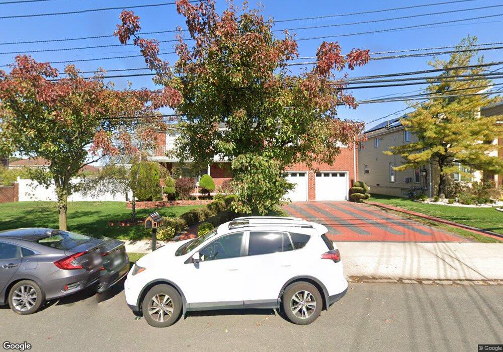
1189 Woodrow Rd Staten Island, NY 10309
Huguenot NeighborhoodEstimated Value: $1,232,000 - $1,465,000
1
Bed
1
Bath
4,000
Sq Ft
$327/Sq Ft
Est. Value
About This Home
This home is located at 1189 Woodrow Rd, Staten Island, NY 10309 and is currently estimated at $1,306,872, approximately $326 per square foot. 1189 Woodrow Rd is a home located in Richmond County with nearby schools including P.S. 4 - Maurice Wollin, I.S. 075 Frank D. Paulo, and Tottenville High School.
Ownership History
Date
Name
Owned For
Owner Type
Purchase Details
Closed on
Jan 19, 1999
Sold by
Eng Kenny and Ng Wun Ching Young
Bought by
Rexhaj Isuf
Current Estimated Value
Home Financials for this Owner
Home Financials are based on the most recent Mortgage that was taken out on this home.
Original Mortgage
$170,000
Interest Rate
6.74%
Create a Home Valuation Report for This Property
The Home Valuation Report is an in-depth analysis detailing your home's value as well as a comparison with similar homes in the area
Home Values in the Area
Average Home Value in this Area
Purchase History
| Date | Buyer | Sale Price | Title Company |
|---|---|---|---|
| Rexhaj Isuf | $370,000 | -- |
Source: Public Records
Mortgage History
| Date | Status | Borrower | Loan Amount |
|---|---|---|---|
| Previous Owner | Rexhaj Isuf | $170,000 |
Source: Public Records
Tax History Compared to Growth
Tax History
| Year | Tax Paid | Tax Assessment Tax Assessment Total Assessment is a certain percentage of the fair market value that is determined by local assessors to be the total taxable value of land and additions on the property. | Land | Improvement |
|---|---|---|---|---|
| 2025 | $13,152 | $70,080 | $21,869 | $48,211 |
| 2024 | $13,152 | $71,520 | $20,216 | $51,304 |
| 2023 | $12,546 | $61,776 | $18,513 | $43,263 |
| 2022 | $12,332 | $74,340 | $22,080 | $52,260 |
| 2021 | $12,903 | $78,360 | $22,080 | $56,280 |
| 2020 | $12,243 | $70,200 | $22,080 | $48,120 |
| 2019 | $11,415 | $70,200 | $22,080 | $48,120 |
| 2018 | $10,494 | $51,480 | $22,080 | $29,400 |
| 2017 | $11,389 | $55,872 | $20,938 | $34,934 |
| 2016 | $10,693 | $53,487 | $21,606 | $31,881 |
| 2015 | $9,430 | $50,460 | $18,420 | $32,040 |
| 2014 | $9,430 | $49,140 | $18,420 | $30,720 |
Source: Public Records
Map
Nearby Homes
- 30 Alverson Loop
- 559 Alverson Ave
- 727 Stafford Ave
- 1272 Woodrow Rd
- 839 Sinclair Ave
- 629 Marcy Ave
- 816 Sinclair Ave
- 104 Wieland Ave
- 106 Wieland Ave
- 0 Woodrow Rd
- 108 Wieland Ave
- 880 Sinclair Ave
- 9 Mallow St
- 142 Wieland Ave
- 703 Marcy Ave
- 735 Sheldon Ave
- 859 Rathbun Ave
- 973 Sheldon Ave
- 47 Hemlock St
- 960 Rensselaer Ave
- 1181 Woodrow Rd
- 595 Alverson Ave
- 20 Alverson Loop
- 4 Vernon Ave
- 30 Alverson Loop Unit House
- 579 Alverson Ave
- 1171 Woodrow Rd
- 48 Gilroy St
- 8 Vernon Ave
- 1204 Woodrow Rd
- 12 Vernon Ave
- 38 Gilroy St
- 590 Alverson Ave
- 21 Alverson Loop
- 1208 Woodrow Rd
- 16 Vernon Ave
- 40 Alverson Loop
- 55 Ramapo Ave
- 51 Ramapo Ave
- 1212 Woodrow Rd