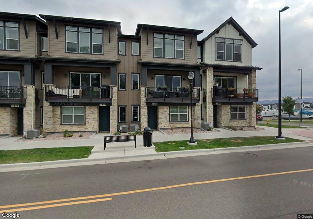
11890 W 52nd Ave Wheat Ridge, CO 80033
Appleridge Estates NeighborhoodEstimated Value: $580,000 - $612,000
3
Beds
4
Baths
2,058
Sq Ft
$289/Sq Ft
Est. Value
About This Home
This home is located at 11890 W 52nd Ave, Wheat Ridge, CO 80033 and is currently estimated at $594,600, approximately $288 per square foot. 11890 W 52nd Ave is a home with nearby schools including Vanderhoof Elementary School, Drake Junior High School, and Arvada West High School.
Ownership History
Date
Name
Owned For
Owner Type
Purchase Details
Closed on
Jan 11, 2023
Sold by
Remington Homes Co
Bought by
Doyle Eileen T
Current Estimated Value
Home Financials for this Owner
Home Financials are based on the most recent Mortgage that was taken out on this home.
Original Mortgage
$581,012
Outstanding Balance
$562,680
Interest Rate
6.49%
Mortgage Type
New Conventional
Estimated Equity
$31,920
Purchase Details
Closed on
Jan 19, 2022
Sold by
Hance Ranch Station Llc
Bought by
Remington Homes Co
Create a Home Valuation Report for This Property
The Home Valuation Report is an in-depth analysis detailing your home's value as well as a comparison with similar homes in the area
Home Values in the Area
Average Home Value in this Area
Purchase History
| Date | Buyer | Sale Price | Title Company |
|---|---|---|---|
| Doyle Eileen T | -- | -- | |
| Remington Homes Co | $303,455 | None Listed On Document |
Source: Public Records
Mortgage History
| Date | Status | Borrower | Loan Amount |
|---|---|---|---|
| Open | Doyle Eileen T | $581,012 |
Source: Public Records
Tax History Compared to Growth
Tax History
| Year | Tax Paid | Tax Assessment Tax Assessment Total Assessment is a certain percentage of the fair market value that is determined by local assessors to be the total taxable value of land and additions on the property. | Land | Improvement |
|---|---|---|---|---|
| 2024 | $6,342 | $33,021 | $6,030 | $26,991 |
| 2023 | $6,342 | $33,021 | $6,030 | $26,991 |
| 2022 | $3,349 | $18,574 | $18,574 | $0 |
| 2021 | $1,645 | $9,287 | $9,287 | $0 |
| 2020 | $1,617 | $9,130 | $9,130 | $0 |
| 2019 | $1,202 | $7,250 | $7,250 | $0 |
| 2018 | $0 | $0 | $0 | $0 |
Source: Public Records
Map
Nearby Homes
- 5154 Taft Ct
- 5240 Routt Ct Unit B
- Haskins Station Plan at Haskins Station
- Plan 133 at Haskins Station
- Plan 132 at Haskins Station
- Plan 122 at Haskins Station
- Plan 123 at Haskins Station
- 5173 Vivian St
- 12320 W 51st Ave
- 5188 Ward Rd
- 5160 Ward Rd
- 5182 Rob Way
- 11873 W 56th Cir
- 5293 Quail Way
- 11205 W 53rd Ln
- 11201 W 53rd Dr
- 5368 Quail St
- 5387 Pierson Ct
- 5555 Ward Rd
- 5738 Urban Center
- 11884 W 52nd Ave
- 11896 W 52nd Ave
- 11878 W 52nd Ave
- 11872 W 52nd Ave
- 5190 Taft Ct
- 5184 Taft Ct
- 5184 Taft Ct
- 11866 W 52nd Ave
- 5178 Taft Ct
- 11860 W 52nd Ave
- 11855 W 51st Ave
- 11854 W 52nd Ave
- 5172 Taft Ct
- 11857 W 51st Ave
- 11855 W 52nd Ave
- 11859 W 51st Ave
- 5166 Taft Ct
- 11848 W 52nd Ave
- 11861 W 51st Ave
- 5160 Taft Ct