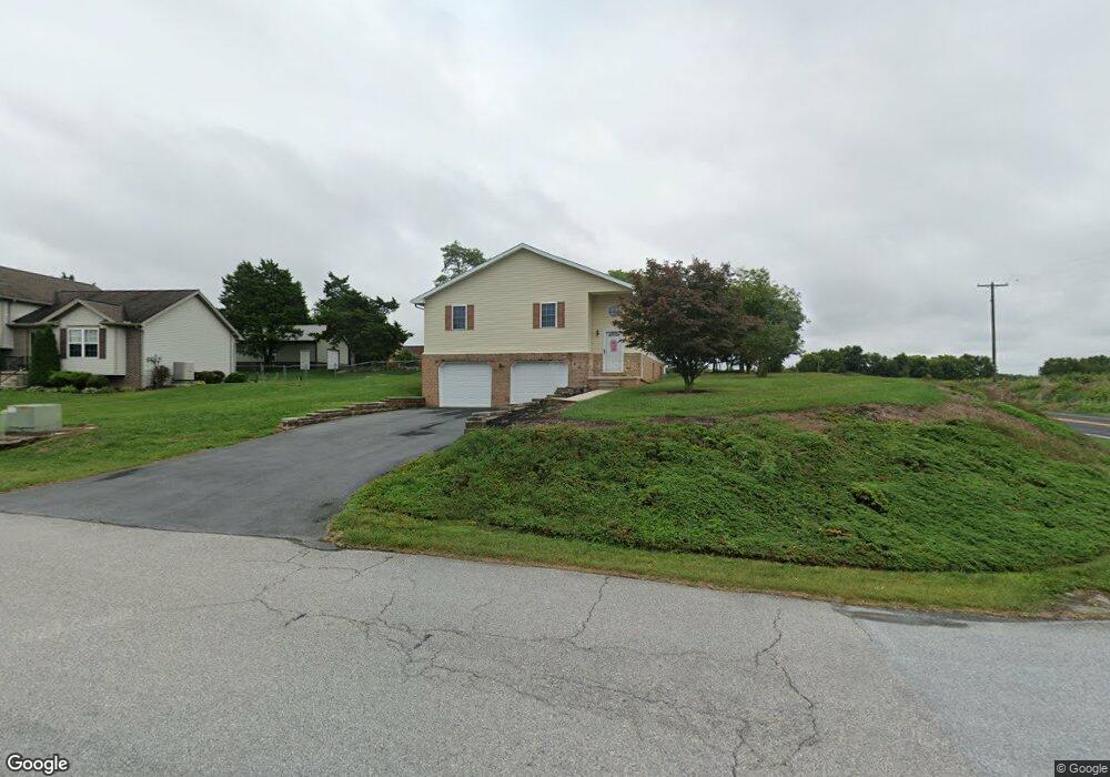
11898 Waxwing Dr Greencastle, PA 17225
Estimated Value: $158,801 - $338,000
--
Bed
--
Bath
1,502
Sq Ft
$179/Sq Ft
Est. Value
About This Home
This home is located at 11898 Waxwing Dr, Greencastle, PA 17225 and is currently estimated at $268,200, approximately $178 per square foot. 11898 Waxwing Dr is a home located in Franklin County with nearby schools including Greencastle-Antrim Primary School, Greencastle-Antrim Elementary School, and Greencastle-Antrim Middle School.
Ownership History
Date
Name
Owned For
Owner Type
Purchase Details
Closed on
Feb 16, 2007
Sold by
Mcdaid Rondy L and Baker Lori D
Bought by
Mcdaid Randy L and Mcdaid Lori D
Current Estimated Value
Home Financials for this Owner
Home Financials are based on the most recent Mortgage that was taken out on this home.
Original Mortgage
$144,000
Outstanding Balance
$86,585
Interest Rate
6.23%
Mortgage Type
New Conventional
Estimated Equity
$181,615
Create a Home Valuation Report for This Property
The Home Valuation Report is an in-depth analysis detailing your home's value as well as a comparison with similar homes in the area
Home Values in the Area
Average Home Value in this Area
Purchase History
| Date | Buyer | Sale Price | Title Company |
|---|---|---|---|
| Mcdaid Randy L | -- | None Available |
Source: Public Records
Mortgage History
| Date | Status | Borrower | Loan Amount |
|---|---|---|---|
| Open | Mcdaid Randy L | $144,000 |
Source: Public Records
Tax History Compared to Growth
Tax History
| Year | Tax Paid | Tax Assessment Tax Assessment Total Assessment is a certain percentage of the fair market value that is determined by local assessors to be the total taxable value of land and additions on the property. | Land | Improvement |
|---|---|---|---|---|
| 2025 | $3,587 | $21,440 | $2,340 | $19,100 |
| 2024 | $3,254 | $21,440 | $2,340 | $19,100 |
| 2023 | $3,216 | $21,440 | $2,340 | $19,100 |
| 2022 | $3,162 | $21,080 | $2,340 | $18,740 |
| 2021 | $3,100 | $21,080 | $2,340 | $18,740 |
| 2020 | $3,020 | $21,080 | $2,340 | $18,740 |
| 2019 | $2,951 | $21,080 | $2,340 | $18,740 |
| 2018 | $2,919 | $21,080 | $2,340 | $18,740 |
| 2017 | $2,846 | $21,080 | $2,340 | $18,740 |
| 2016 | $604 | $21,080 | $2,340 | $18,740 |
| 2015 | $563 | $21,080 | $2,340 | $18,740 |
| 2014 | $563 | $21,080 | $2,340 | $18,740 |
Source: Public Records
Map
Nearby Homes
- 431 Leitersburg St
- 674 Lohman Ave
- 775 Lohman Ave
- 823 Buchanan Trail E
- 34.77 Acres Red Oak Estate S
- 0 Molly Pitcher Hwy Unit PAFL178468
- 0 Molly Pitcher Hwy Unit PAFL2030380
- 0 Molly Pitcher Hwy Unit PAFL178444
- 271 E Baltimore St
- 480 S Carlisle St
- 602 Brookview Dr
- 11498 Nicole Dr
- 45 W Dahlgren St
- 763 Joy Dr
- 231 N Allison St Unit 1
- 101 N Carlisle St
- 148 N Carlisle St
- 12976 Daybreak Ln
- 375 Carolle St
- 1223 E Pebblebrook Dr
- 11896 Waxwing Dr
- 11892 Waxwing Dr
- 11864 Waxwing Dr
- 11869 Waxwing Dr
- 571 Leitersburg Rd
- 11856 Waxwing Dr
- 601 Leitersburg Rd
- 569 Leitersburg Rd
- 572 Tall Cedar Ln
- 569 Leitersburg Rd
- 567 Leitersburg Rd
- 11848 Waxwing Dr
- 560 Tall Cedar Ln
- 575 Tall Cedar Ln
- 0 Tall Cedar Ln
- 567 Tall Cedar Ln
- 11817 Waxwing Dr
- 555 Tall Cedar Ln
- 547 Leitersburg Rd
- 11828 Waxwing Dr