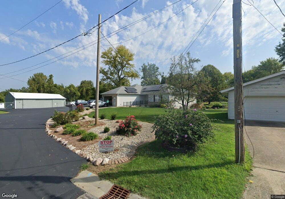
119 Alpha Dr Collinsville, IL 62234
Estimated Value: $332,106 - $401,000
5
Beds
6
Baths
2,476
Sq Ft
$151/Sq Ft
Est. Value
About This Home
This home is located at 119 Alpha Dr, Collinsville, IL 62234 and is currently estimated at $374,277, approximately $151 per square foot. 119 Alpha Dr is a home located in Madison County with nearby schools including John A Renfro Elementary School, Dorris Intermediate School, and Collinsville Middle School.
Ownership History
Date
Name
Owned For
Owner Type
Purchase Details
Closed on
Apr 11, 2003
Sold by
Townsend Donald R and Townsend Sandra I
Bought by
Townsend Sandra I and Michelle Rene Townsend Special Need Disc
Current Estimated Value
Home Financials for this Owner
Home Financials are based on the most recent Mortgage that was taken out on this home.
Original Mortgage
$172,300
Interest Rate
5.76%
Mortgage Type
New Conventional
Create a Home Valuation Report for This Property
The Home Valuation Report is an in-depth analysis detailing your home's value as well as a comparison with similar homes in the area
Home Values in the Area
Average Home Value in this Area
Purchase History
| Date | Buyer | Sale Price | Title Company |
|---|---|---|---|
| Townsend Sandra I | -- | Fatic | |
| Townsend Donald R | -- | -- |
Source: Public Records
Mortgage History
| Date | Status | Borrower | Loan Amount |
|---|---|---|---|
| Closed | Townsend Donald R | $172,300 |
Source: Public Records
Tax History Compared to Growth
Tax History
| Year | Tax Paid | Tax Assessment Tax Assessment Total Assessment is a certain percentage of the fair market value that is determined by local assessors to be the total taxable value of land and additions on the property. | Land | Improvement |
|---|---|---|---|---|
| 2024 | $6,461 | $107,060 | $7,200 | $99,860 |
| 2023 | $6,461 | $99,090 | $6,660 | $92,430 |
| 2022 | $6,127 | $88,970 | $5,960 | $83,010 |
| 2021 | $5,360 | $83,590 | $5,600 | $77,990 |
| 2020 | $5,148 | $79,750 | $5,340 | $74,410 |
| 2019 | $4,997 | $77,030 | $5,160 | $71,870 |
| 2018 | $5,240 | $78,040 | $5,190 | $72,850 |
| 2017 | $5,239 | $76,490 | $5,090 | $71,400 |
| 2016 | $5,509 | $76,490 | $5,090 | $71,400 |
| 2015 | $5,127 | $74,500 | $4,960 | $69,540 |
| 2014 | $5,127 | $74,500 | $4,960 | $69,540 |
| 2013 | $5,127 | $74,500 | $4,960 | $69,540 |
Source: Public Records
Map
Nearby Homes
- 22 Brookwood Dr
- 5 Brookwood Dr
- 2007 Belt Line Rd
- 414 Bunker Hill Dr
- 1121 Carraway Ct
- 1059 Lafayette Ct Unit A
- 1035 Lafayette Ct Unit B
- 1051 Lafayette Ct Unit A
- 1224 Cedar Ridge Ct
- 10 White Lily Dr
- 0 N Keebler Ave
- 123 Elliot St
- 0 Strong Ave
- 100 Debbie Dr
- 203 Greenfield Dr
- 308 Brown Ave
- 123 W Wickliffe Ave
- 617 N Morrison Ave
- 1120 Williams St
- 510 N Combs Ave
- 157 Rolling Oaks Dr
- 159 Rolling Oaks Dr
- 155 Rolling Oaks Dr
- 161 Rolling Oaks Dr
- 153 Rolling Oaks Dr
- 163 Rolling Oaks Dr
- 151 Rolling Oaks Dr
- 149 Rolling Oaks Dr
- 165 Rolling Oaks Dr
- 147 Rolling Oaks Dr
- 145 Rolling Oaks Dr
- 167 Rolling Oaks Dr
- 143 Rolling Oaks Dr
- 304 Chesapeake Ln
- 141 Rolling Oaks Dr
- 166 Rolling Oaks Dr
- 308 Chesapeake Ln
- 139 Rolling Oaks Dr
- 152 Rolling Oaks Dr
- 302 Chesapeake Ln