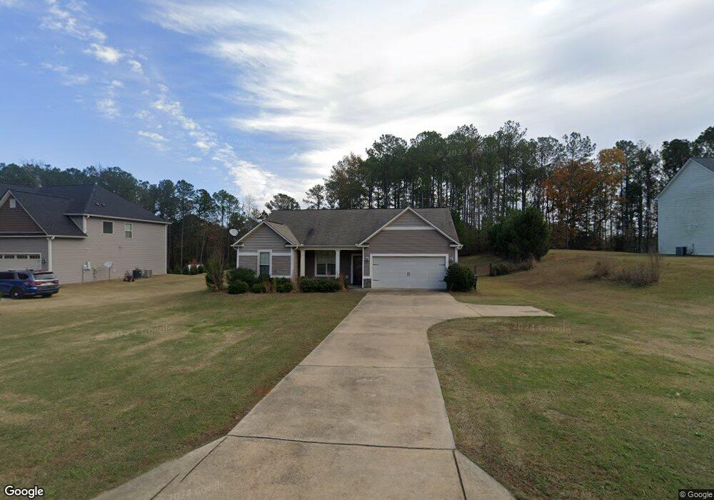
119 Amhurst Dr West Point, GA 31833
Estimated Value: $254,400 - $311,000
4
Beds
2
Baths
1,561
Sq Ft
$181/Sq Ft
Est. Value
About This Home
This home is located at 119 Amhurst Dr, West Point, GA 31833 and is currently estimated at $281,850, approximately $180 per square foot. 119 Amhurst Dr is a home located in Troup County with nearby schools including West Point Elementary School, Long Cane Elementary School, and Whitesville Road Elementary School.
Ownership History
Date
Name
Owned For
Owner Type
Purchase Details
Closed on
Mar 15, 2019
Sold by
Hunt Heather E
Bought by
Lee Ho Kyong
Current Estimated Value
Home Financials for this Owner
Home Financials are based on the most recent Mortgage that was taken out on this home.
Original Mortgage
$169,191
Outstanding Balance
$147,525
Interest Rate
4.3%
Mortgage Type
New Conventional
Estimated Equity
$134,325
Purchase Details
Closed on
Mar 30, 2015
Sold by
Hunt Steven D
Bought by
Hunt Steven D and Hunt Heather E
Home Financials for this Owner
Home Financials are based on the most recent Mortgage that was taken out on this home.
Original Mortgage
$148,249
Interest Rate
3.5%
Mortgage Type
FHA
Purchase Details
Closed on
Mar 11, 2013
Sold by
Dri Amhurst Llc
Bought by
Vaughn Jesse C
Create a Home Valuation Report for This Property
The Home Valuation Report is an in-depth analysis detailing your home's value as well as a comparison with similar homes in the area
Home Values in the Area
Average Home Value in this Area
Purchase History
| Date | Buyer | Sale Price | Title Company |
|---|---|---|---|
| Lee Ho Kyong | $167,500 | -- | |
| Lee Ho Kyong | $167,500 | -- | |
| Hunt Steven D | -- | -- | |
| Hunt Steven D | $151,000 | -- | |
| Hunt Steven D | -- | -- | |
| Hunt Steven D | $151,000 | -- | |
| Vaughn Jesse C | $138,800 | -- | |
| Vaughn Jesse C | $138,800 | -- |
Source: Public Records
Mortgage History
| Date | Status | Borrower | Loan Amount |
|---|---|---|---|
| Open | Lee Ho Kyong | $169,191 | |
| Previous Owner | Hunt Steven D | $148,249 |
Source: Public Records
Tax History
| Year | Tax Paid | Tax Assessment Tax Assessment Total Assessment is a certain percentage of the fair market value that is determined by local assessors to be the total taxable value of land and additions on the property. | Land | Improvement |
|---|---|---|---|---|
| 2025 | $2,408 | $88,280 | $14,000 | $74,280 |
| 2024 | $2,107 | $77,240 | $14,000 | $63,240 |
| 2023 | $2,181 | $79,960 | $14,000 | $65,960 |
| 2022 | $1,939 | $69,480 | $10,000 | $59,480 |
| 2021 | $2,055 | $68,120 | $10,000 | $58,120 |
| 2020 | $1,994 | $66,120 | $8,000 | $58,120 |
| 2019 | $1,759 | $58,320 | $6,000 | $52,320 |
Source: Public Records
Map
Nearby Homes
- 107 Amhurst Dr
- 4172 Bartley Rd
- 101 Garden Walk
- 648 Warner Rd
- 0 Warner Rd Unit 10686116
- 209 Harris Walk
- 211 Harris Walk
- 215 Harris Walk
- 223 Harris Walk
- 225 Harris Walk
- 221 Harris Walk
- 0 Johns Rd Unit 10615130
- 1015 Adams Rd
- 0 Sandtown Rd Unit 10255987
- Sandtown Road Unit: 1 2+ - Acre
- 143 W Drummond Rd
- 151 W Drummond Rd
- 157 W Drummond Rd
- 137 W Drummond Rd
- 131 W Drummond Rd
- 119 Amhurst Dr Unit 12
- 121 Amhurst Dr Unit 13
- 121 Amhurst Dr
- 117 Amhurst Dr Unit 11
- 123 Amhurst Dr Unit LOT 14
- 115 Amhurst Dr
- 120 Amhurst Dr
- 118 Amhurst Dr
- 122 Amhurst Dr
- 125 Amhurst Dr Unit 15
- 125 Amhurst Dr
- 113 Amhurst Dr
- 113 Amhurst Dr Unit LOT 9
- 116 Amhurst Dr
- 124 Amhurst Dr
- 124 Amhurst Dr Unit 59
- 127 Amhurst Dr Unit 16
- 127 Amhurst Dr
- 114 Amhurst Dr
- 126 Amhurst Dr
Your Personal Tour Guide
Ask me questions while you tour the home.