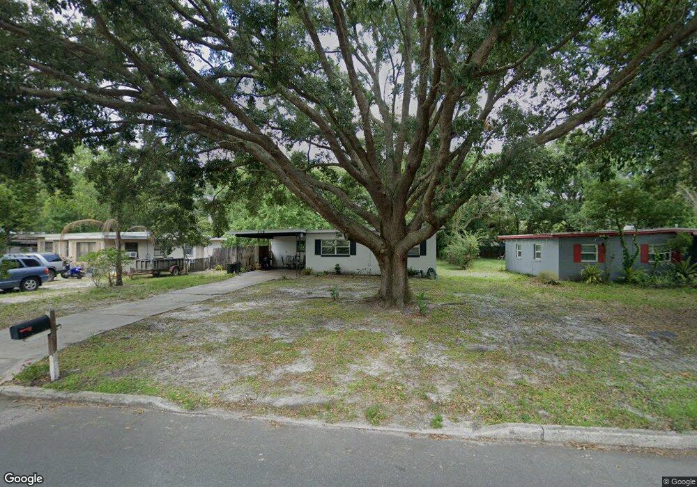
119 Anderson Cir Sanford, FL 32771
Estimated Value: $170,068 - $244,000
2
Beds
3
Baths
972
Sq Ft
$206/Sq Ft
Est. Value
About This Home
This home is located at 119 Anderson Cir, Sanford, FL 32771 and is currently estimated at $200,517, approximately $206 per square foot. 119 Anderson Cir is a home located in Seminole County with nearby schools including Seminole High School, Pine Crest Elementary School, and Hamilton Elementary School.
Ownership History
Date
Name
Owned For
Owner Type
Purchase Details
Closed on
Feb 1, 2024
Sold by
Shin Yong Suk
Bought by
M & Y Shin Holdings Llc
Current Estimated Value
Purchase Details
Closed on
Apr 7, 2016
Sold by
Persaud P Ranjan
Bought by
Woon Shin Myoung
Purchase Details
Closed on
Aug 31, 2012
Sold by
Clark James A and Clark Patricia A
Bought by
Persaud P Ranjan
Purchase Details
Closed on
Jul 1, 1986
Bought by
Woon Shin M
Purchase Details
Closed on
Jun 1, 1979
Bought by
Woon Shin M
Create a Home Valuation Report for This Property
The Home Valuation Report is an in-depth analysis detailing your home's value as well as a comparison with similar homes in the area
Home Values in the Area
Average Home Value in this Area
Purchase History
| Date | Buyer | Sale Price | Title Company |
|---|---|---|---|
| M & Y Shin Holdings Llc | $100 | None Listed On Document | |
| M & Y Shin Holdings Llc | $100 | None Listed On Document | |
| Woon Shin Myoung | -- | None Available | |
| Persaud P Ranjan | $15,000 | Pcs Title | |
| Woon Shin M | $40,000 | -- | |
| Woon Shin M | $100 | -- |
Source: Public Records
Tax History
| Year | Tax Paid | Tax Assessment Tax Assessment Total Assessment is a certain percentage of the fair market value that is determined by local assessors to be the total taxable value of land and additions on the property. | Land | Improvement |
|---|---|---|---|---|
| 2025 | $2,447 | $134,983 | $55,000 | $79,983 |
| 2024 | $1,956 | $104,667 | -- | -- |
| 2023 | $1,811 | $95,152 | $0 | $0 |
| 2021 | $1,462 | $78,638 | $0 | $0 |
| 2020 | $1,313 | $71,489 | $0 | $0 |
| 2019 | $1,272 | $68,739 | $0 | $0 |
| 2018 | $1,166 | $62,147 | $0 | $0 |
| 2017 | $1,096 | $57,538 | $0 | $0 |
| 2016 | $953 | $48,460 | $0 | $0 |
| 2015 | $842 | $46,299 | $0 | $0 |
| 2014 | $842 | $42,824 | $0 | $0 |
Source: Public Records
Map
Nearby Homes
- 129 Mayfair Cir
- 120 Club Rd
- 101 Country Club Dr
- 2005 Hartwell Ave
- 2437 Hartwell Ave
- 2432 Chase Ave
- 1807 Peach Ave
- 0 Peach Ave
- 0 Peach Ave
- 1606 Peach Ave
- 1809 Pear Ave
- 1809 Chase Ave
- 5642 W State Rd 46
- 1910 William Clark Ave
- 851 W 24th Place
- 1502 W 16th St
- 1212 W 16th St
- 202 Terrace Ct
- 832 W 25th St
- 1011 W 16th St
- 121 Anderson Cir
- 117 Anderson Cir
- 123 Anderson Cir
- 118 Anderson Cir Unit 3
- 132 Hays Dr
- 115 Anderson Cir
- 122 Anderson Cir
- 105 Wilkins Cir
- 107 Wilkins Cir
- 200 Bradshaw Dr
- 103 Wilkins Cir
- 113 Anderson Cir
- 109 Wilkins Cir
- 201 Bradshaw Dr
- 116 Anderson Cir
- 135 Hays Dr
- 202 Hays Dr
- 111 Anderson Cir
- 201 Hays Dr
- 133 Hays Dr
Your Personal Tour Guide
Ask me questions while you tour the home.