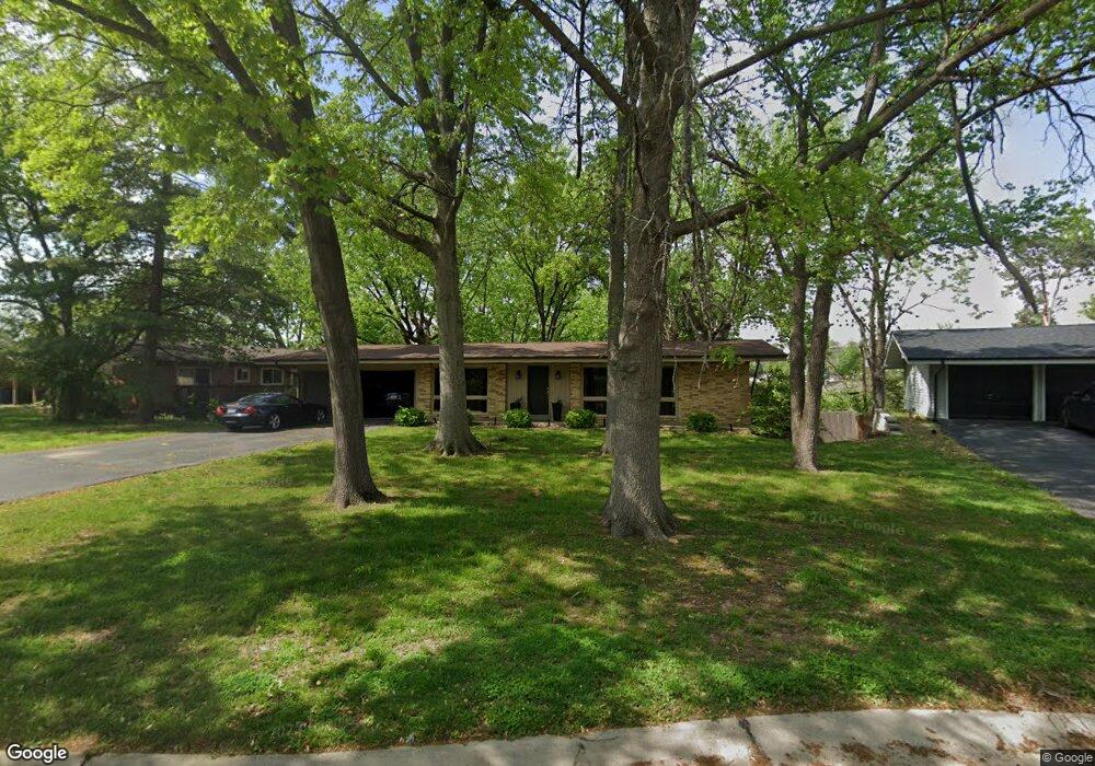
119 Brookside Ct Saint Louis, MO 63146
Estimated Value: $288,285 - $359,000
3
Beds
3
Baths
1,232
Sq Ft
$262/Sq Ft
Est. Value
About This Home
This home is located at 119 Brookside Ct, Saint Louis, MO 63146 and is currently estimated at $322,321, approximately $261 per square foot. 119 Brookside Ct is a home located in St. Louis County with nearby schools including Willow Brook Elementary School, Pattonville Heights Middle School, and Pattonville High School.
Ownership History
Date
Name
Owned For
Owner Type
Purchase Details
Closed on
Feb 14, 2020
Sold by
Hearst Susan
Bought by
Hearst Jonathan D and Young Stacy
Current Estimated Value
Home Financials for this Owner
Home Financials are based on the most recent Mortgage that was taken out on this home.
Original Mortgage
$237,500
Outstanding Balance
$210,290
Interest Rate
3.6%
Mortgage Type
New Conventional
Estimated Equity
$112,031
Purchase Details
Closed on
Jun 30, 2005
Sold by
Sandweiss Barry O and Sandweiss Dana S
Bought by
Hearst Susan
Home Financials for this Owner
Home Financials are based on the most recent Mortgage that was taken out on this home.
Original Mortgage
$185,250
Interest Rate
3.12%
Mortgage Type
New Conventional
Purchase Details
Closed on
Aug 15, 1997
Sold by
Madeline Smith and Madeline Marlene Ann
Bought by
Sandweiss Barry O
Home Financials for this Owner
Home Financials are based on the most recent Mortgage that was taken out on this home.
Original Mortgage
$108,494
Interest Rate
7.6%
Mortgage Type
FHA
Create a Home Valuation Report for This Property
The Home Valuation Report is an in-depth analysis detailing your home's value as well as a comparison with similar homes in the area
Home Values in the Area
Average Home Value in this Area
Purchase History
| Date | Buyer | Sale Price | Title Company |
|---|---|---|---|
| Hearst Jonathan D | $250,000 | Title Partners Agency Llc | |
| Hearst Susan | $195,000 | -- | |
| Sandweiss Barry O | -- | Land Title Company |
Source: Public Records
Mortgage History
| Date | Status | Borrower | Loan Amount |
|---|---|---|---|
| Open | Hearst Jonathan D | $237,500 | |
| Previous Owner | Hearst Susan | $185,250 | |
| Previous Owner | Sandweiss Barry O | $108,494 |
Source: Public Records
Tax History
| Year | Tax Paid | Tax Assessment Tax Assessment Total Assessment is a certain percentage of the fair market value that is determined by local assessors to be the total taxable value of land and additions on the property. | Land | Improvement |
|---|---|---|---|---|
| 2025 | $3,304 | $51,560 | $15,540 | $36,020 |
| 2024 | $3,304 | $47,080 | $7,750 | $39,330 |
| 2023 | $3,316 | $47,080 | $7,750 | $39,330 |
| 2022 | $3,004 | $38,800 | $11,650 | $27,150 |
| 2021 | $2,988 | $38,800 | $11,650 | $27,150 |
| 2020 | $2,873 | $35,810 | $9,630 | $26,180 |
| 2019 | $2,855 | $35,810 | $9,630 | $26,180 |
| 2018 | $2,462 | $28,270 | $9,630 | $18,640 |
| 2017 | $2,468 | $28,270 | $9,630 | $18,640 |
| 2016 | $2,615 | $29,410 | $7,710 | $21,700 |
Source: Public Records
Map
Nearby Homes
- 118 Brookside Ct
- 156 Forest Brook Ln
- 141 Meadowlark Dr
- 10381 Oxford Hill Dr Unit 6
- 10381 Oxford Hill Dr Unit 14
- 10367 Oxford Hill Dr Unit 26
- 10387 Forest Brook Ln Unit F
- 10395 Forest Brook Ln Unit E
- 10391 Forest Brook Ln Unit C
- 1411 Willow Brook Cove Unit 8
- 1380 Willow Brook Cove Ct Unit 1
- 10379 Forest Brook Ln Unit G
- 11152 Port Royal Dr
- 1467 Willow Brook Cove Unit C1467
- 10429 Corbeil Dr Unit 60
- 10407 Briarbend Dr Unit 3
- 10401 Briarbend Dr Unit 4
- 10328 Forest Brook Ln Unit H
- 10446 Willowdale Dr Unit 10446
- 1054 Willow Brook Dr
- 120 Brookside Ct
- 116 Willow Brook Dr
- 121 Brookside Ct
- 117 Brookside Ct
- 124 Brookside Ct
- 125 Brookside Ct
- 115 Willow Brook Dr
- 122 Brookside Ct
- 126 Brookside Ct
- 123 Brookside Ct
- 114 Willow Brook Dr
- 152 Forest Brook Ln
- 127 Willow Brook Dr
- 146 Glenridge Ln
- 147 Glenridge Ln
- 145 Glenridge Ln
- 151 Forest Brook Ln
- 82 Pebblebrook Ln
- 144 Meadowlark Dr
- 113 Willow Brook Dr
Your Personal Tour Guide
Ask me questions while you tour the home.