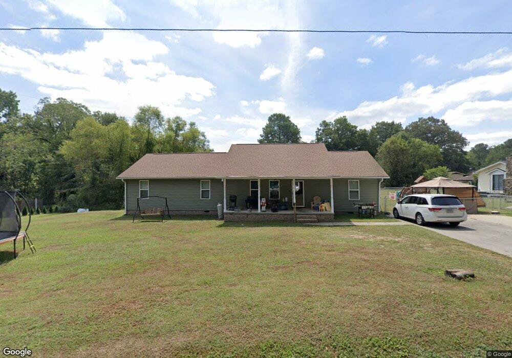
119 Campground Rd NE Calhoun, GA 30701
Estimated Value: $275,000 - $291,000
3
Beds
2
Baths
1,914
Sq Ft
$147/Sq Ft
Est. Value
About This Home
This home is located at 119 Campground Rd NE, Calhoun, GA 30701 and is currently estimated at $281,252, approximately $146 per square foot. 119 Campground Rd NE is a home located in Gordon County with nearby schools including Red Bud Elementary School, Red Bud Middle School, and Sonoraville High School.
Ownership History
Date
Name
Owned For
Owner Type
Purchase Details
Closed on
Feb 12, 2009
Sold by
Pierce Hershell
Bought by
Pierce Hershell and Pierce Tonia R
Current Estimated Value
Home Financials for this Owner
Home Financials are based on the most recent Mortgage that was taken out on this home.
Original Mortgage
$78,700
Interest Rate
5.03%
Mortgage Type
New Conventional
Purchase Details
Closed on
Jan 31, 2004
Sold by
Pierce Hershell and Parke Edna P
Bought by
Pierce Hershel
Purchase Details
Closed on
Feb 4, 2003
Sold by
Pierce Hershel
Bought by
Pierce Hershell and Parker Edna P
Purchase Details
Closed on
Jan 31, 2003
Sold by
Pierce Homer S and Annie Mae
Bought by
Pierce Hershell
Create a Home Valuation Report for This Property
The Home Valuation Report is an in-depth analysis detailing your home's value as well as a comparison with similar homes in the area
Home Values in the Area
Average Home Value in this Area
Purchase History
| Date | Buyer | Sale Price | Title Company |
|---|---|---|---|
| Pierce Hershell | -- | -- | |
| Pierce Hershel | -- | -- | |
| Pierce Hershell | -- | -- | |
| Pierce Hershell | $44,400 | -- | |
| Pierce Hershell | -- | -- |
Source: Public Records
Mortgage History
| Date | Status | Borrower | Loan Amount |
|---|---|---|---|
| Closed | Pierce Hershell | $78,700 |
Source: Public Records
Tax History Compared to Growth
Tax History
| Year | Tax Paid | Tax Assessment Tax Assessment Total Assessment is a certain percentage of the fair market value that is determined by local assessors to be the total taxable value of land and additions on the property. | Land | Improvement |
|---|---|---|---|---|
| 2024 | $1,887 | $76,280 | $6,040 | $70,240 |
| 2023 | $1,758 | $71,200 | $6,040 | $65,160 |
| 2022 | $1,743 | $66,520 | $6,040 | $60,480 |
| 2021 | $1,459 | $54,080 | $6,040 | $48,040 |
| 2020 | $1,510 | $54,720 | $6,040 | $48,680 |
| 2019 | $1,519 | $54,720 | $6,040 | $48,680 |
| 2018 | $1,404 | $50,760 | $6,040 | $44,720 |
| 2017 | $1,363 | $48,000 | $6,040 | $41,960 |
| 2016 | $1,366 | $48,000 | $6,040 | $41,960 |
| 2015 | $1,351 | $47,080 | $6,040 | $41,040 |
| 2014 | $1,251 | $44,962 | $6,076 | $38,886 |
Source: Public Records
Map
Nearby Homes
- 279 Owens Gin Rd NE
- 367 School House Rd NE
- 320 School House Rd NE
- 00 Hunts Gin Rd L1
- 158 Brooksmill Dr NE
- 0 Woodedge Dr NE Unit 7661757
- 0 Woodedge Dr NE Unit LOT 36
- 426 Fields Ferry Dr NE
- 00002 Lovebridge Rd SE
- lot 4 Lovebridge Rd SE
- 127 Telluride Trail NE
- 0 Lovebridge Rd SE
- 0 Hunts Gin Rd L2
- 121 Harrison Ln NE
- 702 Cash Rd SE
- 0 Libby Ln SE Unit 10275212
- 0 Libby Ln SE Unit 7362041
- 0 Owens Gin Rd NE Unit 10605970
- 0 Owens Gin Rd NE Unit 7650167
- 0 Owens Gin Rd NE Unit 10581957
- 107 Campground Rd NE
- 141 Campground Rd NE
- 253 Knight Dr NE
- 211 Knight Dr NE
- 177 Knight Dr NE
- 00 Bethesda Church Cash Rd
- 104 Owens Cutoff Rd NE
- 1005 School House Rd NE
- 4681 Red Bud Rd NE
- 1049 School House Rd NE
- 220 Knight Dr NE
- 1035 School House Rd NE
- 288 Knight Dr NE
- 1065 School House Rd NE
- 125 Owens Cutoff Rd NE
- 158 Knight Dr NE
- 148 Knight Dr NE
- 106 Webb Dr NE
- 109 Webb Dr NE
- 4597 Red Bud Rd NE