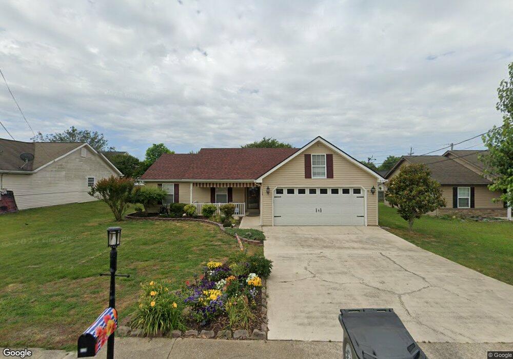
119 Colony Cir Fort Oglethorpe, GA 30742
Estimated Value: $257,455 - $292,000
3
Beds
2
Baths
1,248
Sq Ft
$218/Sq Ft
Est. Value
About This Home
This home is located at 119 Colony Cir, Fort Oglethorpe, GA 30742 and is currently estimated at $272,114, approximately $218 per square foot. 119 Colony Cir is a home located in Catoosa County with nearby schools including Battlefield Primary School, Battlefield Elementary School, and Lakeview Middle School.
Ownership History
Date
Name
Owned For
Owner Type
Purchase Details
Closed on
May 16, 2024
Sold by
Tenney Della W
Bought by
Furman Linda Diane Tr
Current Estimated Value
Purchase Details
Closed on
Jan 26, 2007
Sold by
Strickland Joseph Edward
Bought by
Tenney Edward J
Home Financials for this Owner
Home Financials are based on the most recent Mortgage that was taken out on this home.
Original Mortgage
$94,400
Interest Rate
6.14%
Mortgage Type
New Conventional
Purchase Details
Closed on
Dec 18, 2006
Sold by
Watson Sherrie E
Bought by
Strickland Joseph Edward
Home Financials for this Owner
Home Financials are based on the most recent Mortgage that was taken out on this home.
Original Mortgage
$94,400
Interest Rate
6.14%
Mortgage Type
New Conventional
Purchase Details
Closed on
Oct 29, 1999
Bought by
Strickland Joseph E
Create a Home Valuation Report for This Property
The Home Valuation Report is an in-depth analysis detailing your home's value as well as a comparison with similar homes in the area
Home Values in the Area
Average Home Value in this Area
Purchase History
| Date | Buyer | Sale Price | Title Company |
|---|---|---|---|
| Furman Linda Diane Tr | -- | -- | |
| Tenney Edward J | $118,000 | -- | |
| Strickland Joseph Edward | -- | -- | |
| Strickland Joseph E | $87,900 | -- |
Source: Public Records
Mortgage History
| Date | Status | Borrower | Loan Amount |
|---|---|---|---|
| Previous Owner | Tenney Edward J | $94,400 |
Source: Public Records
Tax History Compared to Growth
Tax History
| Year | Tax Paid | Tax Assessment Tax Assessment Total Assessment is a certain percentage of the fair market value that is determined by local assessors to be the total taxable value of land and additions on the property. | Land | Improvement |
|---|---|---|---|---|
| 2024 | $534 | $88,932 | $11,000 | $77,932 |
| 2023 | $479 | $69,240 | $11,000 | $58,240 |
| 2022 | $368 | $54,061 | $11,000 | $43,061 |
| 2021 | $1,596 | $54,061 | $11,000 | $43,061 |
| 2020 | $1,427 | $48,344 | $11,000 | $37,344 |
| 2019 | $275 | $46,344 | $9,000 | $37,344 |
| 2018 | $1,452 | $46,344 | $9,000 | $37,344 |
| 2017 | $274 | $43,454 | $7,200 | $36,254 |
| 2016 | $265 | $40,288 | $7,200 | $33,088 |
| 2015 | -- | $40,288 | $7,200 | $33,088 |
| 2014 | -- | $40,288 | $7,200 | $33,088 |
| 2013 | -- | $38,676 | $6,912 | $31,764 |
Source: Public Records
Map
Nearby Homes
- 124 Colony Cir
- 351 Franklin Cir
- 6 Rocky Ford Rd
- 183 McDonald Dr
- 17 Southshore Dr
- 1305 Park Forrest Dr
- 180 Gem Dr
- 129 Cedar Grove Ln
- 1002 Cedar Creek Dr
- 504 Frieda Dr
- 64 Stovall St
- 325 Mockingbird Ln
- 15 Evelyn Dr
- 300 Dogwood Ln
- 301 Dogwood Ln
- 99 Battlewood Dr
- 17 Evergreen Cir
- 66 Yellow Brick Rd
- 544 Neal Dr
- 64 Yellow Brick Rd