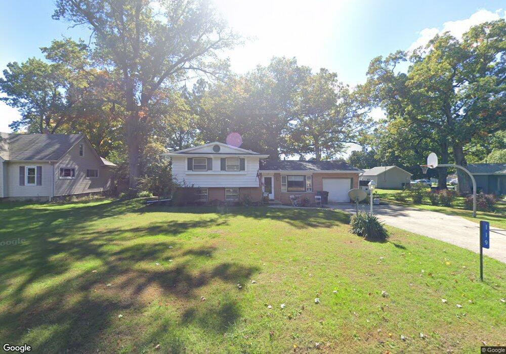
119 E Poplar St Silver Lake, WI 53170
Estimated Value: $282,909 - $370,000
3
Beds
2
Baths
1,372
Sq Ft
$230/Sq Ft
Est. Value
About This Home
This home is located at 119 E Poplar St, Silver Lake, WI 53170 and is currently estimated at $315,477, approximately $229 per square foot. 119 E Poplar St is a home located in Kenosha County with nearby schools including Riverview Elementary School and Wilmot High School.
Ownership History
Date
Name
Owned For
Owner Type
Purchase Details
Closed on
Aug 31, 2005
Sold by
Diedrich Michael J and Diedrich Dawn M
Bought by
Saucerman Jeffery A and Saucerman Carolyn F
Current Estimated Value
Home Financials for this Owner
Home Financials are based on the most recent Mortgage that was taken out on this home.
Original Mortgage
$151,000
Outstanding Balance
$78,478
Interest Rate
5.89%
Mortgage Type
New Conventional
Estimated Equity
$236,999
Create a Home Valuation Report for This Property
The Home Valuation Report is an in-depth analysis detailing your home's value as well as a comparison with similar homes in the area
Home Values in the Area
Average Home Value in this Area
Purchase History
| Date | Buyer | Sale Price | Title Company |
|---|---|---|---|
| Saucerman Jeffery A | $171,500 | Professional Title Scus |
Source: Public Records
Mortgage History
| Date | Status | Borrower | Loan Amount |
|---|---|---|---|
| Open | Saucerman Jeffery A | $151,000 |
Source: Public Records
Tax History
| Year | Tax Paid | Tax Assessment Tax Assessment Total Assessment is a certain percentage of the fair market value that is determined by local assessors to be the total taxable value of land and additions on the property. | Land | Improvement |
|---|---|---|---|---|
| 2025 | $3,637 | $265,400 | $52,900 | $212,500 |
| 2024 | $3,220 | $236,100 | $42,500 | $193,600 |
| 2023 | $2,962 | $236,100 | $42,500 | $193,600 |
| 2022 | $3,355 | $189,100 | $38,700 | $150,400 |
| 2021 | $3,310 | $189,100 | $38,700 | $150,400 |
| 2020 | $3,184 | $168,200 | $36,700 | $131,500 |
| 2019 | $3,052 | $168,200 | $36,700 | $131,500 |
| 2018 | $2,542 | $127,000 | $29,500 | $97,500 |
| 2017 | $3,158 | $127,000 | $29,500 | $97,500 |
| 2016 | $3,135 | $127,000 | $29,500 | $97,500 |
| 2015 | $3,343 | $171,600 | $44,900 | $126,700 |
| 2014 | $3,601 | $171,600 | $44,900 | $126,700 |
Source: Public Records
Map
Nearby Homes
- Lt1 296th Ave
- 416 S Cogswell Dr Unit 18
- 416 S Cogswell Dr Unit 19
- 325 W Park St
- 9506 296th Ave
- 750 4th Ct
- 802 N Manor Dr Unit 2
- 808 N Manor Dr
- 9710 304th Ave
- 1215 Pryor St
- LT14 276th Ave
- 10335 278th Ave
- 31103 75th Place
- 28421 107th St
- 9912 271st Ave
- 9918 271st Ave
- 33016 Bassett Rd
- 29102 112th Place
- Lt0 State Highway 50
- Lt0 Wisconsin 50
Your Personal Tour Guide
Ask me questions while you tour the home.