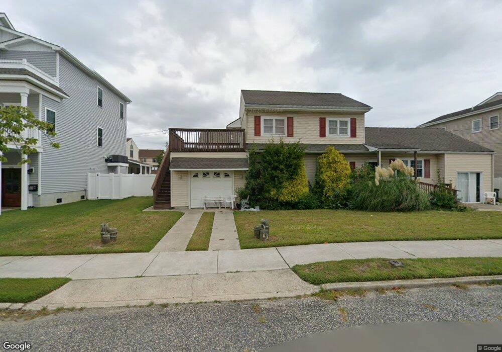
119 E Rochester Ave Wildwood, NJ 08260
The Wildwoods NeighborhoodEstimated Value: $1,015,000 - $1,090,000
--
Bed
--
Bath
2,011
Sq Ft
$521/Sq Ft
Est. Value
About This Home
This home is located at 119 E Rochester Ave, Wildwood, NJ 08260 and is currently estimated at $1,048,369, approximately $521 per square foot. 119 E Rochester Ave is a home located in Cape May County with nearby schools including David C. Douglass Veterans Memorial School, Carl T. Mitnick School, and Maud Abrams School.
Ownership History
Date
Name
Owned For
Owner Type
Purchase Details
Closed on
Jan 25, 2023
Sold by
Warner Doris G
Bought by
Distefano Casanda T
Current Estimated Value
Purchase Details
Closed on
Apr 1, 1999
Sold by
Papotto Joseph
Bought by
Warner Walter and Warner Doris
Create a Home Valuation Report for This Property
The Home Valuation Report is an in-depth analysis detailing your home's value as well as a comparison with similar homes in the area
Home Values in the Area
Average Home Value in this Area
Purchase History
| Date | Buyer | Sale Price | Title Company |
|---|---|---|---|
| Distefano Casanda T | -- | -- | |
| Distefano Casanda T | -- | None Listed On Document | |
| Warner Walter | $155,000 | -- |
Source: Public Records
Tax History Compared to Growth
Tax History
| Year | Tax Paid | Tax Assessment Tax Assessment Total Assessment is a certain percentage of the fair market value that is determined by local assessors to be the total taxable value of land and additions on the property. | Land | Improvement |
|---|---|---|---|---|
| 2025 | $9,715 | $489,700 | $361,900 | $127,800 |
| 2024 | $9,715 | $489,700 | $361,900 | $127,800 |
| 2023 | $9,564 | $489,700 | $361,900 | $127,800 |
| 2022 | $9,265 | $489,700 | $361,900 | $127,800 |
| 2021 | $8,520 | $489,700 | $361,900 | $127,800 |
| 2020 | $8,819 | $489,700 | $361,900 | $127,800 |
| 2019 | $8,574 | $489,700 | $361,900 | $127,800 |
| 2018 | $8,369 | $489,700 | $361,900 | $127,800 |
| 2017 | $8,374 | $489,700 | $361,900 | $127,800 |
| 2016 | $8,256 | $489,700 | $361,900 | $127,800 |
| 2015 | $7,982 | $489,700 | $361,900 | $127,800 |
| 2014 | $8,319 | $527,000 | $399,200 | $127,800 |
Source: Public Records
Map
Nearby Homes
- 111 Austin Ave
- 130 E North Station Ave Unit 130
- 128 E North Station Ave Unit 128
- 101 W Saint Louis Ave
- 100 E Raleigh Ave
- 524 Turtle Gut Cir Unit 524
- 209 E Pittsburgh Ave
- 9601 Atlantic Ave Unit 604
- 107 E Hollywood Ave
- 9103 Atlantic Ave Unit 405
- 9103 Atlantic Ave Unit 310
- 9103 Atlantic Ave Unit 411
- 9103 Atlantic Ave Unit 202
- 127 W Hollywood Ave
- 300 E Raleigh Ave Unit 509
- 300 E Raleigh Ave Unit 216
- 9101 Atlantic Ave Unit 303
- 9101 Atlantic Ave Unit 306
- 8901 Atlantic Ave Unit 203
- 8901 Atlantic Ave Unit 601
- 116 E Richmond Ave
- 114 E Richmond Ave Unit 114
- 117 E Rochester Ave
- 117 E Rochester Ave Unit B
- 117 E Rochester #B Ave Unit B
- 117 E Rochester B Ave Unit B
- 117 E Rochester Ave Unit A
- 123 E Rochester Ave Unit Oceanside
- 123 E Rochester Ave Unit 123
- 121 E Rochester Ave
- 118 E Richmond Ave
- 120 E Richmond Ave
- 112 E Richmond Ave
- 108 E Rochester Ave
- 110 E Richmond Ave
- 106 E Rochester Ave
- 110 E Rochester Ave
- 115 E Rochester Ave
- 108 E Richmond Ave
- 115 E Memphis Ave