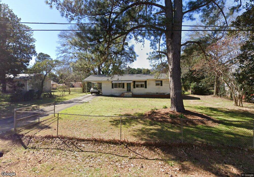
119 Fisher St Warner Robins, GA 31093
Estimated Value: $123,211 - $144,000
3
Beds
1
Bath
1,128
Sq Ft
$121/Sq Ft
Est. Value
About This Home
This home is located at 119 Fisher St, Warner Robins, GA 31093 and is currently estimated at $136,803, approximately $121 per square foot. 119 Fisher St is a home located in Houston County with nearby schools including Westside Elementary School, Northside Middle School, and Northside High School.
Ownership History
Date
Name
Owned For
Owner Type
Purchase Details
Closed on
Sep 13, 2000
Sold by
Henderson Johnny J and Henderson Virginia
Bought by
Henderson Virginia A
Current Estimated Value
Purchase Details
Closed on
Apr 18, 1989
Sold by
Burke Kate R
Bought by
Henderson Johnny J and Henderson Virginia A
Purchase Details
Closed on
Jul 18, 1986
Sold by
Stewart J W
Bought by
Burke Kate R
Purchase Details
Closed on
Jan 8, 1960
Sold by
Tyson Reba L
Bought by
Stewart J W
Purchase Details
Closed on
May 27, 1955
Bought by
Tyson Reba L
Create a Home Valuation Report for This Property
The Home Valuation Report is an in-depth analysis detailing your home's value as well as a comparison with similar homes in the area
Home Values in the Area
Average Home Value in this Area
Purchase History
| Date | Buyer | Sale Price | Title Company |
|---|---|---|---|
| Henderson Virginia A | -- | -- | |
| Henderson Johnny J | -- | -- | |
| Burke Kate R | -- | -- | |
| Stewart J W | -- | -- | |
| Tyson Reba L | -- | -- |
Source: Public Records
Tax History Compared to Growth
Tax History
| Year | Tax Paid | Tax Assessment Tax Assessment Total Assessment is a certain percentage of the fair market value that is determined by local assessors to be the total taxable value of land and additions on the property. | Land | Improvement |
|---|---|---|---|---|
| 2024 | $708 | $29,600 | $5,560 | $24,040 |
| 2023 | $563 | $23,280 | $3,600 | $19,680 |
| 2022 | $527 | $21,800 | $3,600 | $18,200 |
| 2021 | $480 | $19,760 | $3,600 | $16,160 |
| 2020 | $488 | $20,000 | $3,600 | $16,400 |
| 2019 | $488 | $20,000 | $3,600 | $16,400 |
| 2018 | $488 | $20,000 | $3,600 | $16,400 |
| 2017 | $489 | $20,000 | $3,600 | $16,400 |
| 2016 | $489 | $20,000 | $3,600 | $16,400 |
| 2015 | $490 | $20,000 | $3,600 | $16,400 |
| 2014 | -- | $20,000 | $3,600 | $16,400 |
| 2013 | -- | $21,840 | $4,000 | $17,840 |
Source: Public Records
Map
Nearby Homes
- 209 Knodishall Dr
- 129 Maryjay Dr
- 111 Hawthorne Rd
- 501 Pinecrest Dr
- 318 Somerset Dr
- 301 Millside Dr
- 321 Somerset Dr
- 303 Pinecrest Dr
- 112 Peacock Dr
- 725 B East Side Dr
- 127 N Amanda Place
- 221 Gilchrist Dr
- 110 Westcliff Cir Unit C
- 106 Westcliff Cir
- 103 Westcliff Cir Unit A
- 103 Westcliff Cir Unit A
- 115 Wray St
- 115 Pershing Place Ct
- 707 Wilmington Dr
- 103 Shannon Ln