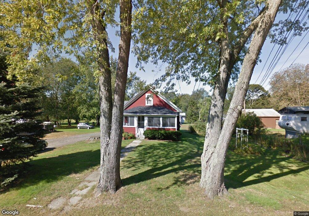
119 Fore Rd Eliot, ME 03903
South Eliot NeighborhoodEstimated Value: $314,000 - $579,000
4
Beds
3
Baths
2,866
Sq Ft
$142/Sq Ft
Est. Value
About This Home
This home is located at 119 Fore Rd, Eliot, ME 03903 and is currently estimated at $406,019, approximately $141 per square foot. 119 Fore Rd is a home located in York County with nearby schools including Marshwood High School and Seacoast Waldorf School.
Ownership History
Date
Name
Owned For
Owner Type
Purchase Details
Closed on
Aug 13, 2025
Sold by
Plaisted Ft and Plaisted
Bought by
Plaisted Richard C
Current Estimated Value
Purchase Details
Closed on
May 17, 2023
Sold by
Plaisted Richard C
Bought by
Plaisted Ft and Plaisted
Purchase Details
Closed on
Oct 23, 2006
Sold by
Mccarthy Beverly P and Plaisted Richard C
Bought by
Plaisted Richard C
Create a Home Valuation Report for This Property
The Home Valuation Report is an in-depth analysis detailing your home's value as well as a comparison with similar homes in the area
Home Values in the Area
Average Home Value in this Area
Purchase History
| Date | Buyer | Sale Price | Title Company |
|---|---|---|---|
| Plaisted Richard C | -- | -- | |
| Plaisted Ft | -- | None Available | |
| Plaisted Ft | -- | None Available | |
| Plaisted Ft | -- | None Available | |
| Plaisted Ft | -- | None Available | |
| Plaisted Ft | -- | None Available | |
| Plaisted Ft | -- | None Available | |
| Plaisted Richard C | -- | -- | |
| Plaisted Richard C | -- | -- | |
| Plaisted Richard C | -- | -- |
Source: Public Records
Mortgage History
| Date | Status | Borrower | Loan Amount |
|---|---|---|---|
| Previous Owner | Plaisted Richard C | $70,000 |
Source: Public Records
Tax History
| Year | Tax Paid | Tax Assessment Tax Assessment Total Assessment is a certain percentage of the fair market value that is determined by local assessors to be the total taxable value of land and additions on the property. | Land | Improvement |
|---|---|---|---|---|
| 2024 | $2,650 | $223,600 | $106,000 | $117,600 |
| 2023 | $2,620 | $213,900 | $100,600 | $113,300 |
| 2022 | $2,583 | $213,500 | $100,600 | $112,900 |
| 2021 | $2,475 | $207,100 | $96,000 | $111,100 |
| 2020 | $255 | $185,500 | $91,400 | $94,100 |
| 2019 | $252 | $185,500 | $91,400 | $94,100 |
| 2018 | $2,727 | $185,500 | $91,400 | $94,100 |
| 2017 | $2,653 | $185,500 | $91,400 | $94,100 |
| 2016 | $2,606 | $185,500 | $91,400 | $94,100 |
| 2015 | $2,645 | $188,900 | $91,400 | $97,500 |
| 2014 | $2,607 | $188,900 | $91,400 | $97,500 |
| 2013 | $2,488 | $188,900 | $91,400 | $97,500 |
Source: Public Records
Map
Nearby Homes
- 0 Franks Fort Island Unit 1650383
- 33 Little Bay Dr
- 13 Little Bay Dr
- 0 Cote Dr Unit 55B
- 18 Little Bay Dr
- 348 Dover Point Rd
- 28 Little Bay Dr
- 354 Dover Point Rd
- 71 Shipwright Way
- 10 Shipwright Way
- 21 Clearwater Dr
- 61 Beane Ln
- Slip B18 Little Bay
- 18 Shipping Ln
- 18 Deborah Ln
- 41 Clearwater Dr
- 42 Caslyn Dr
- 220 Dover Point Rd
- 161 Bolt Hill Rd
- 8 Caslyn Dr
- 13 Fore Rd
- 10 Fore Rd
- 125 Fore Rd
- 126 Fore Rd
- 118 Fore Rd
- 129 Fore Rd
- 111 Fore Rd
- 114 Fore Rd
- 0 River Rd Unit map 51 lot 34
- 0 River Rd Unit 845555
- 0 River Rd Unit 845547
- 0 River Rd Unit 793896
- 0 River Rd Unit 721408
- 0 River Rd Unit 473835
- 0 River Rd Unit 857314
- 0 River Rd Unit 665671
- 0 River Rd Unit 916183
- 0 River Rd Unit 961604
- 0 River Rd Unit 1082051
- 0 River Rd Unit 1261744
Your Personal Tour Guide
Ask me questions while you tour the home.