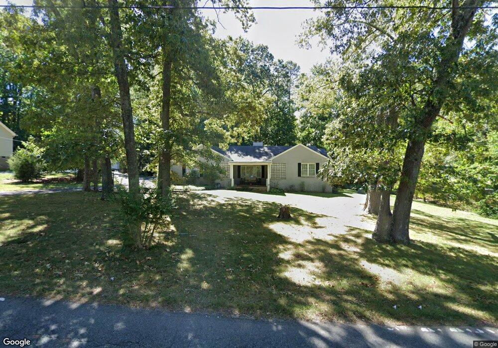
119 Forest Dr Thomasville, NC 27360
Estimated Value: $285,000 - $342,000
3
Beds
2
Baths
2,375
Sq Ft
$132/Sq Ft
Est. Value
About This Home
This home is located at 119 Forest Dr, Thomasville, NC 27360 and is currently estimated at $314,556, approximately $132 per square foot. 119 Forest Dr is a home located in Davidson County with nearby schools including Fair Grove Elementary School, E. Lawson Brown Middle School, and East Davidson High School.
Ownership History
Date
Name
Owned For
Owner Type
Purchase Details
Closed on
Dec 31, 2009
Sold by
Watford Realty Inc
Bought by
Craddock Jennifer
Current Estimated Value
Home Financials for this Owner
Home Financials are based on the most recent Mortgage that was taken out on this home.
Original Mortgage
$138,650
Outstanding Balance
$85,334
Interest Rate
3.75%
Mortgage Type
New Conventional
Estimated Equity
$229,222
Create a Home Valuation Report for This Property
The Home Valuation Report is an in-depth analysis detailing your home's value as well as a comparison with similar homes in the area
Home Values in the Area
Average Home Value in this Area
Purchase History
| Date | Buyer | Sale Price | Title Company |
|---|---|---|---|
| Craddock Jennifer | $155,000 | None Available |
Source: Public Records
Mortgage History
| Date | Status | Borrower | Loan Amount |
|---|---|---|---|
| Open | Craddock Jennifer | $138,650 |
Source: Public Records
Tax History
| Year | Tax Paid | Tax Assessment Tax Assessment Total Assessment is a certain percentage of the fair market value that is determined by local assessors to be the total taxable value of land and additions on the property. | Land | Improvement |
|---|---|---|---|---|
| 2025 | $2,037 | $178,270 | $0 | $0 |
| 2024 | $2,037 | $178,270 | $0 | $0 |
| 2023 | $2,037 | $178,270 | $0 | $0 |
| 2022 | $2,037 | $178,270 | $0 | $0 |
| 2021 | $2,037 | $178,270 | $0 | $0 |
| 2020 | $1,741 | $155,010 | $0 | $0 |
| 2019 | $1,767 | $155,010 | $0 | $0 |
| 2018 | $1,767 | $155,010 | $0 | $0 |
| 2017 | $1,767 | $155,010 | $0 | $0 |
| 2016 | $1,705 | $155,010 | $0 | $0 |
| 2015 | $1,705 | $155,010 | $0 | $0 |
| 2014 | $1,510 | $137,240 | $0 | $0 |
Source: Public Records
Map
Nearby Homes
- 119 Hillcrest Rd
- 104 Willowbrook Dr
- 158 S Old Fisher Ferry Rd
- 300 Willowbrook Dr
- 73 Harris Farm Ct
- 122 S Old Fisher Ferry Rd
- 323 Jarrett Rd
- 0 Smith Dr
- 32 Ranchor Dr
- 114 Brooke Ridge Dr
- 128 Kendall Mill Rd
- 12 Braxton Ln
- 143 Lambeth Rd
- 4 Braxton Ln
- 1109 W Holly Hill Rd
- 109 Fletcher's Farm Dr
- 1892 Lake Rd
- 1111 Forest Ln
- 821 Fisher Ferry St
- 406 Jack Pine St
- 203 Forest Dr
- 117 Forest Dr
- 205 Forest Dr
- 489 Fairgrove Rd
- 115 Forest Dr
- 116 Forest Dr
- 207 Forest Dr
- 509 Fairgrove Rd
- 457 Fairgrove Rd
- 475 Fairgrove Rd
- 113 Forest Dr
- 200 Forest Dr
- 206 S Westwood Ave
- 535 Fairgrove Rd
- 209 Forest Dr
- 551 Fairgrove Rd
- 204 Forest Dr
- 439 Fairgrove Rd
- 114 Forest Dr
- 206 Forest Dr
Your Personal Tour Guide
Ask me questions while you tour the home.