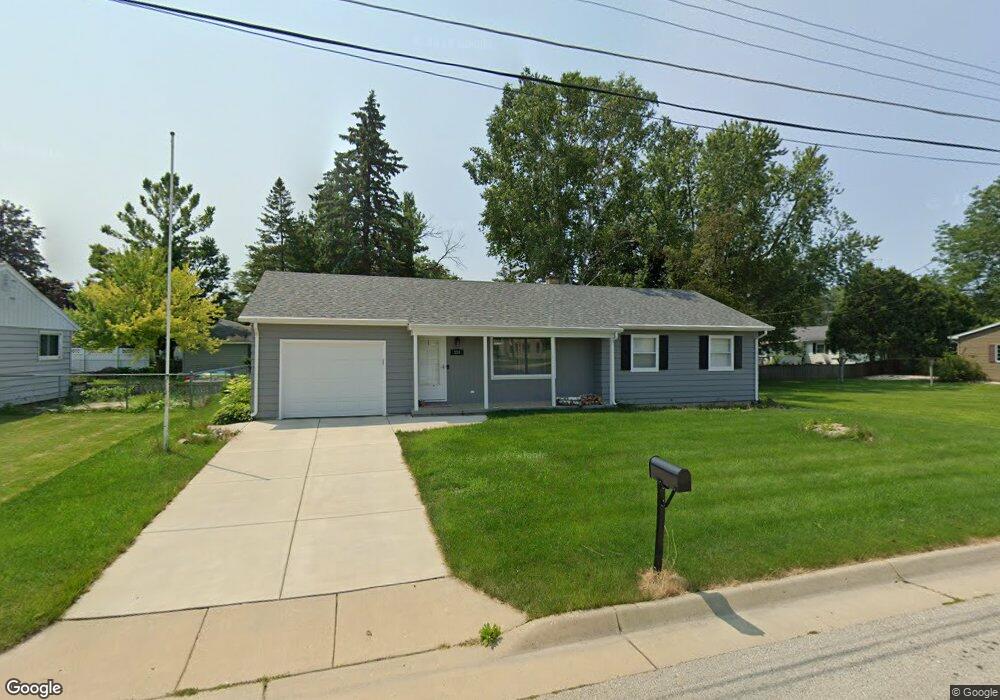
119 Franklin St Watertown, WI 53094
Estimated Value: $212,000 - $265,000
3
Beds
2
Baths
1,051
Sq Ft
$225/Sq Ft
Est. Value
About This Home
This home is located at 119 Franklin St, Watertown, WI 53094 and is currently estimated at $236,462, approximately $224 per square foot. 119 Franklin St is a home located in Jefferson County with nearby schools including Watertown High School, eCampus Academy Charter School, and Trinity-St. Luke's Lutheran Elementary School.
Ownership History
Date
Name
Owned For
Owner Type
Purchase Details
Closed on
Jun 16, 2017
Sold by
Crew Mark R and Crew Autumn A
Bought by
Mac Real Estate Invetments Llc
Current Estimated Value
Purchase Details
Closed on
Dec 10, 2008
Sold by
Bank Of New York Trust Company Na
Bought by
Carew Mark R and Carew Autumn
Purchase Details
Closed on
Jul 30, 2008
Sold by
Salas Mayre M
Bought by
The Bank Of New York Trust Company Na
Purchase Details
Closed on
Sep 30, 2005
Sold by
Glaznap Florence H
Bought by
Salas Mayre M and Salas Jose A
Home Financials for this Owner
Home Financials are based on the most recent Mortgage that was taken out on this home.
Original Mortgage
$151,900
Interest Rate
8.5%
Mortgage Type
Adjustable Rate Mortgage/ARM
Create a Home Valuation Report for This Property
The Home Valuation Report is an in-depth analysis detailing your home's value as well as a comparison with similar homes in the area
Home Values in the Area
Average Home Value in this Area
Purchase History
| Date | Buyer | Sale Price | Title Company |
|---|---|---|---|
| Mac Real Estate Invetments Llc | -- | None Available | |
| Carew Mark R | $82,000 | None Available | |
| The Bank Of New York Trust Company Na | -- | None Available | |
| Salas Mayre M | $151,900 | None Available | |
| Glaznap Florence H | -- | None Available |
Source: Public Records
Mortgage History
| Date | Status | Borrower | Loan Amount |
|---|---|---|---|
| Previous Owner | Salas Mayre M | $151,900 |
Source: Public Records
Tax History Compared to Growth
Tax History
| Year | Tax Paid | Tax Assessment Tax Assessment Total Assessment is a certain percentage of the fair market value that is determined by local assessors to be the total taxable value of land and additions on the property. | Land | Improvement |
|---|---|---|---|---|
| 2024 | $2,938 | $198,200 | $47,400 | $150,800 |
| 2023 | $2,930 | $166,200 | $41,400 | $124,800 |
| 2022 | $2,942 | $166,200 | $41,400 | $124,800 |
| 2021 | $2,728 | $107,500 | $24,000 | $83,500 |
| 2020 | $2,697 | $107,500 | $24,000 | $83,500 |
| 2019 | $2,634 | $107,500 | $24,000 | $83,500 |
| 2018 | $2,562 | $107,500 | $24,000 | $83,500 |
| 2017 | $2,434 | $107,500 | $24,000 | $83,500 |
| 2016 | $2,404 | $107,500 | $24,000 | $83,500 |
| 2015 | $2,374 | $107,500 | $24,000 | $83,500 |
| 2014 | $2,407 | $107,500 | $24,000 | $83,500 |
| 2013 | $2,451 | $107,500 | $24,000 | $83,500 |
Source: Public Records
Map
Nearby Homes
- 1313 Utah St
- 1301 Utah St
- 1314 Waldron St
- 1418 S 9th St
- 1215 Utah St
- 908 Franklin St
- 131 Cedar Ct
- 1507 S 10th St
- 1330 S 10th St
- 758 Johnson St
- 750 Johnson St
- The Saybrook Plan at Rock River Ridge
- The Atwater Plan at Rock River Ridge
- The Hudson Plan at Rock River Ridge
- The Coral Plan at Rock River Ridge
- The Drake Plan at Rock River Ridge
- The Addison Plan at Rock River Ridge
- The Bradford Plan at Rock River Ridge
- The Catalina Plan at Rock River Ridge
- The Adrian Plan at Rock River Ridge
- 121 Franklin St
- 1604 Neenah St
- 1606 Neenah St Unit 1608
- 1601 Neenah St
- 1519 River Dr
- 1521 River Dr
- 1603 Neenah St
- 1603 River Dr
- 1523 River Dr
- 1525 Neenah St
- 1610 Neenah St
- 1605 Neenah St
- 1520 River Dr
- 1601 River Dr
- 1605 River Dr
- 1524 River Dr
- 1521 Neenah St
- 1612 Neenah St
- 1609 Neenah St
- 1526 River Dr