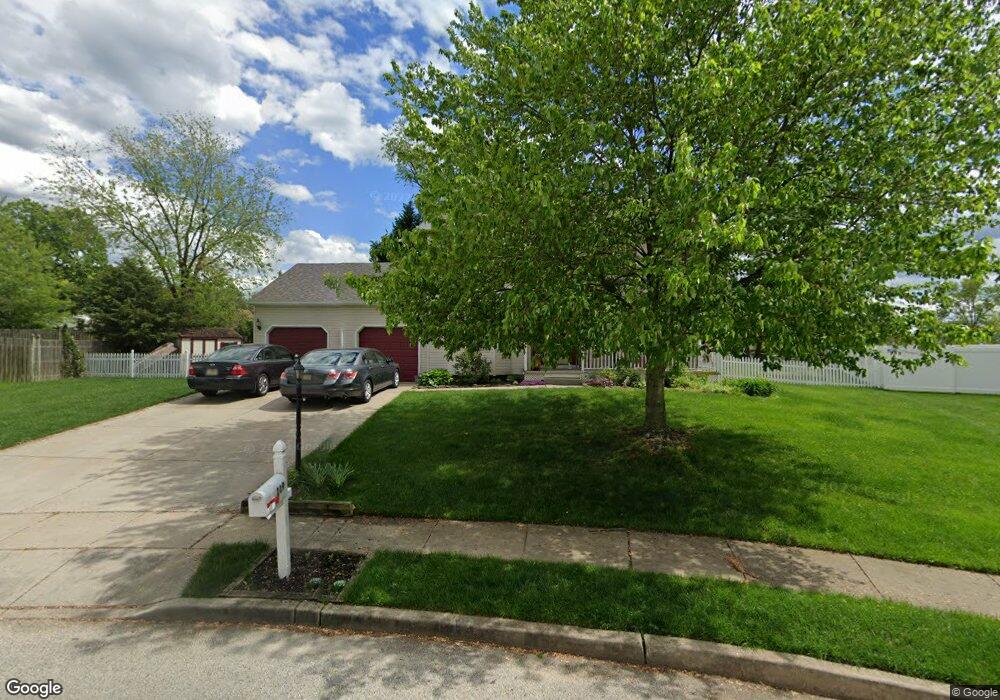
119 Horseshoe Dr Mantua, NJ 08051
Mantua Township NeighborhoodEstimated Value: $515,000 - $578,000
--
Bed
--
Bath
2,259
Sq Ft
$244/Sq Ft
Est. Value
About This Home
This home is located at 119 Horseshoe Dr, Mantua, NJ 08051 and is currently estimated at $552,128, approximately $244 per square foot. 119 Horseshoe Dr is a home located in Gloucester County with nearby schools including Centre City School, Clearview Regional Middle School, and Clearview Regional High School.
Ownership History
Date
Name
Owned For
Owner Type
Purchase Details
Closed on
Mar 27, 1998
Sold by
Jessup Associates Inc
Bought by
Evans James C and Evans Joyce E
Current Estimated Value
Home Financials for this Owner
Home Financials are based on the most recent Mortgage that was taken out on this home.
Original Mortgage
$144,000
Outstanding Balance
$27,049
Interest Rate
6.98%
Estimated Equity
$525,079
Create a Home Valuation Report for This Property
The Home Valuation Report is an in-depth analysis detailing your home's value as well as a comparison with similar homes in the area
Home Values in the Area
Average Home Value in this Area
Purchase History
| Date | Buyer | Sale Price | Title Company |
|---|---|---|---|
| Evans James C | $180,060 | -- |
Source: Public Records
Mortgage History
| Date | Status | Borrower | Loan Amount |
|---|---|---|---|
| Open | Evans James C | $144,000 |
Source: Public Records
Tax History Compared to Growth
Tax History
| Year | Tax Paid | Tax Assessment Tax Assessment Total Assessment is a certain percentage of the fair market value that is determined by local assessors to be the total taxable value of land and additions on the property. | Land | Improvement |
|---|---|---|---|---|
| 2025 | $12,110 | $470,300 | $120,400 | $349,900 |
| 2024 | $11,983 | $470,300 | $120,400 | $349,900 |
| 2023 | $11,983 | $470,300 | $120,400 | $349,900 |
| 2022 | $9,203 | $263,100 | $66,900 | $196,200 |
| 2021 | $9,272 | $263,100 | $66,900 | $196,200 |
| 2020 | $9,198 | $263,100 | $66,900 | $196,200 |
| 2019 | $9,043 | $263,100 | $66,900 | $196,200 |
| 2018 | $8,914 | $263,100 | $66,900 | $196,200 |
| 2017 | $8,780 | $263,100 | $66,900 | $196,200 |
| 2016 | $8,680 | $263,100 | $66,900 | $196,200 |
| 2015 | $8,467 | $263,100 | $66,900 | $196,200 |
| 2014 | $8,182 | $263,100 | $66,900 | $196,200 |
Source: Public Records
Map
Nearby Homes
- 590 Bridgeton Pike
- 36 Bluebird Rd
- 485 Harrison Ave
- 26 Woodstream Ct
- 155 Whippoorwill Way
- 190 Mockingbird Ln
- 204 W Landing Rd
- 284 Columbus Dr
- 261 Tony Cir
- 17 Oakton Dr
- 119 Monroe Ave
- 131 Firth Dr
- 290 Montgomery Dr
- 41 Woodbrook Dr Unit C041
- 19 Marathon Dr
- 325 Bridgeton Pike
- 333 Jackson Rd
- 27 Kristen Ln
- 1433 Tristram Cir
- 205 Redbud Ln Unit 205
- 117 Horseshoe Dr
- 121 Horseshoe Dr
- 116 Horseshoe Dr
- 640 Boise Ave
- 642 Boise Ave
- 190 Cheyenne Ave
- 188 Cheyenne Ave
- 115 Horseshoe Dr
- 186 Cheyenne Ave
- 192 Cheyenne Ave
- 644 Santa fe Dr
- 123 Horseshoe Dr
- 646 Santa fe Dr
- 124 Horseshoe Dr
- 114 Horseshoe Dr
- 184 Cheyenne Ave
- 637 Boise Ave
- 113 Horseshoe Dr
- 648 Santa fe Dr
- 638 Boise Ave