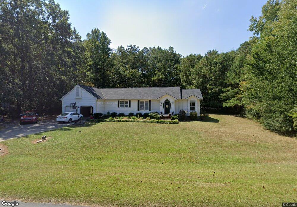
119 Jones Rd Calhoun, GA 30701
Estimated Value: $246,353 - $290,000
3
Beds
2
Baths
1,781
Sq Ft
$152/Sq Ft
Est. Value
About This Home
This home is located at 119 Jones Rd, Calhoun, GA 30701 and is currently estimated at $270,588, approximately $151 per square foot. 119 Jones Rd is a home located in Gordon County with nearby schools including Red Bud Elementary School, Red Bud Middle School, and Sonoraville High School.
Ownership History
Date
Name
Owned For
Owner Type
Purchase Details
Closed on
Nov 17, 2009
Sold by
Federal National Mortgage Association
Bought by
Shropshire Anthony
Current Estimated Value
Home Financials for this Owner
Home Financials are based on the most recent Mortgage that was taken out on this home.
Original Mortgage
$108,163
Outstanding Balance
$70,554
Interest Rate
4.98%
Mortgage Type
New Conventional
Estimated Equity
$200,034
Purchase Details
Closed on
Aug 4, 2009
Sold by
Citimortgage Inc
Bought by
Federal National Mortgage Association
Purchase Details
Closed on
Mar 29, 2004
Sold by
Kenemer Mary Ann Leatherwood
Bought by
Clegg Audrey and Jeremias Vazquez
Create a Home Valuation Report for This Property
The Home Valuation Report is an in-depth analysis detailing your home's value as well as a comparison with similar homes in the area
Home Values in the Area
Average Home Value in this Area
Purchase History
| Date | Buyer | Sale Price | Title Company |
|---|---|---|---|
| Shropshire Anthony | $106,000 | -- | |
| Federal National Mortgage Association | -- | -- | |
| Citimortgage Inc | $77,210 | -- | |
| Clegg Audrey | $119,900 | -- |
Source: Public Records
Mortgage History
| Date | Status | Borrower | Loan Amount |
|---|---|---|---|
| Open | Shropshire Anthony | $108,163 |
Source: Public Records
Tax History Compared to Growth
Tax History
| Year | Tax Paid | Tax Assessment Tax Assessment Total Assessment is a certain percentage of the fair market value that is determined by local assessors to be the total taxable value of land and additions on the property. | Land | Improvement |
|---|---|---|---|---|
| 2024 | $1,802 | $64,724 | $3,280 | $61,444 |
| 2023 | $1,686 | $60,612 | $3,280 | $57,332 |
| 2022 | $521 | $56,736 | $3,280 | $53,456 |
| 2021 | $1,357 | $46,232 | $3,280 | $42,952 |
| 2020 | $1,388 | $46,880 | $3,280 | $43,600 |
| 2019 | $1,385 | $46,880 | $3,280 | $43,600 |
| 2018 | $402 | $43,696 | $3,280 | $40,416 |
| 2017 | $387 | $41,336 | $3,280 | $38,056 |
| 2016 | $388 | $41,336 | $3,280 | $38,056 |
| 2015 | $385 | $40,536 | $3,280 | $37,256 |
| 2014 | $365 | $39,029 | $3,304 | $35,725 |
Source: Public Records
Map
Nearby Homes
- 367 Mount Vernon Dr
- 249 Davis Dr
- 111 Nike Dr
- 218 Newtown Rd NE
- 106 Mount Vernon Dr
- 118 Old Mill Dr
- 154 Millers Ln
- 137 Millers Ln
- 135 Millers Ln
- 218 Newtown Rd
- 122 Millers Ln
- 115 Old Mill Dr
- 106 Millers Ln
- 108 Mill Stone Dr
- 106 Windmill Ct
- 104 Windmill Ct
- 145 Green Row
- 1215 U S 41
- 130 Red Oak Ln
- 133 Red Oak Ln
- 121 Jones Rd
- 125 Westminster Way
- 118 Jones Rd
- 135 Westminster Way
- 160 Westwind Dr
- 145 Westminster Way
- 122 Jones Rd
- 105 Jones Rd
- 0 Windy Hill Dr Unit Lot 2 8872815
- 0 Windy Hill Dr Unit Lot 1 8872812
- 0 Windy Hill Dr Unit Lot 1
- Lot 2 Windy Hill Dr
- Lot 1 Windy Hill Dr
- 00 Windy Hill Dr
- 123 Jones Rd
- 142 Jarrett Dr
- 150 Twin Oaks Dr
- 144 Jarrett Dr
- 146 Twin Oaks Dr
- 221 Windy Hill Dr