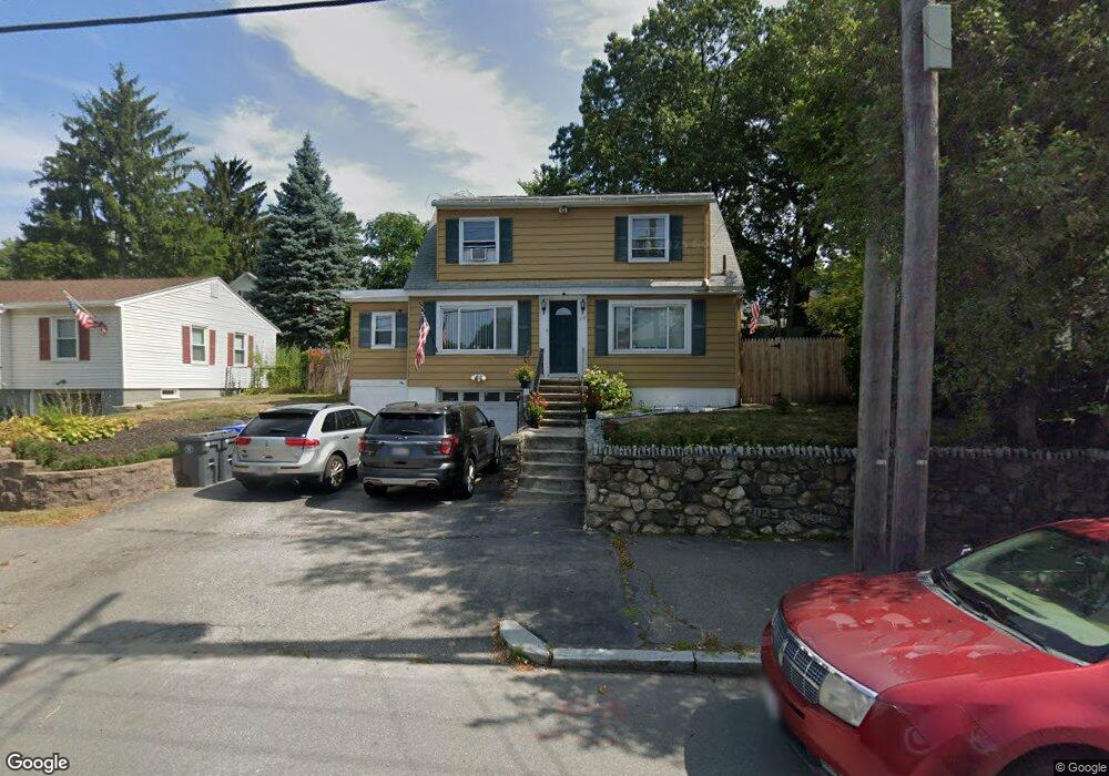
119 Lawrence St Methuen, MA 01844
The East End NeighborhoodEstimated Value: $507,542 - $518,000
3
Beds
1
Bath
1,440
Sq Ft
$357/Sq Ft
Est. Value
About This Home
This home is located at 119 Lawrence St, Methuen, MA 01844 and is currently estimated at $514,136, approximately $357 per square foot. 119 Lawrence St is a home located in Essex County with nearby schools including Mendota Elementary School, Tenney Grammar School, and South Point Elementary School.
Ownership History
Date
Name
Owned For
Owner Type
Purchase Details
Closed on
Oct 30, 1997
Sold by
Smith Sean M
Bought by
Rego James
Current Estimated Value
Purchase Details
Closed on
May 12, 1994
Sold by
Bonanno Raymon Dj
Bought by
Smith Sean M
Purchase Details
Closed on
Jul 25, 1988
Sold by
Consoli Paul
Bought by
Bonanno Raymond
Create a Home Valuation Report for This Property
The Home Valuation Report is an in-depth analysis detailing your home's value as well as a comparison with similar homes in the area
Home Values in the Area
Average Home Value in this Area
Purchase History
| Date | Buyer | Sale Price | Title Company |
|---|---|---|---|
| Rego James | $88,500 | -- | |
| Rego James | $88,500 | -- | |
| Smith Sean M | $80,000 | -- | |
| Smith Sean M | $80,000 | -- | |
| Bonanno Raymond | $139,000 | -- |
Source: Public Records
Mortgage History
| Date | Status | Borrower | Loan Amount |
|---|---|---|---|
| Open | Bonanno Raymond | $18,500 | |
| Open | Bonanno Raymond | $157,000 |
Source: Public Records
Tax History Compared to Growth
Tax History
| Year | Tax Paid | Tax Assessment Tax Assessment Total Assessment is a certain percentage of the fair market value that is determined by local assessors to be the total taxable value of land and additions on the property. | Land | Improvement |
|---|---|---|---|---|
| 2025 | $4,535 | $428,600 | $192,300 | $236,300 |
| 2024 | $4,441 | $408,900 | $172,400 | $236,500 |
| 2023 | $4,146 | $354,400 | $152,500 | $201,900 |
| 2022 | $3,808 | $291,800 | $119,300 | $172,500 |
| 2021 | $3,607 | $273,500 | $112,700 | $160,800 |
| 2020 | $3,523 | $262,100 | $106,100 | $156,000 |
| 2019 | $3,420 | $241,000 | $99,500 | $141,500 |
| 2018 | $3,339 | $234,000 | $99,500 | $134,500 |
| 2017 | $3,123 | $213,200 | $92,800 | $120,400 |
| 2016 | $2,886 | $194,900 | $86,200 | $108,700 |
| 2015 | $2,546 | $174,400 | $71,600 | $102,800 |
Source: Public Records
Map
Nearby Homes
- 100-102 Phillips St
- 18 Larchwood Rd
- 35 Hardy St
- 48 Larchwood Rd
- 2 Horne St
- 82 Oakside Ave
- 2 Lawrence St
- 87 Oakside Ave
- 364 Lawrence St
- 83 Oakside Ave
- 69 Broadway
- 5 Arlington Terrace
- 23 Chase St
- 24 Railroad St
- 434-438 Hampshire St
- 183 Berkeley St
- 20-22 Ashland Ave
- 169 Berkeley St
- 27 Exchange St
- 29 Willow St Unit B
- 115 Lawrence St
- 123 Lawrence St
- 72 Tower St
- 76 Tower St
- 127 Lawrence St
- 111 Lawrence St
- 70 Tower St
- 78 Tower St
- 62 Lawrence St Unit 64
- 232 Tenney St
- 66 Lawrence St
- 107 Lawrence St
- 80 Tower St
- 131 Lawrence St
- 131 Lawrence St Unit 131
- 66 Tower St
- 68 Lawrence St
- 224 Tenney St Unit 226
- 65 Tower St
- 61 Tower St