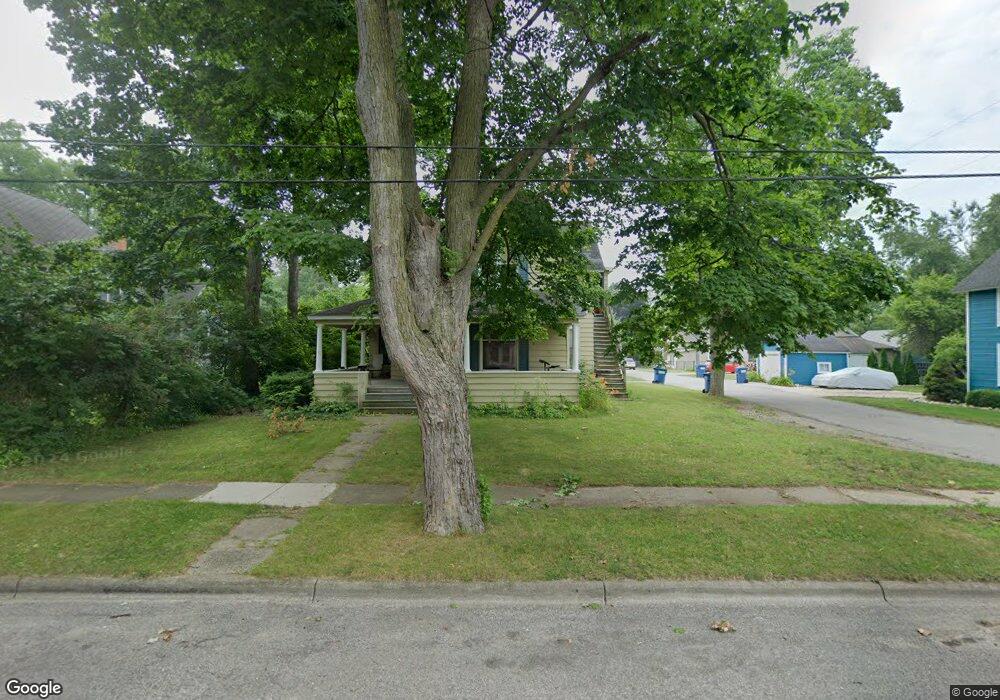
119 Locust St Unit LOCUST Clinton, MI 49236
Estimated Value: $153,000 - $247,000
4
Beds
2
Baths
2,038
Sq Ft
$93/Sq Ft
Est. Value
About This Home
This home is located at 119 Locust St Unit LOCUST, Clinton, MI 49236 and is currently estimated at $188,751, approximately $92 per square foot. 119 Locust St Unit LOCUST is a home located in Lenawee County with nearby schools including Clinton Elementary School, Clinton Middle School, and Clinton High School.
Ownership History
Date
Name
Owned For
Owner Type
Purchase Details
Closed on
Jun 27, 2020
Sold by
119 Locust Llc
Bought by
Eaton Donald R and Canham Clare
Current Estimated Value
Home Financials for this Owner
Home Financials are based on the most recent Mortgage that was taken out on this home.
Original Mortgage
$67,000
Outstanding Balance
$59,411
Interest Rate
3.1%
Mortgage Type
New Conventional
Estimated Equity
$129,340
Purchase Details
Closed on
May 23, 2016
Sold by
Eaton Donald R
Bought by
119 Loucst Llc
Purchase Details
Closed on
May 13, 2010
Sold by
Wells Fargo Financial America Inc
Bought by
Eaton Donald R and Donald R Eaton Restated Revocable Trust
Purchase Details
Closed on
Oct 1, 2009
Sold by
Strayer Ross J and Eddy Lisa G
Bought by
Wells Fargo Financial American Inc
Purchase Details
Closed on
Nov 13, 2006
Sold by
Eddy Lisa G
Bought by
Strayer Ross J
Create a Home Valuation Report for This Property
The Home Valuation Report is an in-depth analysis detailing your home's value as well as a comparison with similar homes in the area
Home Values in the Area
Average Home Value in this Area
Purchase History
| Date | Buyer | Sale Price | Title Company |
|---|---|---|---|
| Eaton Donald R | -- | None Available | |
| 119 Loucst Llc | -- | None Available | |
| Eaton Donald R | $26,000 | Rels Title | |
| Wells Fargo Financial American Inc | $50,000 | None Available | |
| Strayer Ross J | -- | None Available |
Source: Public Records
Mortgage History
| Date | Status | Borrower | Loan Amount |
|---|---|---|---|
| Open | Eaton Donald R | $67,000 |
Source: Public Records
Tax History Compared to Growth
Tax History
| Year | Tax Paid | Tax Assessment Tax Assessment Total Assessment is a certain percentage of the fair market value that is determined by local assessors to be the total taxable value of land and additions on the property. | Land | Improvement |
|---|---|---|---|---|
| 2025 | $4,423 | $117,700 | $0 | $0 |
| 2024 | $2,469 | $110,800 | $0 | $0 |
| 2023 | $3,837 | $101,200 | $0 | $0 |
| 2022 | $3,743 | $93,300 | $0 | $0 |
| 2021 | $5,020 | $80,000 | $0 | $0 |
| 2020 | $3,995 | $81,800 | $0 | $0 |
| 2019 | $2,820 | $60,000 | $0 | $0 |
| 2018 | $3,718 | $56,032 | $0 | $0 |
| 2017 | $3,246 | $49,353 | $0 | $0 |
| 2016 | $3,109 | $48,608 | $0 | $0 |
| 2014 | -- | $54,886 | $0 | $0 |
Source: Public Records
Map
Nearby Homes
- 317 Clark St
- 103 W Michigan Ave
- 201 Bartlett St
- 116 Currier St
- 111 Washington St
- 118 Litchfield St
- 3581 Kehoe Rd
- V/L Post Oak Dr
- 0 Mcneil Hwy Unit Parcel C
- 10000 Mcneil Hwy
- 13001 BLK Bartlett Rd
- 13002 Bartlett Rd
- 1549 Taylor Rd
- 11800 N Adrian Hwy
- 13828 Allen Rd
- 10000 Meads Hwy
- 9000 Matthews Hwy
- 9769 Tecumseh Clinton Hwy
- 3888 Kaiser Rd
- 9410 Newburg Ct
- 115 Locust St
- 111 Locust St
- 122 Locust St
- 122 Locust St Unit LOCUST
- 116 Locust St
- 112 Locust St
- 108 Locust St
- 504 Tecumseh Rd
- 510 Tecumseh Rd
- 103 Clark St
- 404 Tecumseh Rd
- 110 Tyrrell St
- 110 Tyrrell St Unit TYRELL ST
- 118 Tyrrell St
- 114 Tyrrell St
- 114 Tyrrell St Unit TYRRELL ST
- 122 Tyrrell St
- 129 Clark St
- 100 Clark St Unit BLK
- 102 Tyrrell St