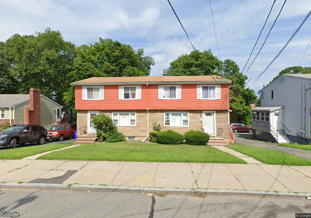
119 Lorna Rd Unit 121 Mattapan, MA 02126
Southern Mattapan NeighborhoodEstimated Value: $785,000 - $947,000
6
Beds
6
Baths
2,352
Sq Ft
$371/Sq Ft
Est. Value
About This Home
This home is located at 119 Lorna Rd Unit 121, Mattapan, MA 02126 and is currently estimated at $872,469, approximately $370 per square foot. 119 Lorna Rd Unit 121 is a home located in Suffolk County with nearby schools including KIPP Academy Boston Charter School and Berea Seventh-day Adventist Academy.
Ownership History
Date
Name
Owned For
Owner Type
Purchase Details
Closed on
Nov 30, 1992
Sold by
Farragut Mtg Co Inc
Bought by
Wright Marlon T
Current Estimated Value
Home Financials for this Owner
Home Financials are based on the most recent Mortgage that was taken out on this home.
Original Mortgage
$130,625
Interest Rate
8.06%
Mortgage Type
Purchase Money Mortgage
Purchase Details
Closed on
Jul 22, 1992
Sold by
Freeman Johnnie
Bought by
Farragut Mtg Co Inc
Create a Home Valuation Report for This Property
The Home Valuation Report is an in-depth analysis detailing your home's value as well as a comparison with similar homes in the area
Home Values in the Area
Average Home Value in this Area
Purchase History
| Date | Buyer | Sale Price | Title Company |
|---|---|---|---|
| Wright Marlon T | $137,500 | -- | |
| Farragut Mtg Co Inc | $135,000 | -- |
Source: Public Records
Mortgage History
| Date | Status | Borrower | Loan Amount |
|---|---|---|---|
| Open | Farragut Mtg Co Inc | $84,500 | |
| Closed | Farragut Mtg Co Inc | $130,625 |
Source: Public Records
Tax History Compared to Growth
Tax History
| Year | Tax Paid | Tax Assessment Tax Assessment Total Assessment is a certain percentage of the fair market value that is determined by local assessors to be the total taxable value of land and additions on the property. | Land | Improvement |
|---|---|---|---|---|
| 2025 | $9,058 | $782,200 | $284,200 | $498,000 |
| 2024 | $8,492 | $779,100 | $230,800 | $548,300 |
| 2023 | $7,747 | $721,300 | $213,700 | $507,600 |
| 2022 | $7,848 | $721,300 | $213,700 | $507,600 |
| 2021 | $7,261 | $680,500 | $201,600 | $478,900 |
| 2020 | $5,482 | $519,100 | $188,800 | $330,300 |
| 2019 | $4,883 | $463,300 | $142,800 | $320,500 |
| 2018 | $4,580 | $437,000 | $142,800 | $294,200 |
| 2017 | $4,450 | $420,200 | $142,800 | $277,400 |
| 2016 | $4,320 | $392,700 | $142,800 | $249,900 |
| 2015 | $3,855 | $318,300 | $127,900 | $190,400 |
| 2014 | $3,575 | $284,200 | $127,900 | $156,300 |
Source: Public Records
Map
Nearby Homes
- 30 Glenhill Rd
- 15-17 W Selden St
- 18 Astoria St
- 157 Delhi St
- 808 Morton St Unit 3
- 139 Selden St
- 32 Violet St
- 124 Selden St
- 567B Norfolk St
- 11 French St
- 25 Fessenden St
- 10 Sutton St
- 23 Fessenden St
- 4 Crossman St Unit 4
- 23 Maryknoll St
- 5 Sutton St
- 5 Sutton St Unit 3B
- 32 Crowell St
- 10 Hosmer St
- 24 Constitution Rd
- 123 Lorna Rd
- 115-117 Lorna Rd
- 115 Lorna Rd Unit 117
- 122 W Selden St Unit 124
- 127 Lorna Rd
- 118 W Selden St Unit 120
- 118 W Selden St Unit 1
- 114-116 W Selden St
- 111 Lorna Rd
- 126 W Selden St Unit 1
- 128 W Selden St Unit 2
- 126 W Selden St Unit 2
- 126 W Selden St Unit 128
- 128 W Selden St
- 114 W Selden St Unit 116
- 130 W Selden St Unit 132
- 132 W Selden St Unit 1
- 132 W Selden St Unit 2
- 112 Lorna Rd Unit 114
- 110 W Selden St