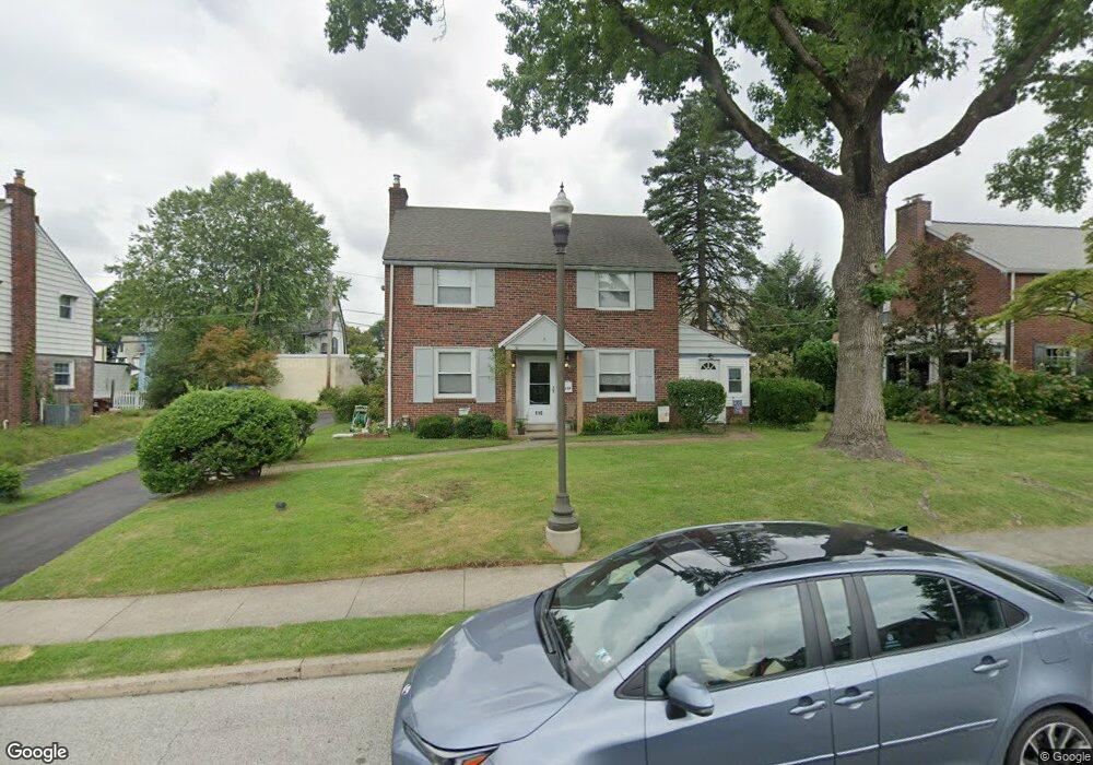
119 Madison Rd Lansdowne, PA 19050
Estimated Value: $322,000 - $428,000
4
Beds
2
Baths
1,692
Sq Ft
$211/Sq Ft
Est. Value
About This Home
This home is located at 119 Madison Rd, Lansdowne, PA 19050 and is currently estimated at $357,085, approximately $211 per square foot. 119 Madison Rd is a home located in Delaware County with nearby schools including Ardmore Avenue School, Penn Wood Middle School, and Penn Wood High School - Cypress Street Campus.
Ownership History
Date
Name
Owned For
Owner Type
Purchase Details
Closed on
May 10, 2004
Sold by
Baughman Myra
Bought by
Callahan Bernard C and Callahan Myra
Current Estimated Value
Purchase Details
Closed on
Jun 27, 2002
Sold by
Layton Robert Dale and Layton Christine Suplee
Bought by
Baughman Myra
Home Financials for this Owner
Home Financials are based on the most recent Mortgage that was taken out on this home.
Original Mortgage
$111,000
Outstanding Balance
$47,755
Interest Rate
6.92%
Estimated Equity
$309,330
Create a Home Valuation Report for This Property
The Home Valuation Report is an in-depth analysis detailing your home's value as well as a comparison with similar homes in the area
Home Values in the Area
Average Home Value in this Area
Purchase History
| Date | Buyer | Sale Price | Title Company |
|---|---|---|---|
| Callahan Bernard C | -- | -- | |
| Baughman Myra | $156,000 | Commonwealth Land Title Ins |
Source: Public Records
Mortgage History
| Date | Status | Borrower | Loan Amount |
|---|---|---|---|
| Open | Baughman Myra | $111,000 |
Source: Public Records
Tax History Compared to Growth
Tax History
| Year | Tax Paid | Tax Assessment Tax Assessment Total Assessment is a certain percentage of the fair market value that is determined by local assessors to be the total taxable value of land and additions on the property. | Land | Improvement |
|---|---|---|---|---|
| 2025 | $7,066 | $171,610 | $55,870 | $115,740 |
| 2024 | $7,066 | $171,610 | $55,870 | $115,740 |
| 2023 | $6,736 | $171,610 | $55,870 | $115,740 |
| 2022 | $6,604 | $171,610 | $55,870 | $115,740 |
| 2021 | $9,917 | $171,610 | $55,870 | $115,740 |
| 2020 | $6,975 | $106,350 | $30,750 | $75,600 |
| 2019 | $6,858 | $106,350 | $30,750 | $75,600 |
| 2018 | $6,740 | $106,350 | $0 | $0 |
| 2017 | $6,591 | $106,350 | $0 | $0 |
| 2016 | $584 | $106,350 | $0 | $0 |
| 2015 | $584 | $106,350 | $0 | $0 |
| 2014 | $584 | $106,350 | $0 | $0 |
Source: Public Records
Map
Nearby Homes
- 108 Gladstone Rd
- 233 Scottdale Rd
- 82 Marple Ave
- 257 W Greenwood Ave
- 80 W Baltimore Ave Unit B510
- 442 E Baltimore Ave
- 603 Montana Ave
- 3847 Dennison Ave
- 0 Bridge St
- 3941 Bridge St
- 162 Burmont Rd
- 185 Berkley Ave
- 271 Drexel Ave
- 182 Berkley Ave
- 38 W Stratford Ave
- 805 E Penn Pines Blvd
- 208 Rosewood Ave
- 338 Springfield Rd
- 242 Shadeland Ave
- 722 Thorndale Rd
- 115 Madison Rd
- 123 Madison Rd
- 124 Gladstone Rd
- 126 Gladstone Rd
- 128 Gladstone Rd
- 122 Gladstone Rd
- 130 Gladstone Rd
- 120 Gladstone Rd
- 122 Madison Rd
- 111 Madison Rd
- 120 Madison Rd
- 118 Gladstone Rd
- 127 Madison Rd
- 124 Madison Rd
- 126 Walsh Rd
- 128 Walsh Rd
- 116 Gladstone Rd
- 118 Madison Rd
- 126 Madison Rd
- 125 Gladstone Rd