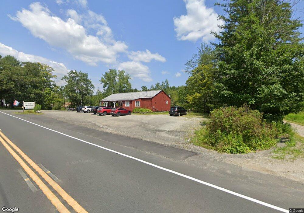
Estimated Value: $335,499
--
Bed
2
Baths
1,735
Sq Ft
$193/Sq Ft
Est. Value
About This Home
This home is located at 119 Main St, Otis, MA 01253 and is currently estimated at $335,499, approximately $193 per square foot. 119 Main St is a home located in Berkshire County with nearby schools including Farmington River Elementary School.
Ownership History
Date
Name
Owned For
Owner Type
Purchase Details
Closed on
Nov 10, 2009
Sold by
Crandall Brian J and Crandall Lucy M
Bought by
Pyenson Andrew L and Pyenson Lynn P
Current Estimated Value
Home Financials for this Owner
Home Financials are based on the most recent Mortgage that was taken out on this home.
Original Mortgage
$160,000
Outstanding Balance
$104,794
Interest Rate
5.06%
Mortgage Type
Commercial
Estimated Equity
$230,705
Create a Home Valuation Report for This Property
The Home Valuation Report is an in-depth analysis detailing your home's value as well as a comparison with similar homes in the area
Home Values in the Area
Average Home Value in this Area
Purchase History
| Date | Buyer | Sale Price | Title Company |
|---|---|---|---|
| Pyenson Andrew L | $297,500 | -- | |
| Pyenson Andrew L | $297,500 | -- | |
| Pyenson Andrew L | $297,500 | -- |
Source: Public Records
Mortgage History
| Date | Status | Borrower | Loan Amount |
|---|---|---|---|
| Open | Pyenson Andrew L | $160,000 | |
| Closed | Pyenson Andrew L | $160,000 | |
| Previous Owner | Pyenson Andrew L | $154,000 |
Source: Public Records
Tax History Compared to Growth
Tax History
| Year | Tax Paid | Tax Assessment Tax Assessment Total Assessment is a certain percentage of the fair market value that is determined by local assessors to be the total taxable value of land and additions on the property. | Land | Improvement |
|---|---|---|---|---|
| 2025 | $1,833 | $283,700 | $61,400 | $222,300 |
| 2024 | $1,315 | $203,000 | $46,100 | $156,900 |
| 2023 | $1,406 | $212,400 | $55,500 | $156,900 |
| 2022 | $1,724 | $222,500 | $55,500 | $167,000 |
| 2021 | $1,813 | $214,000 | $55,500 | $158,500 |
| 2020 | $1,785 | $214,000 | $55,500 | $158,500 |
| 2019 | $1,772 | $214,000 | $55,500 | $158,500 |
| 2018 | $1,772 | $214,000 | $55,500 | $158,500 |
| 2017 | $1,729 | $214,000 | $55,500 | $158,500 |
| 2016 | $1,680 | $214,000 | $55,500 | $158,500 |
| 2015 | $1,612 | $214,100 | $52,300 | $161,800 |
Source: Public Records
Map
Nearby Homes
- 32 S Main Rd
- 245 Clubhouse Dr
- 0 Clubhouse Dr
- 197 Clubhouse Dr
- 289 Monterey Rd
- 303 Lakeshore Dr
- 171 Lake Shore Dr
- 343 Lakeshore Dr
- 377 Highland Way
- 314 Lakeshore Dr
- 316 Lakeshore Dr
- 314 & 316 Lakeshore Dr
- 126 E Shore
- 232 Harrington Rd
- 40 Bliven Rd
- Lot 19-I W Center Rd
- LOT72 W Center Rd
- 309 Tamarack Trail
- 759 N Main Rd
- 7 Perry Rd
- 8 Massachusetts 8
- 124 Main St
- Lot 100 N Main Road Rte8
- 144 N Main Rd
- 201 N Main Rd
- 0 Dimmock Rd L:10 Unit 71250391
- 99&100 Louden-Bethlehem Rd
- 0 Dimmock Rd L:10 Unit 71556524
- 99&100 Louden-Bethlehem Ln
- 00 Stebbins Rd
- 408 Lion Hill Rd
- 9 Big Pond
- 556/557 Lion Hill Rd
- 262/264 Kibbe Rd
- 9 Big Island
- village 2 Klondike Campground Unit 20
- village 2 Klondike Campground Unit 21
- Lot# 123 E Otis Rd
- Lot # 72 W Center Rd
- Lot # 69 W Center Rd
