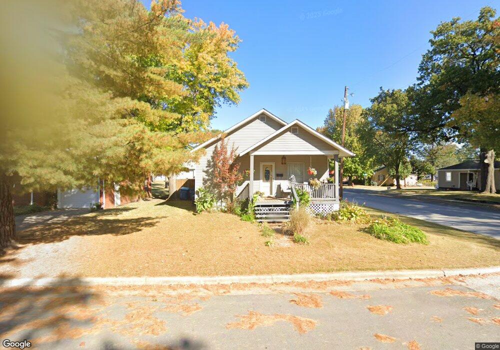
119 Manning Ave Wood River, IL 62095
Estimated Value: $75,323 - $109,000
3
Beds
1
Bath
780
Sq Ft
$123/Sq Ft
Est. Value
About This Home
This home is located at 119 Manning Ave, Wood River, IL 62095 and is currently estimated at $95,831, approximately $122 per square foot. 119 Manning Ave is a home located in Madison County with nearby schools including Eastwood Elementary School, East Alton Middle School, and East Alton-Wood River High School.
Ownership History
Date
Name
Owned For
Owner Type
Purchase Details
Closed on
Nov 30, 2007
Sold by
Meyers Mcgee Laura V and Meyers William C
Bought by
Searles Karen
Current Estimated Value
Home Financials for this Owner
Home Financials are based on the most recent Mortgage that was taken out on this home.
Original Mortgage
$55,500
Outstanding Balance
$35,437
Interest Rate
6.47%
Mortgage Type
Purchase Money Mortgage
Estimated Equity
$60,394
Create a Home Valuation Report for This Property
The Home Valuation Report is an in-depth analysis detailing your home's value as well as a comparison with similar homes in the area
Home Values in the Area
Average Home Value in this Area
Purchase History
| Date | Buyer | Sale Price | Title Company |
|---|---|---|---|
| Searles Karen | $55,500 | Community Title & Escrow Ltd |
Source: Public Records
Mortgage History
| Date | Status | Borrower | Loan Amount |
|---|---|---|---|
| Open | Searles Karen | $55,500 |
Source: Public Records
Tax History Compared to Growth
Tax History
| Year | Tax Paid | Tax Assessment Tax Assessment Total Assessment is a certain percentage of the fair market value that is determined by local assessors to be the total taxable value of land and additions on the property. | Land | Improvement |
|---|---|---|---|---|
| 2024 | $1,530 | $23,750 | $4,480 | $19,270 |
| 2023 | $1,530 | $22,140 | $4,180 | $17,960 |
| 2022 | $1,417 | $20,440 | $3,860 | $16,580 |
| 2021 | $1,215 | $19,050 | $3,600 | $15,450 |
| 2020 | $1,167 | $18,350 | $3,470 | $14,880 |
| 2019 | $1,110 | $17,810 | $3,370 | $14,440 |
| 2018 | $1,067 | $16,930 | $3,210 | $13,720 |
| 2017 | $986 | $16,520 | $3,130 | $13,390 |
| 2016 | $965 | $16,520 | $3,130 | $13,390 |
| 2015 | $959 | $16,350 | $3,100 | $13,250 |
| 2014 | $959 | $16,350 | $3,100 | $13,250 |
| 2013 | $959 | $16,580 | $3,140 | $13,440 |
Source: Public Records
Map
Nearby Homes
- 726 Rice St
- 777 Condit St
- 833 State St
- 209 Elble Ave
- 41 W Penning Ave
- 469 N 1st St
- 98 Wood River Ave
- 133 Lincoln Ave
- 121 Whitelaw Ave
- 104 Whitelaw Ave
- 641 Leslie Ave
- 330 S Pence St
- 72 E Acton Ave
- 207 E Penning Ave
- 959 Cedar Dr
- 537 Tipton Ave
- 523 Wilson Ave
- 242 E Lorena Ave
- 109 S Shamrock St
- 145 Victory Dr