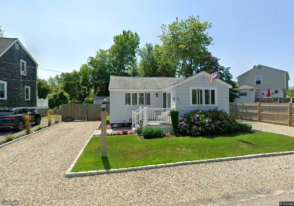
119 Monitor Rd Unit 1 Marshfield, MA 02050
Ocean Bluff-Brant Rock NeighborhoodEstimated Value: $537,000 - $653,000
2
Beds
1
Bath
800
Sq Ft
$730/Sq Ft
Est. Value
About This Home
This home is located at 119 Monitor Rd Unit 1, Marshfield, MA 02050 and is currently estimated at $584,189, approximately $730 per square foot. 119 Monitor Rd Unit 1 is a home located in Plymouth County with nearby schools including Daniel Webster, Furnace Brook Middle School, and Marshfield High School.
Ownership History
Date
Name
Owned For
Owner Type
Purchase Details
Closed on
Nov 2, 2022
Sold by
Melia Gerard F and Melia Debra A
Bought by
Mellia Ft and Melia
Current Estimated Value
Purchase Details
Closed on
Oct 18, 2021
Sold by
Driscoll Stephen J
Bought by
Melia Gerard F and Melia Debra A
Home Financials for this Owner
Home Financials are based on the most recent Mortgage that was taken out on this home.
Original Mortgage
$340,000
Interest Rate
2.8%
Mortgage Type
Purchase Money Mortgage
Purchase Details
Closed on
Aug 3, 2016
Sold by
Smith Brendan C
Bought by
Driscoll Stephen J
Home Financials for this Owner
Home Financials are based on the most recent Mortgage that was taken out on this home.
Original Mortgage
$269,100
Interest Rate
3.56%
Mortgage Type
New Conventional
Purchase Details
Closed on
Oct 29, 2008
Sold by
Loewen Bruce and Loewen Candace
Bought by
Smith Brendan C
Purchase Details
Closed on
Jun 1, 2006
Sold by
Penniman Amy
Bought by
Loewen Bruce and Loewen Candace
Purchase Details
Closed on
Nov 3, 1987
Sold by
Hegan Walter H
Bought by
Hegan Walter H
Home Financials for this Owner
Home Financials are based on the most recent Mortgage that was taken out on this home.
Original Mortgage
$35,000
Interest Rate
10.97%
Mortgage Type
Purchase Money Mortgage
Create a Home Valuation Report for This Property
The Home Valuation Report is an in-depth analysis detailing your home's value as well as a comparison with similar homes in the area
Home Values in the Area
Average Home Value in this Area
Purchase History
| Date | Buyer | Sale Price | Title Company |
|---|---|---|---|
| Mellia Ft | -- | None Available | |
| Melia Gerard F | $425,000 | None Available | |
| Driscoll Stephen J | $299,000 | -- | |
| Driscoll Stephen J | $299,000 | -- | |
| Smith Brendan C | $279,000 | -- | |
| Smith Brendan C | $279,000 | -- | |
| Loewen Bruce | $276,500 | -- | |
| Loewen Bruce | $276,500 | -- | |
| Hegan Walter H | $35,000 | -- |
Source: Public Records
Mortgage History
| Date | Status | Borrower | Loan Amount |
|---|---|---|---|
| Previous Owner | Melia Gerard F | $340,000 | |
| Previous Owner | Driscoll Stephen J | $269,100 | |
| Previous Owner | Hegan Walter H | $243,100 | |
| Previous Owner | Hegan Walter H | $35,000 |
Source: Public Records
Tax History Compared to Growth
Tax History
| Year | Tax Paid | Tax Assessment Tax Assessment Total Assessment is a certain percentage of the fair market value that is determined by local assessors to be the total taxable value of land and additions on the property. | Land | Improvement |
|---|---|---|---|---|
| 2025 | $4,613 | $466,000 | $317,700 | $148,300 |
| 2024 | $4,475 | $430,700 | $297,900 | $132,800 |
| 2023 | $4,392 | $388,000 | $268,100 | $119,900 |
| 2022 | $4,073 | $314,500 | $228,400 | $86,100 |
| 2021 | $3,900 | $295,700 | $218,400 | $77,300 |
| 2020 | $3,487 | $261,600 | $188,600 | $73,000 |
| 2019 | $3,441 | $257,200 | $188,600 | $68,600 |
| 2018 | $3,439 | $257,200 | $188,600 | $68,600 |
| 2017 | $3,235 | $235,800 | $178,700 | $57,100 |
| 2016 | $3,135 | $225,900 | $168,800 | $57,100 |
| 2015 | $3,002 | $225,900 | $168,800 | $57,100 |
| 2014 | $3,001 | $225,800 | $168,800 | $57,000 |
Source: Public Records
Map
Nearby Homes
- 119 Monitor Rd
- 115 Monitor Rd
- 115 Monitor Rd Unit 1
- 125 Monitor Rd
- 40 Country Way
- 120 Monitor Rd
- 109 Monitor Rd
- 56 Country Way
- 70 Nevada St
- 47 Country Way
- 115 Constellation Rd
- 61 Mayflower Ln
- 32 Country Way
- 57 Mayflower Ln
- 109 Constellation Rd
- 51 Country Way
- 81 Mayflower Ln
- 81 Mayflower Ln Unit 83
- 81 Mayflower Ln Unit 1
- 0 Constellation Rd