Estimated Value: $18,000 - $140,000
2
Beds
1
Bath
988
Sq Ft
$83/Sq Ft
Est. Value
About This Home
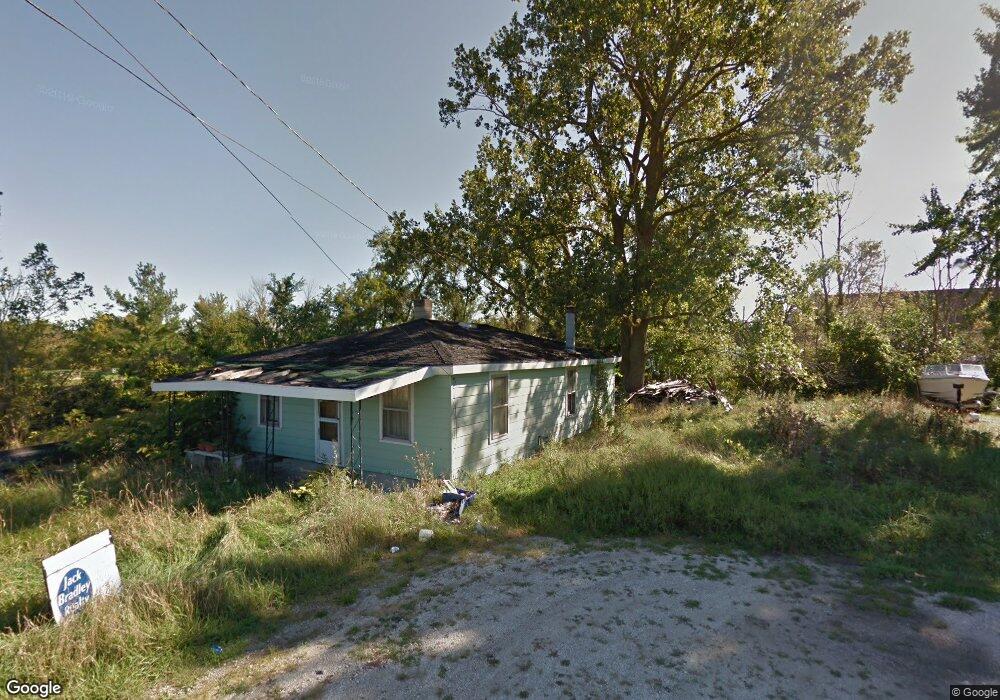
This home is located at 119 N Ashery St, Genoa, OH 43430 and is currently estimated at $82,000, approximately $82 per square foot. 119 N Ashery St is a home located in Ottawa County with nearby schools including Genoa Elementary School and Community Christian Academy.
Ownership History
Date
Name
Owned For
Owner Type
Purchase Details
Closed on
May 14, 2024
Sold by
Williams-Bell Group Llc
Bought by
Sigurdson Mason Alan
Current Estimated Value
Purchase Details
Closed on
Jan 5, 2024
Sold by
Casares Leo R and Casares Yoshiko C
Bought by
Williams-Bell Group Llc
Purchase Details
Closed on
Oct 11, 2018
Sold by
Estate Of Doris Johnson
Bought by
Ottawa County Land Reutilization Corpora
Purchase Details
Closed on
Mar 26, 1992
Sold by
Johnson Harry and Johnson Doris
Bought by
Johnson Doris Irene
Create a Home Valuation Report for This Property
The Home Valuation Report is an in-depth analysis detailing your home's value as well as a comparison with similar homes in the area
Home Values in the Area
Average Home Value in this Area
Purchase History
| Date | Buyer | Sale Price | Title Company |
|---|---|---|---|
| Sigurdson Mason Alan | $10,000 | None Listed On Document | |
| Sigurdson Mason Alan | $10,000 | None Listed On Document | |
| Williams-Bell Group Llc | $6,000 | Northwest Title | |
| Ottawa County Land Reutilization Corpora | -- | None Available | |
| Johnson Doris Irene | -- | -- |
Source: Public Records
Tax History Compared to Growth
Tax History
| Year | Tax Paid | Tax Assessment Tax Assessment Total Assessment is a certain percentage of the fair market value that is determined by local assessors to be the total taxable value of land and additions on the property. | Land | Improvement |
|---|---|---|---|---|
| 2024 | $116 | $2,286 | $2,286 | $0 |
| 2023 | $110 | $2,079 | $2,079 | $0 |
| 2022 | $114 | $2,079 | $2,079 | $0 |
| 2021 | $132 | $2,080 | $2,080 | $0 |
| 2020 | $35 | $1,030 | $1,030 | $0 |
| 2019 | $35 | $1,030 | $1,030 | $0 |
| 2018 | $44 | $3,410 | $1,030 | $2,380 |
| 2017 | $321 | $6,100 | $2,040 | $4,060 |
| 2016 | $322 | $6,100 | $2,040 | $4,060 |
| 2015 | $6,421 | $6,100 | $2,040 | $4,060 |
| 2014 | $5,878 | $6,100 | $2,040 | $4,060 |
| 2013 | $5,367 | $6,100 | $2,040 | $4,060 |
Source: Public Records
Map
Nearby Homes
- 510 Wilson St
- 416 Castle Cove
- 514 West St
- 904 Main St
- 1350 N Genoa Clay Center Rd
- 207 E 11th St
- 1301 West St
- 22771 W Holt Harrigan Rd
- 1615 N Thyre Dr
- 23225 Ohio 51
- 23430 State Route 51 W
- 0 Recker Rd
- 1861 N Opfer-Lentz Rd
- 24764 Bradner Rd
- 19383 Courtland Ave
- 1251 S Railroad St
- 20240 W Portage River South Rd
- 219 Lime St
- 612 W Main St
- 212 S Perry St
- 85 N Ashery St
- 506 Wood St
- 99 N Ashery St
- 502 Wood St
- 3994 Wallingford Ct
- 3992 Wallingford Ct
- 504 Wilbur St
- 502 Wilbur St
- 75 N Ashery St
- 61 N Ashery St
- 414 Wood St
- 416 Wilbur St
- 3993 Edinburgh Ct
- 3995 Edinburgh Ct
- 3996 Wallingford Ct
- 3993 Wallingford Ct
- 409 Wood St
- 3997 Edinburgh Ct
- 416 Wood St
- 43 N Ashery St