Estimated Value: $197,000 - $276,000
--
Bed
--
Bath
1,233
Sq Ft
$189/Sq Ft
Est. Value
About This Home
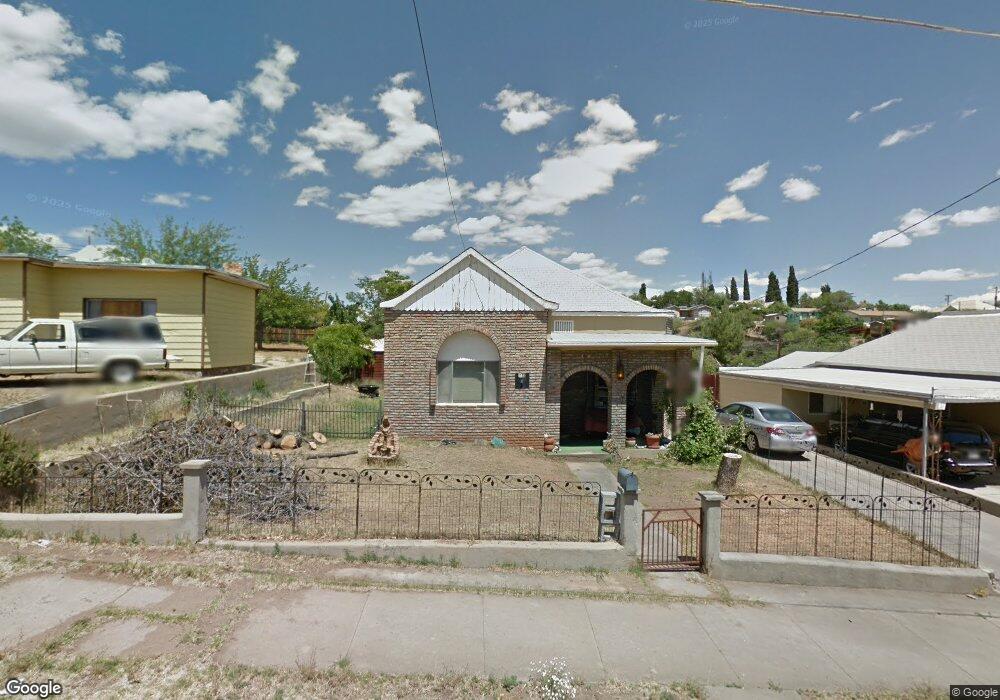
This home is located at 119 N High St, Globe, AZ 85501 and is currently estimated at $233,359, approximately $189 per square foot. 119 N High St is a home located in Gila County with nearby schools including Copper Rim Elementary School, High Desert Middle School, and Globe High School.
Ownership History
Date
Name
Owned For
Owner Type
Purchase Details
Closed on
Apr 8, 2022
Sold by
Porter Bonnie C
Bought by
Porter Johny L and Porter Bonnie C
Current Estimated Value
Purchase Details
Closed on
Feb 4, 2005
Sold by
Meeks Wesley M
Bought by
Porter Ronald E and Porter Bonnie C
Home Financials for this Owner
Home Financials are based on the most recent Mortgage that was taken out on this home.
Original Mortgage
$71,250
Interest Rate
5.87%
Mortgage Type
New Conventional
Create a Home Valuation Report for This Property
The Home Valuation Report is an in-depth analysis detailing your home's value as well as a comparison with similar homes in the area
Home Values in the Area
Average Home Value in this Area
Purchase History
| Date | Buyer | Sale Price | Title Company |
|---|---|---|---|
| Porter Johny L | -- | None Listed On Document | |
| Porter Ronald E | $75,000 | First American Title |
Source: Public Records
Mortgage History
| Date | Status | Borrower | Loan Amount |
|---|---|---|---|
| Previous Owner | Porter Ronald E | $71,250 |
Source: Public Records
Tax History Compared to Growth
Tax History
| Year | Tax Paid | Tax Assessment Tax Assessment Total Assessment is a certain percentage of the fair market value that is determined by local assessors to be the total taxable value of land and additions on the property. | Land | Improvement |
|---|---|---|---|---|
| 2025 | $1,033 | -- | -- | -- |
| 2024 | $1,033 | $19,091 | $913 | $18,178 |
| 2023 | $1,033 | $14,200 | $753 | $13,447 |
| 2022 | $1,011 | $11,171 | $753 | $10,418 |
| 2021 | $1,050 | $11,171 | $753 | $10,418 |
| 2020 | $973 | $0 | $0 | $0 |
| 2019 | $960 | $0 | $0 | $0 |
| 2018 | $918 | $0 | $0 | $0 |
| 2017 | $874 | $0 | $0 | $0 |
| 2016 | $786 | $0 | $0 | $0 |
| 2015 | $743 | $0 | $0 | $0 |
Source: Public Records
Map
Nearby Homes
- 501 E Mesquite St
- 877 E Sycamore St
- 339 N Devereaux St
- 350 N Sutherland St
- 137 N Hill St
- 372 N Fifth St
- 601 N Sutherland St
- 254 N Broad St
- 300 N Broad St
- 610 N Hill St Unit 19B
- 404 S Broad St
- 1309 E Mesquite St
- 289 S Sixth St
- 1320 E Bailey St
- 0 Monroe St
- 1021 High
- 707 S East St
- 1422 E Birch St
- 526 E Carico St
- 425 E North St