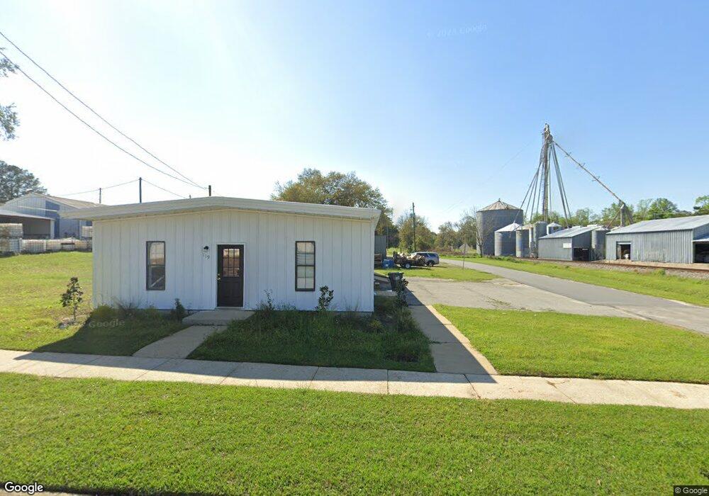
119 N McGriff St Whigham, GA 39897
Estimated Value: $53,041
--
Bed
1
Bath
1,200
Sq Ft
$44/Sq Ft
Est. Value
About This Home
This home is located at 119 N McGriff St, Whigham, GA 39897 and is currently estimated at $53,041, approximately $44 per square foot. 119 N McGriff St is a home located in Grady County.
Ownership History
Date
Name
Owned For
Owner Type
Purchase Details
Closed on
Apr 14, 2023
Sold by
Knight James Q
Bought by
Austinson Josiah Edmund
Current Estimated Value
Home Financials for this Owner
Home Financials are based on the most recent Mortgage that was taken out on this home.
Original Mortgage
$42,500
Outstanding Balance
$37,918
Interest Rate
5.9%
Mortgage Type
New Conventional
Estimated Equity
$15,123
Purchase Details
Closed on
Dec 28, 2000
Sold by
Knight James Q
Bought by
Knight Donald R
Purchase Details
Closed on
Nov 5, 1998
Bought by
Knight James Q
Purchase Details
Closed on
Feb 28, 1996
Sold by
Larkin Wendell C
Bought by
Mid South Timber Co
Purchase Details
Closed on
Jan 29, 1996
Sold by
Kennemur James R
Bought by
Larkin Wendell C
Purchase Details
Closed on
Sep 8, 1989
Bought by
Kennemur James R
Create a Home Valuation Report for This Property
The Home Valuation Report is an in-depth analysis detailing your home's value as well as a comparison with similar homes in the area
Home Values in the Area
Average Home Value in this Area
Purchase History
| Date | Buyer | Sale Price | Title Company |
|---|---|---|---|
| Austinson Josiah Edmund | $50,000 | -- | |
| Knight Donald R | $15,000 | -- | |
| Knight James Q | -- | -- | |
| Mid South Timber Co | $3,500 | -- | |
| Larkin Wendell C | $3,000 | -- | |
| Kennemur James R | $3,000 | -- |
Source: Public Records
Mortgage History
| Date | Status | Borrower | Loan Amount |
|---|---|---|---|
| Open | Austinson Josiah Edmund | $42,500 |
Source: Public Records
Tax History Compared to Growth
Tax History
| Year | Tax Paid | Tax Assessment Tax Assessment Total Assessment is a certain percentage of the fair market value that is determined by local assessors to be the total taxable value of land and additions on the property. | Land | Improvement |
|---|---|---|---|---|
| 2024 | $990 | $27,124 | $1,806 | $25,318 |
| 2023 | $729 | $19,956 | $1,764 | $18,192 |
| 2022 | $729 | $19,956 | $1,764 | $18,192 |
| 2021 | $732 | $19,956 | $1,764 | $18,192 |
| 2020 | $734 | $19,956 | $1,764 | $18,192 |
| 2019 | $734 | $19,956 | $1,764 | $18,192 |
| 2018 | $696 | $19,956 | $1,764 | $18,192 |
| 2017 | $668 | $19,956 | $1,764 | $18,192 |
| 2016 | $681 | $19,956 | $1,764 | $18,192 |
| 2015 | $673 | $19,956 | $1,764 | $18,192 |
| 2014 | $674 | $19,956 | $1,764 | $18,192 |
| 2013 | -- | $19,956 | $1,764 | $18,192 |
Source: Public Records
Map
Nearby Homes
- 206 Lodge Ln
- 165 Larkin St
- 267 Providence Rd
- 723 Providence Rd
- 1718 Old 179 S
- 231 Mcintyre Ln
- 2033 Old 179 N
- 0 Upper Hawthorne Trail
- 1520 Upper Hawthorne Trail
- 1137 Summerfield
- 1389 Lake Front Dr
- 00 Tired Creek Rd
- 0 Earl Hester Rd
- 3695 Tired Creek Rd
- Lot 1 Crine Blvd
- 1500 15th Ave NW
- 1296 McQuaig St NW
- 490 13th St SW
- 000 1st Ave SW
- 1200 15th Ave NW