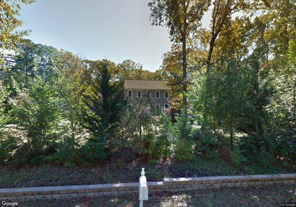
119 Nanticoke Ct Shamong, NJ 08088
Estimated Value: $584,000 - $663,000
5
Beds
3
Baths
2,686
Sq Ft
$233/Sq Ft
Est. Value
About This Home
This home is located at 119 Nanticoke Ct, Shamong, NJ 08088 and is currently estimated at $624,912, approximately $232 per square foot. 119 Nanticoke Ct is a home located in Burlington County with nearby schools including Indian Mills Elementary School, Indian Mills Memorial School, and Shawnee High School.
Ownership History
Date
Name
Owned For
Owner Type
Purchase Details
Closed on
May 17, 2006
Sold by
Schmidt Carl F and Schmidt Lisa T
Bought by
Rossi Peter P and Rossi Renee
Current Estimated Value
Home Financials for this Owner
Home Financials are based on the most recent Mortgage that was taken out on this home.
Original Mortgage
$200,000
Outstanding Balance
$117,283
Interest Rate
6.62%
Mortgage Type
Purchase Money Mortgage
Estimated Equity
$507,629
Create a Home Valuation Report for This Property
The Home Valuation Report is an in-depth analysis detailing your home's value as well as a comparison with similar homes in the area
Home Values in the Area
Average Home Value in this Area
Purchase History
| Date | Buyer | Sale Price | Title Company |
|---|---|---|---|
| Rossi Peter P | $350,000 | None Available |
Source: Public Records
Mortgage History
| Date | Status | Borrower | Loan Amount |
|---|---|---|---|
| Open | Rossi Peter P | $200,000 |
Source: Public Records
Tax History
| Year | Tax Paid | Tax Assessment Tax Assessment Total Assessment is a certain percentage of the fair market value that is determined by local assessors to be the total taxable value of land and additions on the property. | Land | Improvement |
|---|---|---|---|---|
| 2025 | $8,924 | $278,700 | $119,500 | $159,200 |
| 2024 | $8,325 | $278,700 | $119,500 | $159,200 |
| 2023 | $8,325 | $278,700 | $119,500 | $159,200 |
| 2022 | $7,915 | $278,700 | $119,500 | $159,200 |
| 2021 | $7,915 | $278,700 | $119,500 | $159,200 |
| 2020 | $7,820 | $278,700 | $119,500 | $159,200 |
| 2019 | $7,762 | $278,700 | $119,500 | $159,200 |
| 2018 | $7,634 | $278,700 | $119,500 | $159,200 |
| 2017 | $7,896 | $278,700 | $119,500 | $159,200 |
| 2016 | $7,631 | $278,700 | $119,500 | $159,200 |
| 2015 | $7,450 | $278,700 | $119,500 | $159,200 |
| 2014 | $6,993 | $278,700 | $119,500 | $159,200 |
Source: Public Records
Map
Nearby Homes
- 14 Oakview Dr
- 535 Oakshade Rd
- 425 Stokes Rd
- 62 Grassy Lake Rd
- 419 Oakshade Rd
- 0 Indian Mills
- 4 Forest Hollow Ct
- 10 Lexington Ct
- 30 Muskingum Dr
- 26 Tuckerton Rd
- 2 Packenah Trail
- 73 Flyatt Rd
- 5 Liberty Cir
- 15 Lowbridge Passage
- 496 Tuckerton Rd
- 12 Pendleton Ct
- 1 Bradford Dr
- 266 Atsion Rd
- 1240 U S Highway 206
- 1332 Old Indian Mills Rd
- 121 Nanticoke Ct
- 117 Nanticoke Ct
- 116 Nanticoke Ct
- 4 Wilted Grass Trail
- 483 Atsion Rd
- 114 Nanticoke Ct
- 118 Nanticoke Ct
- 120 Nanticoke Ct
- 6 Wilted Grass Trail
- 115 Nanticoke Trail
- 112 Nanticoke Trail
- 16 Meadowbrook Dr
- 477 Atsion Rd
- 115 Mohawk Trail
- 117 Mohawk Trail
- 113 Mohawk Trail
- 8 Wilted Grass Trail
- 113 Nanticoke Trail
- 14 Meadowbrook Dr
- 481 Atsion Rd
Your Personal Tour Guide
Ask me questions while you tour the home.