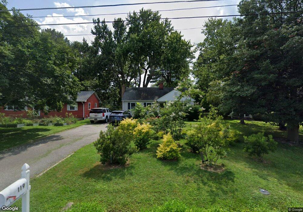
119 Old Wharf Ln Queenstown, MD 21658
Estimated Value: $338,000 - $362,000
--
Bed
1
Bath
1,174
Sq Ft
$296/Sq Ft
Est. Value
About This Home
This home is located at 119 Old Wharf Ln, Queenstown, MD 21658 and is currently estimated at $347,999, approximately $296 per square foot. 119 Old Wharf Ln is a home located in Queen Anne's County with nearby schools including Kennard Elementary School, Centreville Middle School, and Queen Anne's County High School.
Ownership History
Date
Name
Owned For
Owner Type
Purchase Details
Closed on
Feb 26, 2025
Sold by
Warring Elinor W and Warring Joseph Michael
Bought by
Wye Knot Trust and Warring
Current Estimated Value
Purchase Details
Closed on
Apr 6, 2001
Sold by
Tryon Sharon Whaley
Bought by
Warring Joseph M and Warring Elinor
Purchase Details
Closed on
Jun 10, 1996
Sold by
Tryon Sharon Whaley
Bought by
Tryon Sharon Whaley
Create a Home Valuation Report for This Property
The Home Valuation Report is an in-depth analysis detailing your home's value as well as a comparison with similar homes in the area
Home Values in the Area
Average Home Value in this Area
Purchase History
| Date | Buyer | Sale Price | Title Company |
|---|---|---|---|
| Wye Knot Trust | -- | None Listed On Document | |
| Wye Knot Trust | -- | None Listed On Document | |
| Warring Joseph M | $129,500 | -- | |
| Tryon Sharon Whaley | -- | -- |
Source: Public Records
Mortgage History
| Date | Status | Borrower | Loan Amount |
|---|---|---|---|
| Closed | Warring Joseph M | -- |
Source: Public Records
Tax History Compared to Growth
Tax History
| Year | Tax Paid | Tax Assessment Tax Assessment Total Assessment is a certain percentage of the fair market value that is determined by local assessors to be the total taxable value of land and additions on the property. | Land | Improvement |
|---|---|---|---|---|
| 2025 | $2,878 | $245,333 | $0 | $0 |
| 2024 | $2,709 | $230,900 | $130,500 | $100,400 |
| 2023 | $2,564 | $218,533 | $0 | $0 |
| 2022 | $2,399 | $206,167 | $0 | $0 |
| 2021 | $2,251 | $193,800 | $96,700 | $97,100 |
| 2020 | $2,214 | $193,267 | $0 | $0 |
| 2019 | $2,185 | $192,733 | $0 | $0 |
| 2018 | $2,175 | $192,200 | $96,700 | $95,500 |
| 2017 | $2,174 | $191,267 | $0 | $0 |
| 2016 | -- | $190,333 | $0 | $0 |
| 2015 | $2,553 | $189,400 | $0 | $0 |
| 2014 | $2,553 | $189,400 | $0 | $0 |
Source: Public Records
Map
Nearby Homes
- 108 Wall St
- 7204 Main St
- 100 Wall St
- 6915 Main St
- 0 U S 301
- 128 Aker Rd
- 248 Harbor Ln
- 108 Carriage Ln
- 315 Nottingham Ln
- 103 Trevors Ct
- 213 Slippery Hill Ln
- 915 Sportsman Neck Rd
- 149 Unit 141155 SAWMILL Lane
- 201 Sawmill Ln
- 0 Hess Frontage Rd
- 141 Sawmill Ln
- 149 Sawmill Ln
- 155 Sawmill Ln
- 149,141,155 Sawmill Ln
- 227 Homeport Dr
- 117 Old Wharf Ln
- 121 Old Wharf Ln
- 115 Old Wharf Ln
- 125 Old Wharf Ln
- 104 Steamboat Ave
- 7300 Maryland Ave
- 7203 Main St
- 112 Steamboat Ave
- 7209 Main St
- 107 Old Wharf Ln
- 7204 Maryland Ave
- 7303 Main St
- 7200 Maryland Ave
- 7121 Main St
- 130 Old Wharf Ln
- 7305 Main St
- 109 Steamboat Ave
- 105 Steamboat Ave
- 113 Steamboat Ave
- 7112 Maryland Ave