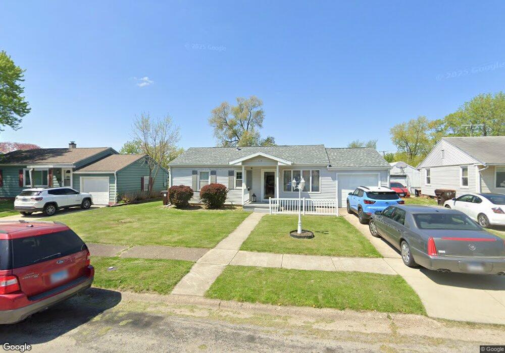
119 Portland Place Lincoln, IL 62656
Estimated Value: $128,410 - $186,000
4
Beds
--
Bath
1,292
Sq Ft
$118/Sq Ft
Est. Value
About This Home
This home is located at 119 Portland Place, Lincoln, IL 62656 and is currently estimated at $152,853, approximately $118 per square foot. 119 Portland Place is a home located in Logan County with nearby schools including Chester-East Lincoln Elementary School, Lincoln Community High School, and Carroll Catholic School.
Ownership History
Date
Name
Owned For
Owner Type
Purchase Details
Closed on
Mar 3, 2010
Sold by
Cecil Karen J and Dutz Karen J
Bought by
Davis Terry R and Davis Mary K
Current Estimated Value
Home Financials for this Owner
Home Financials are based on the most recent Mortgage that was taken out on this home.
Original Mortgage
$94,900
Outstanding Balance
$62,992
Interest Rate
5.01%
Mortgage Type
Stand Alone First
Estimated Equity
$89,861
Create a Home Valuation Report for This Property
The Home Valuation Report is an in-depth analysis detailing your home's value as well as a comparison with similar homes in the area
Home Values in the Area
Average Home Value in this Area
Purchase History
| Date | Buyer | Sale Price | Title Company |
|---|---|---|---|
| Davis Terry R | -- | -- |
Source: Public Records
Mortgage History
| Date | Status | Borrower | Loan Amount |
|---|---|---|---|
| Open | Davis Terry R | $94,900 |
Source: Public Records
Tax History Compared to Growth
Tax History
| Year | Tax Paid | Tax Assessment Tax Assessment Total Assessment is a certain percentage of the fair market value that is determined by local assessors to be the total taxable value of land and additions on the property. | Land | Improvement |
|---|---|---|---|---|
| 2024 | $3,110 | $42,310 | $6,560 | $35,750 |
| 2023 | $2,896 | $39,170 | $6,070 | $33,100 |
| 2022 | $2,746 | $36,600 | $5,670 | $30,930 |
| 2021 | $2,634 | $35,130 | $5,440 | $29,690 |
| 2020 | $2,603 | $34,610 | $5,360 | $29,250 |
| 2019 | $2,541 | $33,930 | $5,250 | $28,680 |
| 2018 | $2,512 | $33,270 | $5,150 | $28,120 |
| 2017 | $2,516 | $33,270 | $5,150 | $28,120 |
| 2016 | $2,498 | $33,230 | $5,140 | $28,090 |
| 2015 | $2,311 | $32,120 | $4,970 | $27,150 |
| 2014 | $2,311 | $32,120 | $4,970 | $27,150 |
| 2013 | $2,311 | $30,490 | $4,720 | $25,770 |
| 2012 | $2,311 | $31,030 | $4,800 | $26,230 |
Source: Public Records
Map
Nearby Homes
- 1624 Delavan St
- 1311 Broadway St
- 1121 Broadway St
- 929 Decatur St
- 1227 Delavan St
- 1225 Delavan St
- 1025 Broadway St
- 928 Broadway St
- 617 Decatur St
- 502 Williamette Ave
- 521 Decatur St
- 418 Wyatt Ave
- 402 Wyatt Ave
- 419 Decatur St
- 802 Bryan Ave
- 113 N Kickapoo St
- 915 Peoria St
- 410 S Chicago St
- 1019 N Mclean St
- 716 S Kickapoo St
- 107 Portland Place
- 125 Portland Place
- 204 Limit St
- 131 Portland Place
- 206 Limit St
- 103 Portland Place
- 104 Nugent Place
- 208 Limit St
- 122 Portland Place
- 116 Portland Place
- 110 Portland Place
- 128 Portland Place
- 102 Nugent Place
- 210 Limit St
- 134 Portland Place
- 202 Nugent Place
- 145 Portland Place
- 140 Portland Place
- 121 Debruler Dr
- 115 Debruler Dr
