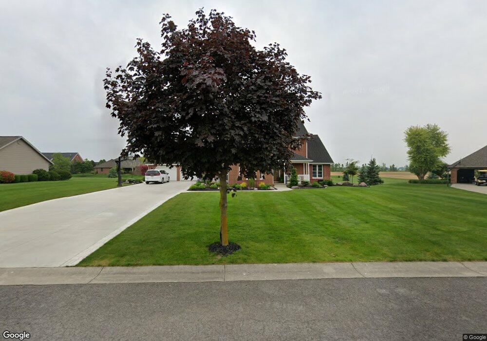
119 Red Maple Ct Fort Jennings, OH 45844
Estimated Value: $218,000 - $543,000
--
Bed
1
Bath
1,844
Sq Ft
$217/Sq Ft
Est. Value
About This Home
This home is located at 119 Red Maple Ct, Fort Jennings, OH 45844 and is currently estimated at $400,486, approximately $217 per square foot. 119 Red Maple Ct is a home with nearby schools including Ottoville Elementary School and Ottoville High School.
Ownership History
Date
Name
Owned For
Owner Type
Purchase Details
Closed on
Aug 27, 2022
Sold by
Mark T Vorst Irrevocable Trust
Bought by
Vorst Mark T
Current Estimated Value
Purchase Details
Closed on
Sep 10, 2018
Sold by
Vorst Mark T
Bought by
Vorst Lisa M and Mark T Vorst Irrevocable Trust
Purchase Details
Closed on
Aug 17, 2018
Sold by
Vorst Mark T and Vorst Lisa M
Bought by
Vorst Mark T
Create a Home Valuation Report for This Property
The Home Valuation Report is an in-depth analysis detailing your home's value as well as a comparison with similar homes in the area
Home Values in the Area
Average Home Value in this Area
Purchase History
| Date | Buyer | Sale Price | Title Company |
|---|---|---|---|
| Vorst Mark T | -- | -- | |
| Vorst Lisa M | -- | None Available | |
| Vorst Mark T | -- | None Available |
Source: Public Records
Tax History Compared to Growth
Tax History
| Year | Tax Paid | Tax Assessment Tax Assessment Total Assessment is a certain percentage of the fair market value that is determined by local assessors to be the total taxable value of land and additions on the property. | Land | Improvement |
|---|---|---|---|---|
| 2024 | $5,129 | $155,220 | $11,510 | $143,710 |
| 2023 | $5,202 | $125,800 | $8,920 | $116,880 |
| 2022 | $4,932 | $125,801 | $8,922 | $116,879 |
| 2021 | $5,102 | $125,800 | $8,920 | $116,880 |
| 2020 | $4,974 | $108,710 | $8,100 | $100,610 |
| 2019 | $4,498 | $115,690 | $8,920 | $106,770 |
| 2018 | $4,262 | $115,690 | $8,920 | $106,770 |
| 2017 | $4,066 | $115,690 | $8,920 | $106,770 |
| 2016 | $4,066 | $108,710 | $8,100 | $100,610 |
| 2015 | $3,901 | $103,850 | $7,050 | $96,800 |
| 2014 | $3,834 | $103,850 | $7,050 | $96,800 |
| 2013 | $4,020 | $103,850 | $7,050 | $96,800 |
Source: Public Records
Map
Nearby Homes
- 320 Auglaize St
- 0 Road 24-Q
- 0 Heritage Cir Unit 6112034
- 0 Heritage Cir Unit 303239
- 7510 State Route 66
- 8951 Brickner Rd
- 17736 Road 20p
- 25853 Road M
- 1303 Carolyn Dr
- 1220 Rose Anna Dr
- 810 N Franklin St
- 704 N Franklin St
- 604 W 6th St
- 628 N Pierce St
- 610 N Washington St
- 20501 U S 224
- 503 W 6th St
- 650 E 6th St
- 616 W 5th St
- 409 N Bredeick St
- 115 Red Maple Ct
- 123 Red Maple Ct
- 118 Red Maple Ct
- 114 Red Maple Ct
- 122 Red Maple Ct
- 111 Red Maple Ct
- 114 Linden Ln
- 113 Linden Ln
- 110 Red Maple Ct
- 111 Linden Ln
- 149 Westwood Dr
- 145 Westwood Dr
- 153 Westwood Dr
- 141 Westwood Dr
- 106 Red Maple Ct
- 108 Red Maple Ct
- 107 Red Maple Ct
- 137 Westwood Dr
- 407 Bradford Ct
- 100 Pine St