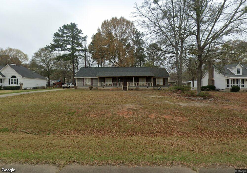
119 Ridge Cir Macon, GA 31216
Estimated Value: $252,000 - $260,000
3
Beds
2
Baths
1,904
Sq Ft
$134/Sq Ft
Est. Value
About This Home
This home is located at 119 Ridge Cir, Macon, GA 31216 and is currently estimated at $255,330, approximately $134 per square foot. 119 Ridge Cir is a home located in Bibb County with nearby schools including Porter Elementary School, Rutland Middle School, and Rutland High School.
Ownership History
Date
Name
Owned For
Owner Type
Purchase Details
Closed on
Dec 12, 2019
Sold by
Rouse Emily J and Fleming Cyri Johnson
Bought by
Rogers John Wesley
Current Estimated Value
Purchase Details
Closed on
Jan 11, 2019
Sold by
Rouse Emily J
Bought by
Johnson Rouse Emily J and Johnson Fleming Cyri
Purchase Details
Closed on
Dec 28, 2007
Sold by
Drawdy Jeffrey and Drawdy Christy
Bought by
Rouse Emily J
Purchase Details
Closed on
Apr 18, 1997
Create a Home Valuation Report for This Property
The Home Valuation Report is an in-depth analysis detailing your home's value as well as a comparison with similar homes in the area
Purchase History
| Date | Buyer | Sale Price | Title Company |
|---|---|---|---|
| Rogers John Wesley | -- | None Available | |
| Johnson Rouse Emily J | -- | None Available | |
| Rouse Emily J | $147,000 | None Available | |
| -- | $105,000 | -- |
Source: Public Records
Tax History
| Year | Tax Paid | Tax Assessment Tax Assessment Total Assessment is a certain percentage of the fair market value that is determined by local assessors to be the total taxable value of land and additions on the property. | Land | Improvement |
|---|---|---|---|---|
| 2025 | $2,104 | $92,608 | $16,000 | $76,608 |
| 2024 | $2,166 | $92,281 | $16,000 | $76,281 |
| 2023 | $1,549 | $85,988 | $16,000 | $69,988 |
| 2022 | $1,858 | $60,658 | $8,840 | $51,818 |
| 2021 | $1,708 | $51,944 | $8,840 | $43,104 |
| 2020 | $1,469 | $44,834 | $7,514 | $37,320 |
| 2019 | $1,481 | $44,834 | $7,514 | $37,320 |
| 2018 | $2,289 | $42,182 | $7,514 | $34,668 |
| 2017 | $1,318 | $42,182 | $7,514 | $34,668 |
| 2016 | $1,166 | $47,897 | $7,072 | $40,825 |
| 2015 | $1,984 | $47,502 | $7,072 | $40,430 |
| 2014 | $2,058 | $48,942 | $7,072 | $41,870 |
Source: Public Records
Map
Nearby Homes
- 180 Ridge Cir
- 141 Bransford Dr
- 221 Pendleton Ct
- 3906 Hartley Bridge Rd
- 104 Tyler Ct
- 3812 Western Way
- 4005 Springhead Way Unit LOT 100
- 4003 Springhead Way Unit LOT 101
- 4009 Springhead Way Unit LOT 98
- 4001 Springhead Way Unit LOT 102
- 106 Hudson Way
- 123 Hudson Way
- 3636 Bonanza Dr
- 5731 School Rd
- 5514 Bankston Lake Rd
- 5524 Bankston Lake Rd
- 1066 Alma Dr
- 1013 Homestead Dr Unit HI199
- 1015 Homestead Dr Unit HI200
- 5608 Swymer Dr
- 125 Ridge Cir
- 216 Forest Pine Dr
- 107 Ridge Cir
- 131 Ridge Cir
- 224 Forest Pine Dr
- 118 Ridge Cir
- 112 Ridge Cir
- 206 Forest Pine Dr
- 230 Forest Pine Dr
- 106 Ridge Cir
- 137 Ridge Cir
- 144 Timber Ridge Dr
- 148 Timber Ridge Dr
- 236 Forest Pine Dr
- 130 Ridge Cir
- 200 Forest Pine Dr
- 217 Forest Pine Dr
- 140 Timber Ridge Dr
- 211 Forest Pine Dr
- 223 Forest Pine Dr
Your Personal Tour Guide
Ask me questions while you tour the home.