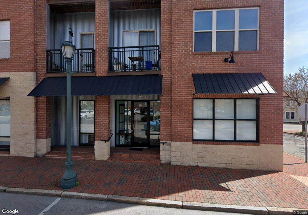
119 S Lee St Unit NULL Salisbury, NC 28144
Estimated Value: $188,000 - $197,000
Studio
2
Baths
1,042
Sq Ft
$184/Sq Ft
Est. Value
About This Home
This home is located at 119 S Lee St Unit NULL, Salisbury, NC 28144 and is currently estimated at $191,884, approximately $184 per square foot. 119 S Lee St Unit NULL is a home located in Rowan County with nearby schools including Carroll T Overton Elementary School, North Rowan Middle School, and Salisbury High School.
Ownership History
Date
Name
Owned For
Owner Type
Purchase Details
Closed on
Nov 14, 2025
Sold by
Kandl Judith E and Kandl Louis C
Bought by
Kearns Arey Mary and Harmer Kenneth W
Current Estimated Value
Home Financials for this Owner
Home Financials are based on the most recent Mortgage that was taken out on this home.
Original Mortgage
$125,000
Outstanding Balance
$125,000
Interest Rate
6.34%
Mortgage Type
New Conventional
Estimated Equity
$66,884
Purchase Details
Closed on
Sep 3, 2013
Sold by
Cranford Karen L
Bought by
Kandl Judith E and Kandl Louis C
Purchase Details
Closed on
Dec 22, 2008
Sold by
Spear Investments Llc
Bought by
Cranford Karen L
Home Financials for this Owner
Home Financials are based on the most recent Mortgage that was taken out on this home.
Original Mortgage
$144,000
Interest Rate
6.1%
Mortgage Type
Unknown
Purchase Details
Closed on
Aug 13, 2008
Sold by
Town Square Development Llc
Bought by
Spear Investments Llc
Create a Home Valuation Report for This Property
The Home Valuation Report is an in-depth analysis detailing your home's value as well as a comparison with similar homes in the area
Home Values in the Area
Average Home Value in this Area
Purchase History
| Date | Buyer | Sale Price | Title Company |
|---|---|---|---|
| Kearns Arey Mary | $190,000 | None Listed On Document | |
| Kandl Judith E | $175,000 | None Available | |
| Cranford Karen L | $160,000 | None Available | |
| Spear Investments Llc | -- | None Available |
Source: Public Records
Mortgage History
| Date | Status | Borrower | Loan Amount |
|---|---|---|---|
| Open | Kearns Arey Mary | $125,000 | |
| Previous Owner | Cranford Karen L | $144,000 |
Source: Public Records
Tax History
| Year | Tax Paid | Tax Assessment Tax Assessment Total Assessment is a certain percentage of the fair market value that is determined by local assessors to be the total taxable value of land and additions on the property. | Land | Improvement |
|---|---|---|---|---|
| 2025 | $1,532 | $208,093 | $1 | $208,092 |
| 2024 | $1,532 | $208,093 | $1 | $208,092 |
| 2023 | $2,813 | $208,093 | $1 | $208,092 |
| 2022 | $1,954 | $125,791 | $1 | $125,790 |
| 2021 | $1,954 | $125,791 | $1 | $125,790 |
| 2020 | $1,954 | $125,791 | $1 | $125,790 |
| 2019 | $1,954 | $125,791 | $1 | $125,790 |
| 2018 | $2,031 | $132,550 | $1 | $132,549 |
| 2017 | $2,021 | $132,550 | $1 | $132,549 |
| 2016 | $1,851 | $124,379 | $1 | $124,378 |
| 2015 | $1,864 | $124,379 | $1 | $124,378 |
| 2014 | $1,833 | $123,715 | $1 | $123,714 |
Source: Public Records
Map
Nearby Homes
- 122 E Innes St
- 300 S Main St Unit K
- 123 N Main St
- 409 E Fisher St
- 420 E Bank St
- 0 Brown St
- 402 E Horah St Unit 35
- 403 S Long St
- 301 S Shaver St
- 501 S Main St
- 406 S Shaver St
- 500 W Council St
- 420 S Jackson St
- 1165 Kildare Dr Unit 2
- 1040 Beckham Rd
- 120 Nolen Dr Unit 72
- 1210 Kildare Dr Unit 80
- 1205 Kildare Dr Unit 5
- 1215 Kildare Dr Unit 6
- 110 Nolen Dr Unit 73
- 129 S Lee St Unit 9
- 139 S Lee St Unit 14
- 127 S Lee St
- 127 S Lee St
- 202 E Fisher St Unit 4
- 214 E Fisher St Unit 15
- 137 S Lee St
- 137 S Lee St Unit 13
- 204 E Fisher St Unit 5
- 115 S Lee St
- 125 S Lee St
- 125 S Lee St Unit 12
- 206 E Fisher St Unit 6
- 135 S Lee St
- 135 S Lee St
- 135 S Lee St
- 212 E Fisher St Unit 11
- 216 E Fisher St Unit 16
- 210 E Fisher St Unit 10
- 210 E Fisher St Unit 210
Your Personal Tour Guide
Ask me questions while you tour the home.