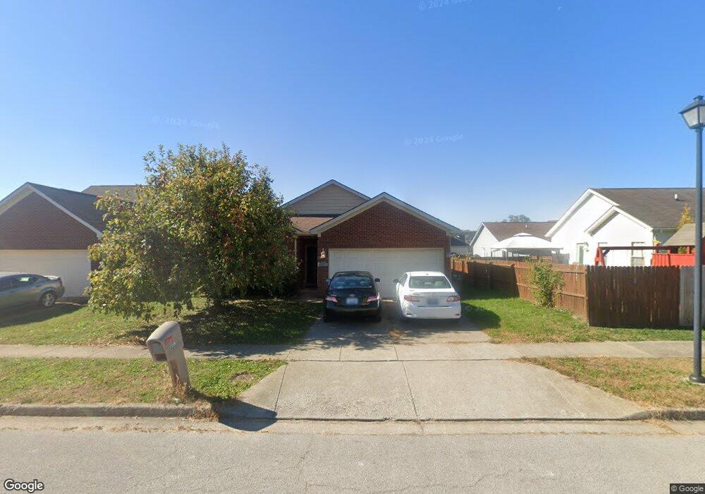
119 Seth Way Georgetown, KY 40324
Northeast Georgetown NeighborhoodEstimated Value: $252,000 - $273,000
3
Beds
2
Baths
1,301
Sq Ft
$204/Sq Ft
Est. Value
About This Home
This home is located at 119 Seth Way, Georgetown, KY 40324 and is currently estimated at $265,225, approximately $203 per square foot. 119 Seth Way is a home located in Scott County with nearby schools including Garth Elementary School, Georgetown Middle School, and Scott County High School.
Ownership History
Date
Name
Owned For
Owner Type
Purchase Details
Closed on
Nov 22, 2011
Sold by
Trauth Amy and Trauth Matthew
Bought by
Brooks Katherine F
Current Estimated Value
Home Financials for this Owner
Home Financials are based on the most recent Mortgage that was taken out on this home.
Original Mortgage
$117,932
Outstanding Balance
$79,742
Interest Rate
4.15%
Mortgage Type
New Conventional
Estimated Equity
$185,483
Purchase Details
Closed on
Jun 2, 2005
Sold by
Rubin Development Company Llc
Bought by
Deaton Compaines Incorporated
Home Financials for this Owner
Home Financials are based on the most recent Mortgage that was taken out on this home.
Original Mortgage
$179,200
Interest Rate
5.66%
Mortgage Type
Purchase Money Mortgage
Create a Home Valuation Report for This Property
The Home Valuation Report is an in-depth analysis detailing your home's value as well as a comparison with similar homes in the area
Home Values in the Area
Average Home Value in this Area
Purchase History
| Date | Buyer | Sale Price | Title Company |
|---|---|---|---|
| Brooks Katherine F | $121,000 | Home Services Title | |
| Deaton Compaines Incorporated | $216,000 | None Available |
Source: Public Records
Mortgage History
| Date | Status | Borrower | Loan Amount |
|---|---|---|---|
| Open | Brooks Katherine F | $117,932 | |
| Previous Owner | Deaton Compaines Incorporated | $179,200 |
Source: Public Records
Tax History
| Year | Tax Paid | Tax Assessment Tax Assessment Total Assessment is a certain percentage of the fair market value that is determined by local assessors to be the total taxable value of land and additions on the property. | Land | Improvement |
|---|---|---|---|---|
| 2025 | $1,941 | $217,900 | $0 | $0 |
| 2024 | $1,898 | $211,000 | $0 | $0 |
| 2023 | $1,830 | $201,800 | $35,000 | $166,800 |
| 2022 | $1,565 | $184,100 | $33,000 | $151,100 |
| 2021 | $1,595 | $169,300 | $33,000 | $136,300 |
| 2020 | $1,322 | $153,900 | $33,000 | $120,900 |
| 2019 | $1,273 | $145,900 | $0 | $0 |
| 2018 | $1,184 | $136,400 | $0 | $0 |
| 2017 | $1,138 | $130,447 | $0 | $0 |
| 2016 | $1,007 | $125,111 | $0 | $0 |
| 2015 | $968 | $121,000 | $0 | $0 |
| 2014 | $1,003 | $121,000 | $0 | $0 |
| 2011 | $78 | $126,300 | $0 | $0 |
Source: Public Records
Map
Nearby Homes
- 131 Serena Way
- 122 Marjorie Place
- 106 Serena Way
- 109 Sunny Cir
- 100 Santa Monica Dr
- 148 Ruth Miller Dr
- 161 Bill Perkins Ln
- 150 Ruth Miller Dr
- 168 Ruth Miller Dr
- 174 Ruth Miller Dr
- 100 Summit Dr
- 155 Bill Perkins Ln
- 131 Bill Perkins Ln
- 243 Harmony Ridge Rd
- 258-260 Elkhorn Meadows Dr
- 115 Bill Perkins Ln
- 203 Pleasant View Dr
- 105 Dusk Ct
- 129 Meadow View Way
- 171 Elkhorn Meadows Dr
Your Personal Tour Guide
Ask me questions while you tour the home.