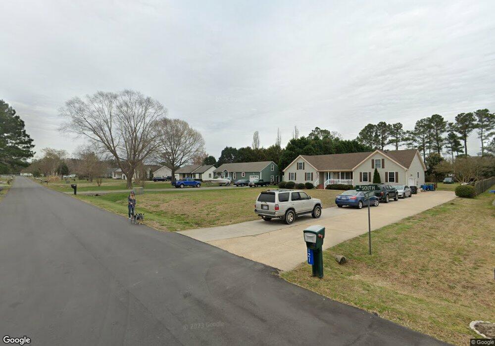
119 South St Moyock, NC 27958
Estimated Value: $376,000 - $421,000
3
Beds
2
Baths
1,482
Sq Ft
$265/Sq Ft
Est. Value
About This Home
This home is located at 119 South St, Moyock, NC 27958 and is currently estimated at $392,130, approximately $264 per square foot. 119 South St is a home located in Currituck County with nearby schools including Moyock Elementary School, Moyock Middle School, and Currituck County High School.
Ownership History
Date
Name
Owned For
Owner Type
Purchase Details
Closed on
Jul 10, 2019
Sold by
Morgan Sharon G
Bought by
Morgan Jeffrey S
Current Estimated Value
Purchase Details
Closed on
Oct 27, 2008
Sold by
Morgan Jeffrey S and Morgan Sharon G
Bought by
Morgan Jeffrey S and Morgan Sharon G
Home Financials for this Owner
Home Financials are based on the most recent Mortgage that was taken out on this home.
Original Mortgage
$254,705
Outstanding Balance
$164,696
Interest Rate
5.78%
Mortgage Type
FHA
Estimated Equity
$227,434
Purchase Details
Closed on
May 31, 2006
Sold by
Morgan Wanda G
Bought by
Morgan Jeffrey S
Home Financials for this Owner
Home Financials are based on the most recent Mortgage that was taken out on this home.
Original Mortgage
$200,000
Interest Rate
6.44%
Mortgage Type
New Conventional
Create a Home Valuation Report for This Property
The Home Valuation Report is an in-depth analysis detailing your home's value as well as a comparison with similar homes in the area
Home Values in the Area
Average Home Value in this Area
Purchase History
| Date | Buyer | Sale Price | Title Company |
|---|---|---|---|
| Morgan Jeffrey S | -- | None Available | |
| Morgan Jeffrey S | -- | None Available | |
| Morgan Jeffrey S | -- | None Available |
Source: Public Records
Mortgage History
| Date | Status | Borrower | Loan Amount |
|---|---|---|---|
| Open | Morgan Jeffrey S | $254,705 | |
| Closed | Morgan Jeffrey S | $200,000 |
Source: Public Records
Tax History Compared to Growth
Tax History
| Year | Tax Paid | Tax Assessment Tax Assessment Total Assessment is a certain percentage of the fair market value that is determined by local assessors to be the total taxable value of land and additions on the property. | Land | Improvement |
|---|---|---|---|---|
| 2024 | $1,813 | $238,600 | $92,900 | $145,700 |
| 2023 | $1,818 | $238,600 | $92,900 | $145,700 |
| 2022 | $1,408 | $238,600 | $92,900 | $145,700 |
| 2021 | $1,400 | $191,100 | $84,500 | $106,600 |
| 2020 | $1,105 | $191,100 | $84,500 | $106,600 |
| 2019 | $1,104 | $191,100 | $84,500 | $106,600 |
| 2018 | $1,106 | $191,100 | $84,500 | $106,600 |
| 2017 | $1,072 | $191,100 | $84,500 | $106,600 |
| 2016 | $1,078 | $191,100 | $84,500 | $106,600 |
| 2015 | $1,076 | $191,100 | $84,500 | $106,600 |
Source: Public Records
Map
Nearby Homes
- 143 Homestead Ln
- 121 Baxter Ln
- 100 N Tall Pines Trail
- 102 Tuscorora Ln
- 101 Tuscorora Ln
- 120 Baxter Station Blvd
- The Woodland Plan at Baxter Station
- 100 Baxter Station Blvd
- 127 Baxter Station Blvd
- 104 Baxter Station Blvd
- 102 N Tall Pines Trail
- 0 Baxter Station Blvd
- 104 Tuscorora Ln
- 0000 Baxter Station Blvd
- 00 Baxter Station Blvd
- 000 Baxter Station Blvd
- 100 Tuscorora Ln
- 4431 Old Battlefield Blvd S
- The Squire Plan at Windswept Pines
- The Reba Plan at Windswept Pines