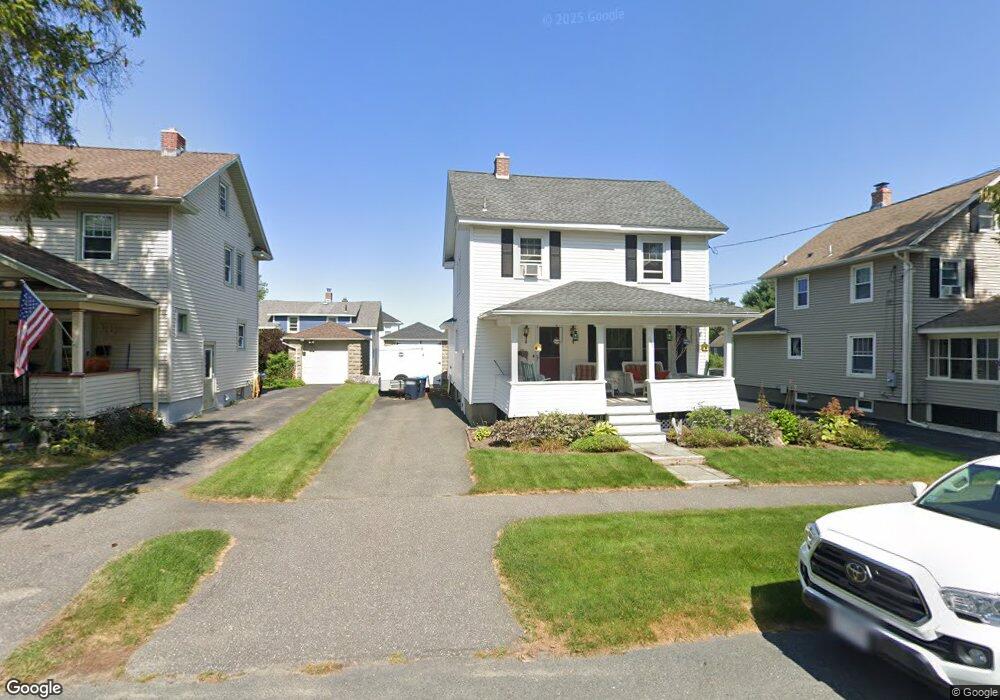
119 Strong Ave Pittsfield, MA 01201
Estimated Value: $255,877 - $308,000
3
Beds
1
Bath
1,404
Sq Ft
$206/Sq Ft
Est. Value
About This Home
This home is located at 119 Strong Ave, Pittsfield, MA 01201 and is currently estimated at $289,469, approximately $206 per square foot. 119 Strong Ave is a home located in Berkshire County with nearby schools including Egremont Elementary School, Theodore Herberg Middle School, and Pittsfield High School.
Ownership History
Date
Name
Owned For
Owner Type
Purchase Details
Closed on
Mar 20, 2020
Sold by
Ireland Nancy J
Bought by
Ireland Keith M and Ireland Nancy J
Current Estimated Value
Purchase Details
Closed on
May 4, 1987
Sold by
Laviolette David E
Bought by
Ireland Keith M
Home Financials for this Owner
Home Financials are based on the most recent Mortgage that was taken out on this home.
Original Mortgage
$58,000
Interest Rate
8.99%
Mortgage Type
Purchase Money Mortgage
Create a Home Valuation Report for This Property
The Home Valuation Report is an in-depth analysis detailing your home's value as well as a comparison with similar homes in the area
Home Values in the Area
Average Home Value in this Area
Purchase History
| Date | Buyer | Sale Price | Title Company |
|---|---|---|---|
| Ireland Keith M | -- | None Available | |
| Ireland Keith M | -- | None Available | |
| Ireland Keith M | -- | None Available | |
| Ireland Keith M | $77,000 | -- |
Source: Public Records
Mortgage History
| Date | Status | Borrower | Loan Amount |
|---|---|---|---|
| Previous Owner | Ireland Keith M | $52,500 | |
| Previous Owner | Ireland Keith M | $58,000 |
Source: Public Records
Tax History
| Year | Tax Paid | Tax Assessment Tax Assessment Total Assessment is a certain percentage of the fair market value that is determined by local assessors to be the total taxable value of land and additions on the property. | Land | Improvement |
|---|---|---|---|---|
| 2025 | $4,214 | $234,900 | $71,200 | $163,700 |
| 2024 | $3,939 | $213,500 | $71,200 | $142,300 |
| 2023 | $3,682 | $201,000 | $71,200 | $129,800 |
| 2022 | $3,330 | $179,400 | $66,800 | $112,600 |
| 2021 | $3,059 | $158,900 | $66,800 | $92,100 |
| 2020 | $3,073 | $155,900 | $66,800 | $89,100 |
| 2019 | $2,880 | $148,300 | $62,300 | $86,000 |
| 2018 | $2,817 | $140,800 | $57,900 | $82,900 |
| 2017 | $2,705 | $137,800 | $57,900 | $79,900 |
| 2016 | $2,534 | $135,100 | $57,900 | $77,200 |
| 2015 | $2,440 | $135,100 | $57,900 | $77,200 |
Source: Public Records
Map
Nearby Homes
- 123 Strong Ave
- 115 Strong Ave
- 83 Hazelwood Terrace
- 127 Strong Ave
- 79 Hazelwood Terrace
- 114 Strong Ave
- 129 Strong Ave
- 101 Strong Ave
- 126 Strong Ave
- 75 Hazelwood Terrace
- 104 Marian Ave
- 133 Strong Ave
- 130 Strong Ave
- 95 Strong Ave
- 20 Endicott St
- 71 Hazelwood Terrace
- 14 Endicott St
- 132 Strong Ave
- 96 Marian Ave
- 137 Strong Ave
Your Personal Tour Guide
Ask me questions while you tour the home.