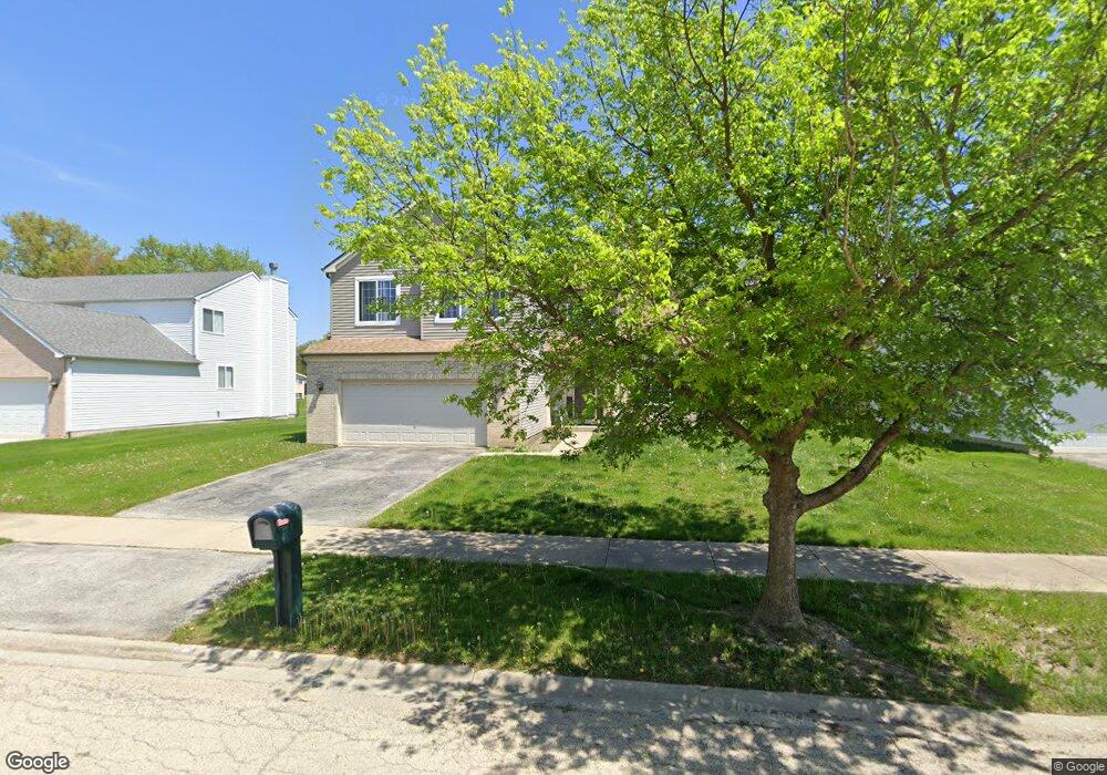
119 Sundance Rd Matteson, IL 60443
Old Matteson NeighborhoodEstimated Value: $370,022 - $423,000
4
Beds
3
Baths
2,622
Sq Ft
$149/Sq Ft
Est. Value
About This Home
This home is located at 119 Sundance Rd, Matteson, IL 60443 and is currently estimated at $389,756, approximately $148 per square foot. 119 Sundance Rd is a home located in Cook County with nearby schools including Illinois School, Arcadia Elementary School, and Indiana Elementary School.
Ownership History
Date
Name
Owned For
Owner Type
Purchase Details
Closed on
May 6, 2002
Sold by
Centex Homes
Bought by
Arnold Steven P
Current Estimated Value
Home Financials for this Owner
Home Financials are based on the most recent Mortgage that was taken out on this home.
Original Mortgage
$242,450
Outstanding Balance
$102,522
Interest Rate
6.95%
Estimated Equity
$287,234
Create a Home Valuation Report for This Property
The Home Valuation Report is an in-depth analysis detailing your home's value as well as a comparison with similar homes in the area
Home Values in the Area
Average Home Value in this Area
Purchase History
| Date | Buyer | Sale Price | Title Company |
|---|---|---|---|
| Arnold Steven P | $255,500 | -- |
Source: Public Records
Mortgage History
| Date | Status | Borrower | Loan Amount |
|---|---|---|---|
| Open | Arnold Steven P | $242,450 |
Source: Public Records
Tax History Compared to Growth
Tax History
| Year | Tax Paid | Tax Assessment Tax Assessment Total Assessment is a certain percentage of the fair market value that is determined by local assessors to be the total taxable value of land and additions on the property. | Land | Improvement |
|---|---|---|---|---|
| 2024 | $11,856 | $32,000 | $5,400 | $26,600 |
| 2023 | $9,479 | $32,000 | $5,400 | $26,600 |
| 2022 | $9,479 | $20,893 | $4,725 | $16,168 |
| 2021 | $9,658 | $20,893 | $4,725 | $16,168 |
| 2020 | $9,061 | $20,893 | $4,725 | $16,168 |
| 2019 | $11,017 | $24,716 | $4,275 | $20,441 |
| 2018 | $11,012 | $24,716 | $4,275 | $20,441 |
| 2017 | $10,602 | $24,716 | $4,275 | $20,441 |
| 2016 | $10,198 | $23,237 | $3,825 | $19,412 |
| 2015 | $10,048 | $23,237 | $3,825 | $19,412 |
| 2014 | $9,759 | $23,237 | $3,825 | $19,412 |
| 2013 | $9,416 | $24,445 | $3,825 | $20,620 |
Source: Public Records
Map
Nearby Homes
- 135 Treehouse Rd
- 153 Treehouse Rd
- 4500 203rd St
- 20340 Crawford Ave
- 20001 Arquilla Cir
- 20520 Crawford Ave
- 19611 Crawford Ave
- 4700 203rd St
- 312 Grafton Place
- 722 Kostner Ave
- 19435 Hickory Place Unit 29A
- 20920 Governors Hwy
- 3907 Troon St
- 19407 Oak Ave Unit 76
- 20601 Parthenon Way
- 19423 Hickory Place Unit 31D
- 19361 Oak Ave Unit 3
- 3521 Park Place
- 98 Lawrence Ln
- 20415 Doria Ln
- 125 Sundance Rd
- 107 Sundance Rd
- 131 Sundance Rd
- 118 Sundance Rd
- 124 Sundance Rd
- 112 Sundance Rd
- 4109 Orchard Ln
- 101 Sundance Rd
- 137 Sundance Rd
- 106 Sundance Rd
- 130 Sundance Rd
- 4111 Orchard Ln
- 100 Sundance Rd
- 136 Sundance Rd
- 57 Sundance Rd
- 121 Moonlight Rd
- 143 Sundance Rd
- 127 Moonlight Rd
- 115 Moonlight Rd
- 135 Moonlight Rd