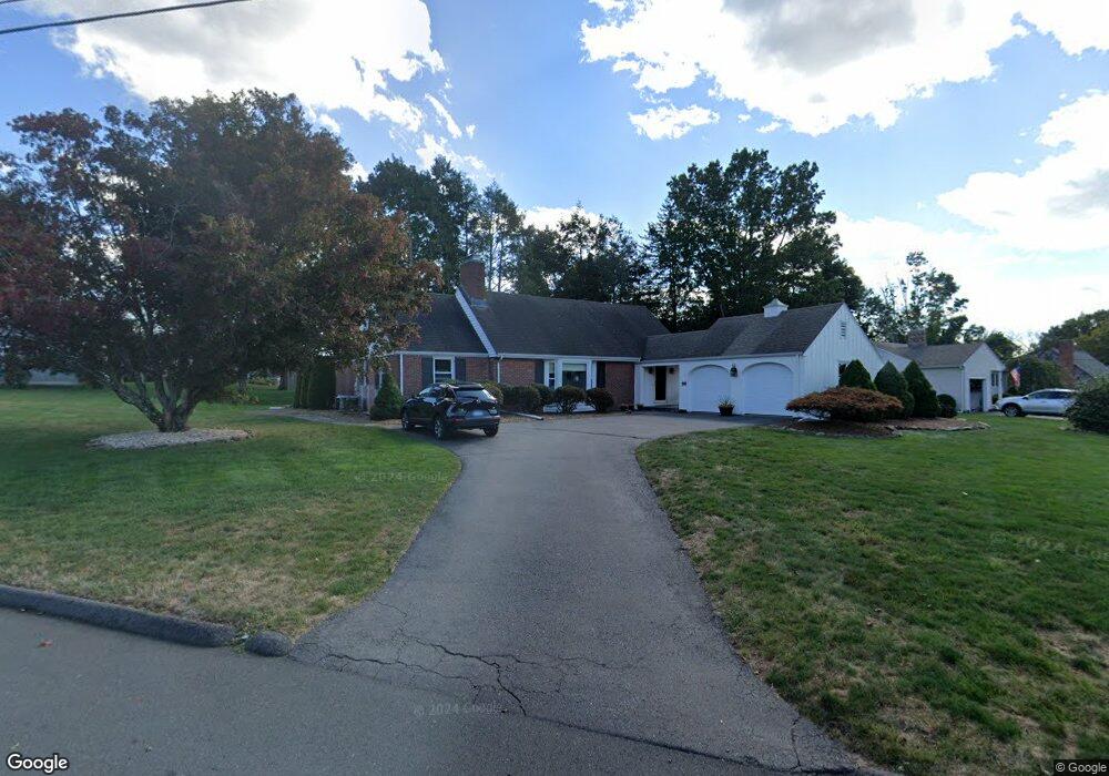
119 Two Stone Dr Wethersfield, CT 06109
Estimated Value: $489,051 - $549,000
3
Beds
2
Baths
2,221
Sq Ft
$235/Sq Ft
Est. Value
About This Home
This home is located at 119 Two Stone Dr, Wethersfield, CT 06109 and is currently estimated at $522,513, approximately $235 per square foot. 119 Two Stone Dr is a home located in Hartford County with nearby schools including Highcrest School, Silas Deane Middle School, and Wethersfield High School.
Ownership History
Date
Name
Owned For
Owner Type
Purchase Details
Closed on
Nov 28, 2000
Sold by
Broaddus Pamela J
Bought by
Condon Steven M and Condon Kelly D
Current Estimated Value
Home Financials for this Owner
Home Financials are based on the most recent Mortgage that was taken out on this home.
Original Mortgage
$170,000
Interest Rate
7.78%
Purchase Details
Closed on
Aug 2, 1995
Sold by
Ross Richard
Bought by
Broaddus Robert E and Broaddus Pamela J
Home Financials for this Owner
Home Financials are based on the most recent Mortgage that was taken out on this home.
Original Mortgage
$152,000
Interest Rate
7.48%
Mortgage Type
Unknown
Create a Home Valuation Report for This Property
The Home Valuation Report is an in-depth analysis detailing your home's value as well as a comparison with similar homes in the area
Home Values in the Area
Average Home Value in this Area
Purchase History
| Date | Buyer | Sale Price | Title Company |
|---|---|---|---|
| Condon Steven M | $229,900 | -- | |
| Broaddus Robert E | $190,000 | -- |
Source: Public Records
Mortgage History
| Date | Status | Borrower | Loan Amount |
|---|---|---|---|
| Open | Broaddus Robert E | $125,300 | |
| Closed | Broaddus Robert E | $169,600 | |
| Closed | Broaddus Robert E | $170,000 | |
| Previous Owner | Broaddus Robert E | $152,000 |
Source: Public Records
Tax History
| Year | Tax Paid | Tax Assessment Tax Assessment Total Assessment is a certain percentage of the fair market value that is determined by local assessors to be the total taxable value of land and additions on the property. | Land | Improvement |
|---|---|---|---|---|
| 2025 | $12,311 | $298,660 | $95,260 | $203,400 |
| 2024 | $9,436 | $218,320 | $84,250 | $134,070 |
| 2023 | $9,121 | $218,320 | $84,250 | $134,070 |
| 2022 | $8,969 | $218,320 | $84,250 | $134,070 |
| 2021 | $8,879 | $218,320 | $84,250 | $134,070 |
| 2020 | $8,883 | $218,320 | $84,250 | $134,070 |
| 2019 | $8,894 | $218,320 | $84,250 | $134,070 |
| 2018 | $8,286 | $203,200 | $76,400 | $126,800 |
| 2017 | $8,081 | $203,200 | $76,400 | $126,800 |
| 2016 | $7,831 | $203,200 | $76,400 | $126,800 |
| 2015 | $7,760 | $203,200 | $76,400 | $126,800 |
| 2014 | $7,466 | $203,200 | $76,400 | $126,800 |
Source: Public Records
Map
Nearby Homes
- 268 Fox Hill Rd
- 70 Mountain Laurel Dr Unit 70
- 18 Mcintosh Cir Unit 18
- 11 Charter Rd
- 92 Berkshire Rd
- 1610 Silas Deane Hwy
- 99 Elm Ridge Dr
- 31 Ox Yoke Dr
- 155 Old Common Rd
- 59 Chapin Ave
- 89 Merriman Rd
- 36 Copper Beech Dr
- 20 Little Oak Ln Unit 20
- 38 Wheeler Rd
- 0 Collier Rd
- 101 Collier Rd
- 250 Edward St
- 25 Heather Hill
- 34 Rose Ct
- 750 Wolcott Hill Rd
- 10 Pasture Trail
- 15 Fox Hill Rd
- 21 Fox Hill Rd
- 124 Two Stone Dr
- 135 Two Stone Dr
- 777 Maple St
- 27 Fox Hill Rd
- 114 Two Stone Dr
- 18 Pasture Trail
- 109 Two Stone Dr
- 797 Maple St
- 769 Maple St
- 35 Fox Hill Rd
- 104 Two Stone Dr
- 15 Pasture Trail
- 763 Maple St
- 788 Maple St
- 798 Maple St
- 16 Fox Hill Rd
- 101 Two Stone Dr
Your Personal Tour Guide
Ask me questions while you tour the home.