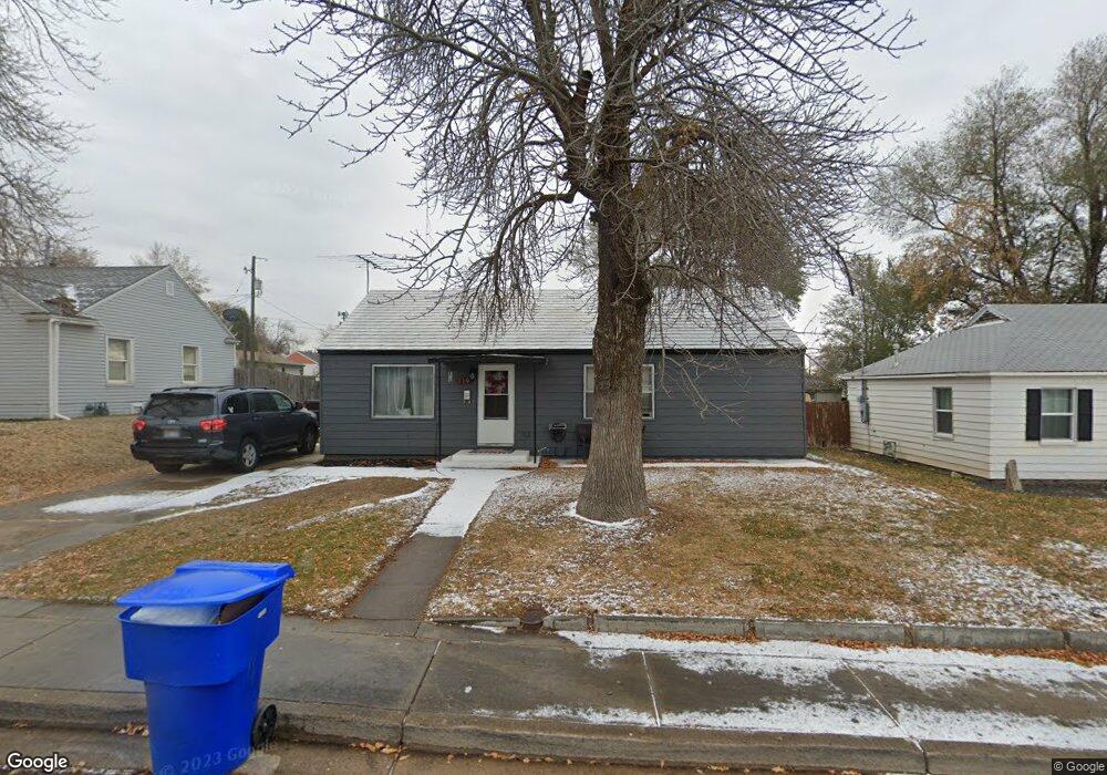
119 W 1900 N Clearfield, UT 84015
Estimated Value: $292,000 - $341,000
2
Beds
1
Bath
1,104
Sq Ft
$291/Sq Ft
Est. Value
About This Home
This home is located at 119 W 1900 N, Clearfield, UT 84015 and is currently estimated at $320,764, approximately $290 per square foot. 119 W 1900 N is a home located in Davis County with nearby schools including Sunset School, Sunset Junior High School, and Northridge High School.
Ownership History
Date
Name
Owned For
Owner Type
Purchase Details
Closed on
Apr 29, 2022
Sold by
Terry H Holbrook Living Trust
Bought by
Bressette Tayler and Bressette Vincent A
Current Estimated Value
Home Financials for this Owner
Home Financials are based on the most recent Mortgage that was taken out on this home.
Original Mortgage
$5,302
Outstanding Balance
$5,015
Interest Rate
5.1%
Estimated Equity
$315,749
Purchase Details
Closed on
May 25, 2021
Sold by
Holbrook Terry H
Bought by
Terry H Holbrook Living Trust
Purchase Details
Closed on
Jul 5, 2002
Sold by
Holbrook Jason H and Holbrook Judy
Bought by
Holbrook Terry H
Home Financials for this Owner
Home Financials are based on the most recent Mortgage that was taken out on this home.
Original Mortgage
$94,090
Interest Rate
6.78%
Create a Home Valuation Report for This Property
The Home Valuation Report is an in-depth analysis detailing your home's value as well as a comparison with similar homes in the area
Home Values in the Area
Average Home Value in this Area
Purchase History
| Date | Buyer | Sale Price | Title Company |
|---|---|---|---|
| Bressette Tayler | -- | First American Title | |
| Terry H Holbrook Living Trust | -- | None Listed On Document | |
| Terry H Holbrook Living Trust | -- | None Listed On Document | |
| Holbrook Terry H | -- | Bonneville Title Company Inc |
Source: Public Records
Mortgage History
| Date | Status | Borrower | Loan Amount |
|---|---|---|---|
| Open | Bressette Tayler | $5,302 | |
| Open | Bressette Tayler | $88,369 | |
| Previous Owner | Holbrook Terry H | $94,090 |
Source: Public Records
Tax History
| Year | Tax Paid | Tax Assessment Tax Assessment Total Assessment is a certain percentage of the fair market value that is determined by local assessors to be the total taxable value of land and additions on the property. | Land | Improvement |
|---|---|---|---|---|
| 2025 | $1,694 | $154,550 | $66,316 | $88,234 |
| 2024 | $1,676 | $152,900 | $63,441 | $89,459 |
| 2023 | $1,563 | $260,000 | $102,100 | $157,900 |
| 2022 | $1,668 | $150,150 | $59,130 | $91,020 |
| 2021 | $1,428 | $202,000 | $59,839 | $142,161 |
| 2020 | $1,229 | $171,000 | $49,797 | $121,203 |
| 2019 | $1,170 | $167,000 | $69,641 | $97,359 |
| 2018 | $1,038 | $145,000 | $55,654 | $89,346 |
| 2016 | $909 | $65,285 | $25,766 | $39,519 |
| 2015 | $862 | $58,630 | $25,766 | $32,864 |
| 2014 | $872 | $60,607 | $26,472 | $34,135 |
| 2013 | -- | $53,571 | $23,265 | $30,306 |
Source: Public Records
Map
Nearby Homes
- 1874 N 75 W
- 1874 N 300 W
- 52 W 2000 N
- 1783 N 300 W
- 2085 N Main St Unit 309
- 2085 N Main St Unit 102
- 2085 N Main St Unit 409
- 2085 N Main St Unit 107
- 2085 N Main St Unit 108
- 2085 N Main St Unit 115
- 2085 N Main St Unit 110
- 2085 N Main St Unit 201
- 2085 N Main St Unit 301
- 2085 N Main St Unit 302
- 2085 N Main St Unit 215
- 2085 N Main St Unit 303
- 1647 N Main St
- 2001 N 400 W
- 2129 N 250 W
- 129 W 2200 N
Your Personal Tour Guide
Ask me questions while you tour the home.