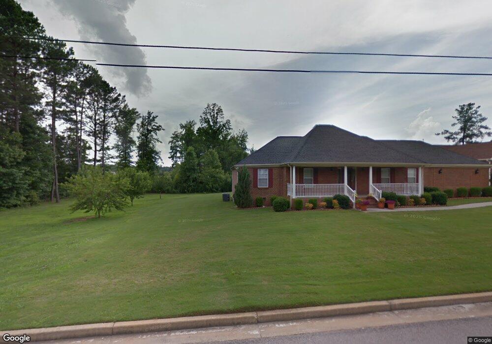
119 W Greenwich Cir Lagrange, GA 30241
Estimated Value: $293,371 - $374,000
4
Beds
3
Baths
2,629
Sq Ft
$122/Sq Ft
Est. Value
About This Home
This home is located at 119 W Greenwich Cir, Lagrange, GA 30241 and is currently estimated at $321,343, approximately $122 per square foot. 119 W Greenwich Cir is a home with nearby schools including Callaway Elementary School, Hogansville Elementary School, and Callaway Middle School.
Ownership History
Date
Name
Owned For
Owner Type
Purchase Details
Closed on
Nov 12, 1999
Sold by
Dorothy Jean Tucker
Bought by
Mccord Elizabeth
Current Estimated Value
Purchase Details
Closed on
Dec 11, 1992
Sold by
John C Tucker
Bought by
Dorothy Jean Tucker
Create a Home Valuation Report for This Property
The Home Valuation Report is an in-depth analysis detailing your home's value as well as a comparison with similar homes in the area
Home Values in the Area
Average Home Value in this Area
Purchase History
| Date | Buyer | Sale Price | Title Company |
|---|---|---|---|
| Mccord Elizabeth | $22,000 | -- | |
| Dorothy Jean Tucker | -- | -- |
Source: Public Records
Tax History Compared to Growth
Tax History
| Year | Tax Paid | Tax Assessment Tax Assessment Total Assessment is a certain percentage of the fair market value that is determined by local assessors to be the total taxable value of land and additions on the property. | Land | Improvement |
|---|---|---|---|---|
| 2024 | $2,806 | $104,880 | $15,000 | $89,880 |
| 2023 | $2,743 | $102,560 | $15,000 | $87,560 |
| 2022 | $2,581 | $94,480 | $12,000 | $82,480 |
| 2021 | $2,892 | $97,880 | $12,000 | $85,880 |
| 2020 | $2,892 | $97,880 | $12,000 | $85,880 |
| 2019 | $2,714 | $91,960 | $12,000 | $79,960 |
| 2018 | $2,713 | $91,960 | $12,000 | $79,960 |
| 2017 | $2,714 | $91,960 | $12,000 | $79,960 |
| 2016 | $2,642 | $89,571 | $12,000 | $77,571 |
| 2015 | $2,646 | $89,571 | $12,000 | $77,571 |
| 2014 | $2,340 | $79,304 | $16,000 | $63,304 |
| 2013 | -- | $82,958 | $16,000 | $66,958 |
Source: Public Records
Map
Nearby Homes
- 75 Thomas Rd
- 913 Arizona St Unit A AND B
- 957 Kelley St
- 1017 Mason St
- 0 Kelley St Unit 10550311
- 0 Upper Big Springs Rd Unit 10545622
- 215 Poplar Cir
- 319 Cooley Rd
- 1604 S Davis Rd
- LOT 4 Borton St
- LOT 3 Borton St
- LOT 5 Borton St
- LOT 6 Borton St
- 311 Mourning Ct Unit LOT 33
- 313 Mourning Ct Unit LOT 32
- 206 Clearview Ct
- 137 Edgewood Ave
- LOT 15 Edgewood Ave
- 626 Smoot St
- 510 Smoot St
- 121 W Greenwich Cir
- 118 W Greenwich Cir
- 115 W Greenwich Cir
- 116 W Greenwich Cir
- 123 W Greenwich Cir
- 120 W Greenwich Cir
- 114 W Greenwich Cir
- 113 W Greenwich Cir
- 132 E Greenwich Cir
- 136 E Greenwich Cir
- 112 W Greenwich Cir
- 203 Berryhill Cir Unit 32
- 203 Berryhill Cir
- 111 W Greenwich Cir
- 138 E Greenwich Cir
- 210 Tamarack Dr
- W W Greenwich Cir
- 200 Berryhill Cir
- 206 Tamarack Dr
- 208 Tamarack Dr