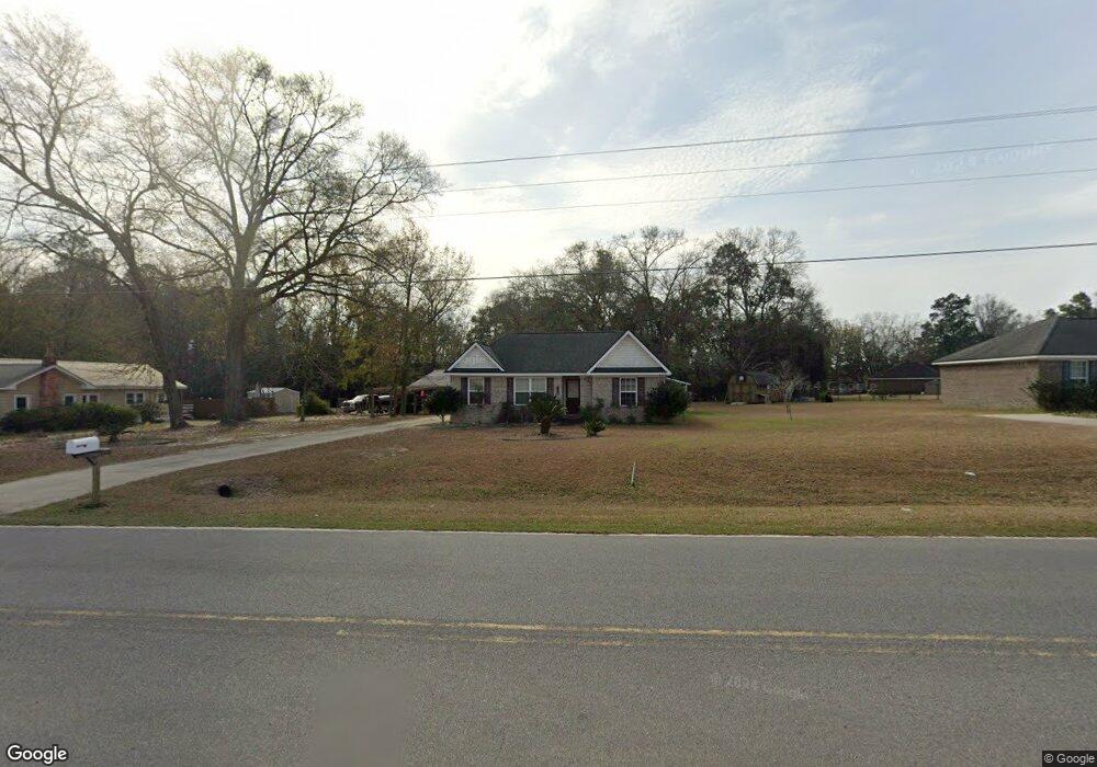
119 W Hencart Rd Glennville, GA 30427
Estimated Value: $134,247 - $167,000
--
Bed
2
Baths
1,175
Sq Ft
$129/Sq Ft
Est. Value
About This Home
This home is located at 119 W Hencart Rd, Glennville, GA 30427 and is currently estimated at $151,312, approximately $128 per square foot. 119 W Hencart Rd is a home located in Tattnall County with nearby schools including Tattnall County High School and Glennville Christian Academy.
Ownership History
Date
Name
Owned For
Owner Type
Purchase Details
Closed on
Jun 10, 2016
Sold by
Herschel Hart Enterprises
Bought by
Kicklighter Daral J
Current Estimated Value
Purchase Details
Closed on
Mar 25, 2010
Sold by
Herschel Hart Enterprises Llc
Bought by
Santiago Felip Rivera
Purchase Details
Closed on
Dec 16, 2009
Sold by
Glennville Bank
Bought by
Herschel Hart Enterprises Llc
Purchase Details
Closed on
Dec 19, 1994
Bought by
Purcell Jerry Paul
Create a Home Valuation Report for This Property
The Home Valuation Report is an in-depth analysis detailing your home's value as well as a comparison with similar homes in the area
Home Values in the Area
Average Home Value in this Area
Purchase History
| Date | Buyer | Sale Price | Title Company |
|---|---|---|---|
| Kicklighter Daral J | $60,000 | -- | |
| Santiago Felip Rivera | $99,450 | -- | |
| Herschel Hart Enterprises Llc | $15,000 | -- | |
| Purcell Jerry Paul | $80,000 | -- |
Source: Public Records
Tax History Compared to Growth
Tax History
| Year | Tax Paid | Tax Assessment Tax Assessment Total Assessment is a certain percentage of the fair market value that is determined by local assessors to be the total taxable value of land and additions on the property. | Land | Improvement |
|---|---|---|---|---|
| 2024 | $1,495 | $42,000 | $3,080 | $38,920 |
| 2023 | $1,495 | $42,000 | $3,080 | $38,920 |
| 2022 | $1,249 | $35,080 | $3,080 | $32,000 |
| 2021 | $1,248 | $35,880 | $3,440 | $32,440 |
| 2020 | $1,249 | $35,880 | $3,440 | $32,440 |
| 2019 | $1,223 | $34,280 | $2,440 | $31,840 |
| 2018 | $1,240 | $34,280 | $2,440 | $31,840 |
| 2017 | $665 | $34,280 | $2,440 | $31,840 |
| 2016 | $273 | $34,280 | $2,440 | $31,840 |
| 2015 | -- | $34,200 | $2,440 | $31,760 |
| 2014 | -- | $35,600 | $2,440 | $33,160 |
| 2013 | -- | $35,600 | $2,440 | $33,160 |
Source: Public Records
Map
Nearby Homes
- 202 Bay St
- 402 W Mann St
- 302 N Church St
- 400 W Mann St
- 128 Fate Rd
- 0 Highway 144 Unit 159215
- 203 Azalea Rd
- 708 Virginia Ave
- 301 E Cedar St
- 653 N Caswell St
- 655 N Caswell St
- 122 Cloverdale Rd
- 0 Homer Waters Rd
- 0000 Homer Waters Rd
- 305 S Baker St
- 404 S Baker St
- 603 E Simon St
- 103 Abbie Ln
- 111 Jay St
- Tract 2 Simon St
- 115 W Hencart Rd
- 121 W Hencart Rd
- 626 W Barnard St
- 628 W Barnard St
- 622 W Barnard St
- 632 W Barnard St
- 630 W Barnard St
- 621 W Barnard St
- 625 W Barnard St
- 623 W Barnard St
- 627 W Barnard St
- 635 W Barnard St
- 629 W Barnard St
- 607 W Mann St
- 609 W Mann St
- 605 W Mann St
- 639 W Barnard St
- Tract 3 Hencart Rd
- Tract 2 Hencart Rd
- Tract 1 Hencart Rd