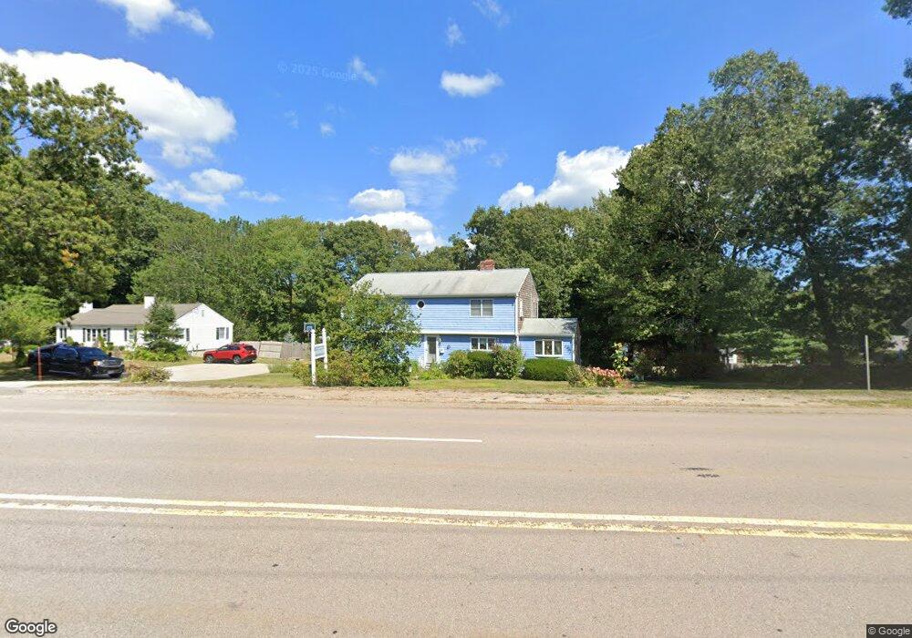
119 Whiting St Hingham, MA 02043
South Hingham NeighborhoodEstimated Value: $882,000 - $1,124,000
3
Beds
2
Baths
2,488
Sq Ft
$405/Sq Ft
Est. Value
About This Home
This home is located at 119 Whiting St, Hingham, MA 02043 and is currently estimated at $1,006,502, approximately $404 per square foot. 119 Whiting St is a home located in Plymouth County with nearby schools including South Elementary School, Norwell KinderCare, and Fusion Academy Hingham.
Ownership History
Date
Name
Owned For
Owner Type
Purchase Details
Closed on
Mar 15, 1994
Sold by
Rooney Kevin G
Bought by
Garvin William E and Greeley-Garvin Tammy
Current Estimated Value
Home Financials for this Owner
Home Financials are based on the most recent Mortgage that was taken out on this home.
Original Mortgage
$155,000
Interest Rate
6.93%
Mortgage Type
Purchase Money Mortgage
Create a Home Valuation Report for This Property
The Home Valuation Report is an in-depth analysis detailing your home's value as well as a comparison with similar homes in the area
Home Values in the Area
Average Home Value in this Area
Purchase History
| Date | Buyer | Sale Price | Title Company |
|---|---|---|---|
| Garvin William E | $199,000 | -- |
Source: Public Records
Mortgage History
| Date | Status | Borrower | Loan Amount |
|---|---|---|---|
| Open | Garvin William E | $115,000 | |
| Closed | Garvin William E | $158,200 | |
| Closed | Garvin William E | $155,000 |
Source: Public Records
Tax History Compared to Growth
Tax History
| Year | Tax Paid | Tax Assessment Tax Assessment Total Assessment is a certain percentage of the fair market value that is determined by local assessors to be the total taxable value of land and additions on the property. | Land | Improvement |
|---|---|---|---|---|
| 2025 | $8,778 | $821,100 | $293,800 | $527,300 |
| 2024 | $8,420 | $776,000 | $293,800 | $482,200 |
| 2023 | $7,335 | $733,500 | $293,800 | $439,700 |
| 2022 | $7,030 | $608,100 | $265,200 | $342,900 |
| 2021 | $7,071 | $599,200 | $265,200 | $334,000 |
| 2020 | $6,909 | $599,200 | $265,200 | $334,000 |
| 2019 | $6,212 | $526,000 | $265,200 | $260,800 |
| 2018 | $6,191 | $526,000 | $265,200 | $260,800 |
| 2017 | $5,418 | $442,300 | $224,400 | $217,900 |
| 2016 | $5,391 | $431,600 | $213,700 | $217,900 |
| 2015 | $5,280 | $421,400 | $203,500 | $217,900 |
Source: Public Records
Map
Nearby Homes
- 100 Whiting St
- 1 Kerri Ln
- 18 Whiting Ln
- 1088 Main St
- 4 Richard Rd
- 18 Colby St
- 55 Turner Rd
- 3 Blueberry Ct
- 4 Edward Cody Ln
- 3 Patriots Way
- 214 Washington St Unit 24
- 214 Washington St Unit 28
- 212 Cushing St
- 12 Hoover Rd
- 79 Tilden Rd
- 15 Pioneer Rd
- 80 Coolidge Rd
- 120 Deerfield Ln
- 279 Pine St
- 86 Black Rock Dr
- 121 Whiting St
- 4 Country Dr
- 4 Country Dr Unit 4
- 109 Whiting St
- 6 Country Dr
- 123 Whiting St
- 2 Hazelwood Dr
- 1 Hazelwood Dr
- 125 Whiting St
- 3 Country Dr
- 8 Country Dr
- 105 Whiting St
- 15 Hazelwood Dr
- 4 Hazelwood Dr
- 7 Country Dr
- 3 Hazelwood Dr
- 101 Whiting St
- 101 Whiting St Unit 101
- 104 Whiting St
- 131 Whiting St