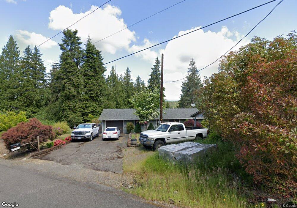
1190 E Daniels Rd Shelton, WA 98584
Estimated Value: $385,466 - $650,000
3
Beds
1
Bath
1,504
Sq Ft
$317/Sq Ft
Est. Value
About This Home
This home is located at 1190 E Daniels Rd, Shelton, WA 98584 and is currently estimated at $476,867, approximately $317 per square foot. 1190 E Daniels Rd is a home located in Mason County with nearby schools including Pioneer Primary School and Pioneer Intermediate/Middle School.
Ownership History
Date
Name
Owned For
Owner Type
Purchase Details
Closed on
Aug 15, 2023
Sold by
Ennor Scott John
Bought by
Ennor Family Trust and Ennor
Current Estimated Value
Purchase Details
Closed on
Aug 4, 2022
Sold by
Scott John Ennor Trust
Bought by
Ennor Scott John and Ennor Nancy Marie
Purchase Details
Closed on
Nov 5, 2019
Sold by
Ennor Scott John and Ennor Scott J
Bought by
Ennor Scott John and Scott John Ennor Trust
Purchase Details
Closed on
Oct 9, 2006
Sold by
Ennor Scott J and Ennor Kimberly A
Bought by
Ennor Scott J
Create a Home Valuation Report for This Property
The Home Valuation Report is an in-depth analysis detailing your home's value as well as a comparison with similar homes in the area
Purchase History
| Date | Buyer | Sale Price | Title Company |
|---|---|---|---|
| Ennor Family Trust | -- | None Listed On Document | |
| Ennor Scott John | -- | None Listed On Document | |
| Ennor Scott John | -- | None Available | |
| Ennor Scott J | -- | First American Title |
Source: Public Records
Tax History
| Year | Tax Paid | Tax Assessment Tax Assessment Total Assessment is a certain percentage of the fair market value that is determined by local assessors to be the total taxable value of land and additions on the property. | Land | Improvement |
|---|---|---|---|---|
| 2025 | $2,283 | $330,180 | $28,490 | $301,690 |
| 2024 | $2,283 | $288,350 | $28,490 | $259,860 |
| 2023 | $2,345 | $262,455 | $23,205 | $239,250 |
| 2022 | $2,893 | $295,415 | $17,190 | $278,225 |
| 2021 | $2,341 | $295,415 | $17,190 | $278,225 |
| 2020 | $2,179 | $219,920 | $16,215 | $203,705 |
| 2018 | $1,809 | $155,095 | $18,425 | $136,670 |
| 2017 | $1,852 | $155,095 | $18,425 | $136,670 |
| 2016 | $1,760 | $163,520 | $33,000 | $130,520 |
| 2015 | $1,494 | $155,200 | $31,350 | $123,850 |
| 2014 | -- | $145,915 | $29,700 | $116,215 |
| 2013 | -- | $148,410 | $29,700 | $118,710 |
Source: Public Records
Map
Nearby Homes
- 1341 E Beaver Ave
- 3 E Lone Fir Dr E Unit Div 2
- 4 E Lone Fir Dr E Unit Div 2
- 3 .29Acres Tideland
- 5 E Lone Fir Dr E Unit Div 2
- 6 E Swindler's Cove Rd
- 7 E Swindler's Cove Rd
- 0 E Daniels Rd
- 153 E Mason Lake Rd
- 2111 Washington 3
- 111 E Maryann Place
- 4831 Washington 3
- 121 Gary's Melody Ln
- 0 Lot 13 E Peyton Place
- 51 E Skyline Dr
- 481 E Leeds Dr
- 40 E Ashwood Ln
- 0 Lot 9-10 E Seamount Way
- 40 E Dogwood Place
- 120 E Ashwood Ln
- 0 L13 Daniels Rd
- 1250 E Beaver Ave
- 1170 E Daniels Rd
- 1150 E Daniels Rd
- 0 E Beaver Ln
- 50 E Beaver Ln
- 1130 E Daniels Rd
- 1330 E Beaver Ave
- 21 E Wilderness Way
- 90 E Beaver Ln
- 0 Wilderness Way Unit 1939249
- 0 Xxx E Wilderness Way
- 1151 E Daniels Rd
- 1331 E Beaver Ave
- 100 E Beaver Ln
- 0 L10 E Wilderness Way
- 1351 E Beaver Ave
- 102 E Beaver Ln
- 50 E Wilderness Way
- 1381 E Beaver Ave
Your Personal Tour Guide
Ask me questions while you tour the home.