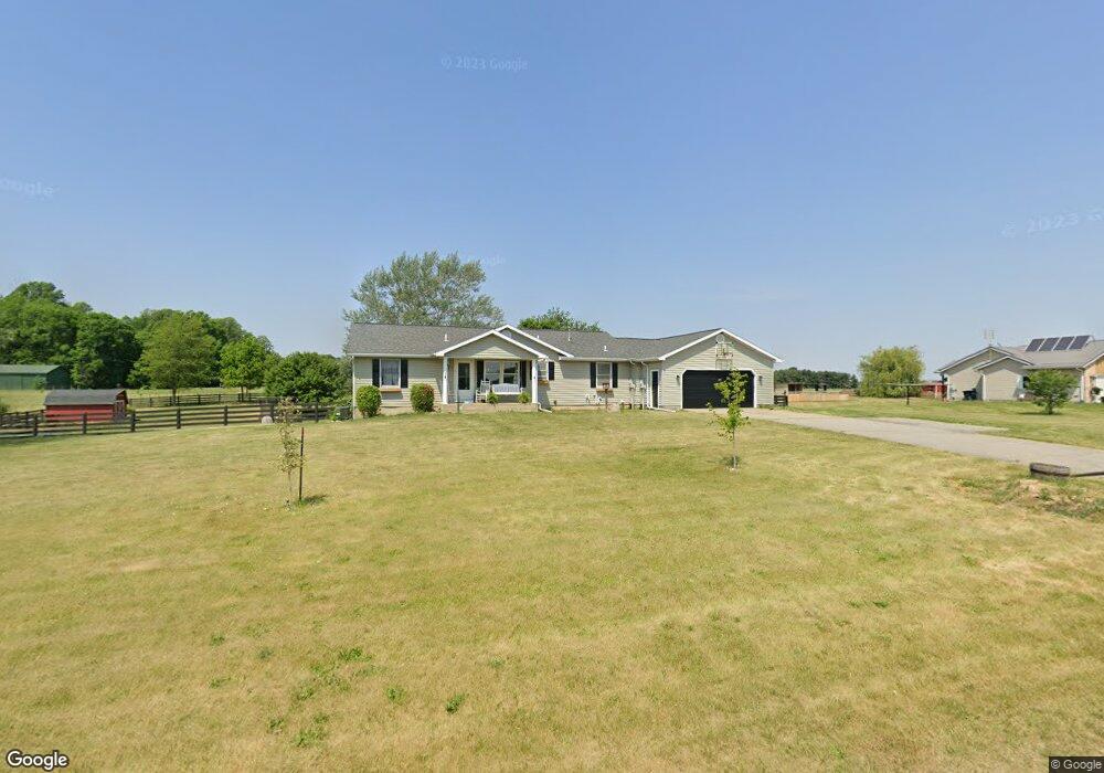
1190 N 200 E Lagrange, IN 46761
Estimated Value: $298,214 - $405,000
3
Beds
2
Baths
1,400
Sq Ft
$257/Sq Ft
Est. Value
About This Home
This home is located at 1190 N 200 E, Lagrange, IN 46761 and is currently estimated at $360,054, approximately $257 per square foot. 1190 N 200 E is a home located in LaGrange County with nearby schools including Lakeland Jr/Sr High School, East Yoder School, and Creekside Amish School.
Ownership History
Date
Name
Owned For
Owner Type
Purchase Details
Closed on
May 16, 2018
Sold by
Dotson Paula C
Bought by
Jones Thurston L
Current Estimated Value
Home Financials for this Owner
Home Financials are based on the most recent Mortgage that was taken out on this home.
Original Mortgage
$128,000
Outstanding Balance
$108,751
Interest Rate
4.39%
Mortgage Type
New Conventional
Estimated Equity
$251,303
Create a Home Valuation Report for This Property
The Home Valuation Report is an in-depth analysis detailing your home's value as well as a comparison with similar homes in the area
Purchase History
| Date | Buyer | Sale Price | Title Company |
|---|---|---|---|
| Jones Thurston L | $160,000 | Attorney Only |
Source: Public Records
Mortgage History
| Date | Status | Borrower | Loan Amount |
|---|---|---|---|
| Open | Jones Thurston L | $128,000 |
Source: Public Records
Tax History
| Year | Tax Paid | Tax Assessment Tax Assessment Total Assessment is a certain percentage of the fair market value that is determined by local assessors to be the total taxable value of land and additions on the property. | Land | Improvement |
|---|---|---|---|---|
| 2025 | $909 | $255,300 | $32,000 | $223,300 |
| 2024 | $909 | $260,000 | $32,000 | $228,000 |
| 2023 | $804 | $250,200 | $30,600 | $219,600 |
| 2022 | $887 | $229,200 | $26,900 | $202,300 |
| 2021 | $671 | $194,100 | $24,500 | $169,600 |
| 2020 | $680 | $185,500 | $23,800 | $161,700 |
| 2019 | $620 | $171,100 | $23,800 | $147,300 |
| 2018 | $555 | $164,500 | $23,800 | $140,700 |
| 2017 | $498 | $155,700 | $23,700 | $132,000 |
| 2016 | $481 | $156,300 | $23,000 | $133,300 |
| 2014 | $1,361 | $143,200 | $23,000 | $120,200 |
| 2013 | $1,361 | $144,500 | $23,000 | $121,500 |
Source: Public Records
Map
Nearby Homes
- 1400 N 200 E
- 737 N Canal St
- 602 N Maple St
- 314 E Michigan St
- 109 E Factory St
- 307 N Detroit St
- 207 S Poplar St
- 920 N 00ew
- 202 W Central Ave
- 2930 N 080 E
- 217 N Sherman St
- 217-219 Church St
- 270 N 035 W
- 2325 E 400 N
- 2200 S State Road 9 Hwy
- 1575 W 195 N
- 1055 S 495 E
- 1630 S 485 E
- 2200 S 460 E
- 2375 S 460 E
Your Personal Tour Guide
Ask me questions while you tour the home.