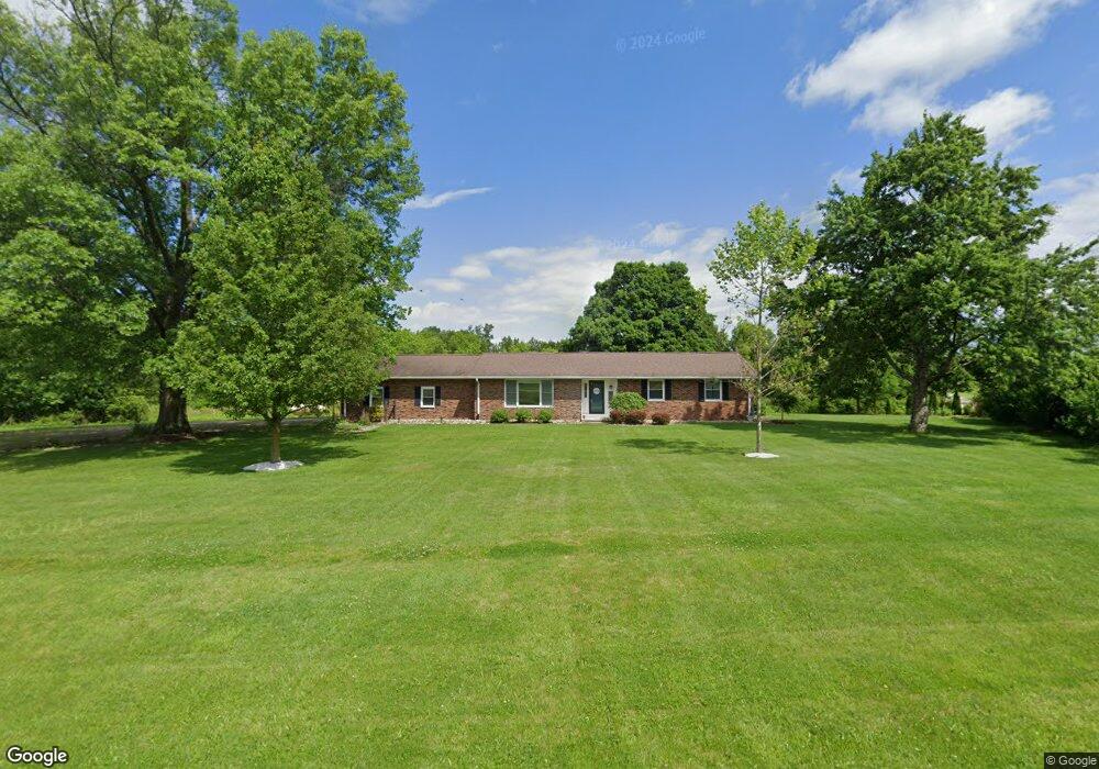
1190 Wyandot Rd Bucyrus, OH 44820
Estimated Value: $297,000 - $366,000
3
Beds
2
Baths
1,498
Sq Ft
$216/Sq Ft
Est. Value
About This Home
This home is located at 1190 Wyandot Rd, Bucyrus, OH 44820 and is currently estimated at $323,443, approximately $215 per square foot. 1190 Wyandot Rd is a home located in Crawford County with nearby schools including Wynford Elementary School, Wynford High School, and Wayside Christian School.
Ownership History
Date
Name
Owned For
Owner Type
Purchase Details
Closed on
Oct 27, 2023
Sold by
Haney Eddie G and Haney Barbara D
Bought by
Williams Lyndie R and Heinlen Carson J
Current Estimated Value
Purchase Details
Closed on
Jan 6, 2022
Sold by
Fawley Terry L
Bought by
Haney Eddie G and Haney Barbara D
Purchase Details
Closed on
May 17, 2019
Sold by
Oberlander Gary L and Oberlander Melissa K
Bought by
Fawley Terry L
Home Financials for this Owner
Home Financials are based on the most recent Mortgage that was taken out on this home.
Original Mortgage
$168,000
Interest Rate
4%
Mortgage Type
Purchase Money Mortgage
Purchase Details
Closed on
Dec 28, 2006
Sold by
Beal Thomas D
Bought by
Caldwell Road Llc
Create a Home Valuation Report for This Property
The Home Valuation Report is an in-depth analysis detailing your home's value as well as a comparison with similar homes in the area
Home Values in the Area
Average Home Value in this Area
Purchase History
| Date | Buyer | Sale Price | Title Company |
|---|---|---|---|
| Williams Lyndie R | $2,727,500 | Acs Title | |
| Haney Eddie G | -- | None Listed On Document | |
| Haney Eddie G | -- | None Listed On Document | |
| Fawley Terry L | $225,000 | Acs Title Bucyrus | |
| Caldwell Road Llc | -- | -- | |
| Caldwell Road Llc | -- | -- | |
| Beal Charles W | -- | -- |
Source: Public Records
Mortgage History
| Date | Status | Borrower | Loan Amount |
|---|---|---|---|
| Previous Owner | Fawley Terry L | $168,000 |
Source: Public Records
Tax History Compared to Growth
Tax History
| Year | Tax Paid | Tax Assessment Tax Assessment Total Assessment is a certain percentage of the fair market value that is determined by local assessors to be the total taxable value of land and additions on the property. | Land | Improvement |
|---|---|---|---|---|
| 2024 | $3,378 | $89,180 | $5,430 | $83,750 |
| 2023 | $3,378 | $49,000 | $4,450 | $44,550 |
| 2022 | $2,188 | $49,000 | $4,450 | $44,550 |
| 2021 | $2,348 | $49,000 | $4,450 | $44,550 |
| 2020 | $1,714 | $38,590 | $4,450 | $34,140 |
| 2019 | $1,359 | $38,590 | $4,450 | $34,140 |
| 2018 | $1,418 | $39,220 | $4,450 | $34,770 |
| 2017 | $1,407 | $39,440 | $4,450 | $34,990 |
| 2016 | $1,172 | $39,440 | $4,450 | $34,990 |
| 2015 | $1,189 | $39,440 | $4,450 | $34,990 |
| 2014 | $1,567 | $37,140 | $4,450 | $32,690 |
| 2013 | $1,567 | $37,140 | $4,450 | $32,690 |
Source: Public Records
Map
Nearby Homes
- 1773 Marion-Melmore Rd
- 2440 Wyandot Rd
- 2273 Kerstetter Rd
- 1123 Hillcrest Dr
- 275 Brentwood St
- 3056 Mccracken Rd
- 130 Brentwood St
- 1112 Hillcrest Dr
- 1149 Farmview Dr
- 1555 Rosedale Ave
- 1315 Lynne Ave
- 0 Lynne Ave
- 1145 Lynne Ave
- 452 Pleasant Ln
- 1665 Lincoln Hwy
- 1211 S Sandusky Ave
- 900 S Spring St
- 1021 S Sandusky Ave
- 325 W Liberty St
- 885 W Perry St
- 1215 Wyandot Rd
- 1225 Wyandot Rd
- 1222 Wyandot Rd
- 1129 Wyandot Rd
- 1285 Wyandot Rd
- 1285 Wyandot Rd
- 1730 Shupp Rd
- 1156 Wyandot Rd
- 1088 Wyandot Rd
- 1288 Wyandot Rd
- 1042 Wyandot Rd
- 1363 Wyandot Rd
- 1290 Wyandot Rd
- 1020 Wyandot Rd
- 1384 Wyandot Rd
- 1437 Wyandot Rd
- 987 Wyandot Rd
- 980 Wyandot Rd
- 974 Wyandot Rd
- 949 Wyandot Rd