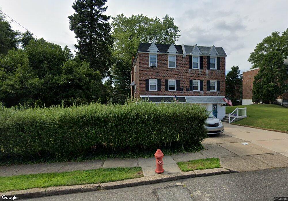
11900 Stevens Rd Philadelphia, PA 19116
Somerton NeighborhoodEstimated Value: $349,627 - $400,000
--
Bed
--
Bath
1,344
Sq Ft
$282/Sq Ft
Est. Value
About This Home
This home is located at 11900 Stevens Rd, Philadelphia, PA 19116 and is currently estimated at $379,657, approximately $282 per square foot. 11900 Stevens Rd is a home with nearby schools including Watson Comly School, CCA Baldi Middle School, and George Washington High School.
Ownership History
Date
Name
Owned For
Owner Type
Purchase Details
Closed on
Apr 29, 2008
Sold by
Brown Joan E and Brown Ronald T
Bought by
Demchenko Paul J
Current Estimated Value
Home Financials for this Owner
Home Financials are based on the most recent Mortgage that was taken out on this home.
Original Mortgage
$153,600
Outstanding Balance
$96,967
Interest Rate
5.99%
Mortgage Type
Purchase Money Mortgage
Estimated Equity
$282,690
Create a Home Valuation Report for This Property
The Home Valuation Report is an in-depth analysis detailing your home's value as well as a comparison with similar homes in the area
Home Values in the Area
Average Home Value in this Area
Purchase History
| Date | Buyer | Sale Price | Title Company |
|---|---|---|---|
| Demchenko Paul J | $192,000 | Commonwealth Land Title Insu |
Source: Public Records
Mortgage History
| Date | Status | Borrower | Loan Amount |
|---|---|---|---|
| Open | Demchenko Paul J | $153,600 |
Source: Public Records
Tax History Compared to Growth
Tax History
| Year | Tax Paid | Tax Assessment Tax Assessment Total Assessment is a certain percentage of the fair market value that is determined by local assessors to be the total taxable value of land and additions on the property. | Land | Improvement |
|---|---|---|---|---|
| 2026 | $3,988 | $357,900 | $71,580 | $286,320 |
| 2025 | $3,988 | $357,900 | $71,580 | $286,320 |
| 2024 | $3,988 | $357,900 | $71,580 | $286,320 |
| 2023 | $3,988 | $284,900 | $56,980 | $227,920 |
| 2022 | $2,728 | $239,900 | $56,980 | $182,920 |
| 2021 | $3,358 | $0 | $0 | $0 |
| 2020 | $3,358 | $0 | $0 | $0 |
| 2019 | $3,162 | $0 | $0 | $0 |
| 2018 | $2,902 | $0 | $0 | $0 |
| 2017 | $2,902 | $0 | $0 | $0 |
| 2016 | $2,482 | $0 | $0 | $0 |
| 2015 | $2,376 | $0 | $0 | $0 |
| 2014 | -- | $207,300 | $94,710 | $112,590 |
| 2012 | -- | $25,760 | $5,031 | $20,729 |
Source: Public Records
Map
Nearby Homes
- 1104 Welton St
- 11902 Barlow St
- 11933 Stevens Rd
- 808 Densmore Rd
- 807 Larkspur St
- 818 Burgess St
- 825 Delray St
- 13027 Worthington Rd
- 813 Piermont St
- 1216 Anna Dr
- 13053 Dorothy Dr
- 13049 Lindsay St
- 11003 Stevens Rd
- 509 Larkspur St
- 13430 Worthington Rd
- 11715 Jeanes St
- 13250 Trevose Rd
- 441 Tomlinson Rd Unit F6
- 11243 Jeanes Place
- 859 Selmer Rd
- 11902 Stevens Rd
- 11904 Stevens Rd
- 11906 Stevens Rd
- 11903 Barlow St
- 11908 Stevens Rd
- 11905 Barlow St
- 11901 Barlow St
- 11905 Stevens Rd
- 11907 Barlow St
- 11910 Stevens Rd
- 11903 Stevens Rd
- 11909 Barlow St
- 11907 Stevens Rd
- 11911 Barlow St
- 11909 Stevens Rd
- 11912 Stevens Rd
- 11911 Stevens Rd
- 1100 Welton St
- 11914 Stevens Rd
- 1102 Welton St